File:Guang yu tu - er juan LOC 2008623187-30.tif
Jump to navigation
Jump to search

Size of this JPG preview of this TIF file: 556 × 600 pixels. Other resolutions: 223 × 240 pixels | 445 × 480 pixels | 712 × 768 pixels | 950 × 1,024 pixels | 1,899 × 2,048 pixels | 4,320 × 4,658 pixels.
Original file (4,320 × 4,658 pixels, file size: 57.57 MB, MIME type: image/tiff)
Captions
Captions
Add a one-line explanation of what this file represents
Summary[edit]
| Description |
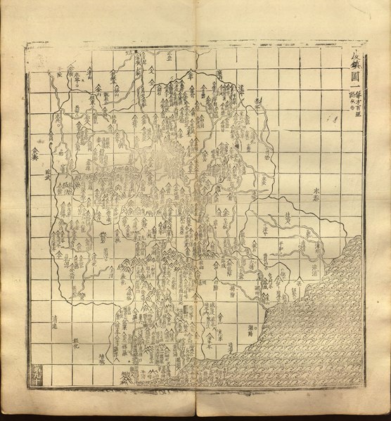
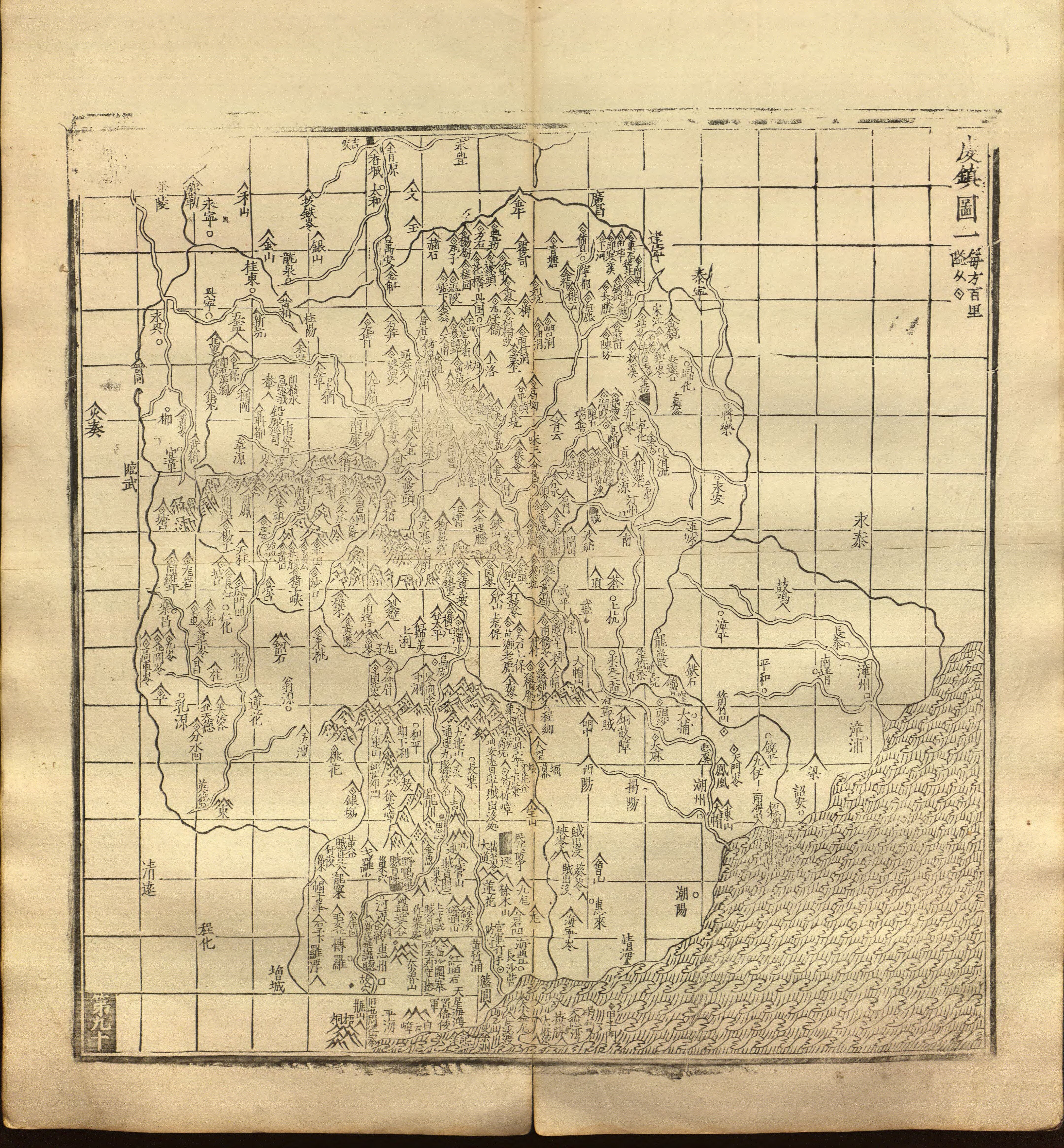
English: A map of the area around Ganzhou in Jiangxi, Chaozhou in Guangdong, and Zhangzhou in Fujian, the "Qianzhen Map" (Qianzhen Tu) from Luo Hongxian's Enlarged Atlas, Vol. 2, based on the maps first drafted by Zhu Siben. Library of Congress copy of Hu Song's 1558 revision. Each square is 100×100 li (about 33×33 km or 20×20 miles).
中文:每方百里 |
||
| Title | English: "Qianzhen Map 1", Enlarged Atlas
中文:廣輿圖·䖍鎮圖一 |
||
| Shelf ID | G2305 .L6 1558 B182.07 L78.1 | ||
| Parent | LOC | ||
| Sheet title | English: p. 90
中文:第九十 |
||
| Date | |||
| Source | LOC | ||
| Author | Zhu Siben, redrafted and revised by Luo Hongxian, edited by Hu Song | ||
| Permission (Reusing this file) |
|
||
| Other versions |
|
||
| Location | China | ||
| Part of | Catalog · Asian · Chinese Rare Book Digital Collection · Asian Division | ||
| Subject | Historical Geography · Defenses · Boundaries · Maps · Early Works To 1800 · China · Administrative And Political Divisions |


Licensing[edit]
|
This is a faithful photographic reproduction of a two-dimensional, public domain work of art. The work of art itself is in the public domain for the following reason:
The official position taken by the Wikimedia Foundation is that "faithful reproductions of two-dimensional public domain works of art are public domain".
This photographic reproduction is therefore also considered to be in the public domain in the United States. In other jurisdictions, re-use of this content may be restricted; see Reuse of PD-Art photographs for details. | ||||
File history
Click on a date/time to view the file as it appeared at that time.
| Date/Time | Thumbnail | Dimensions | User | Comment | |
|---|---|---|---|---|---|
| current | 16:09, 12 May 2019 |  | 4,320 × 4,658 (57.57 MB) | Fæ (talk | contribs) | LOC Maps multisheet https://www.loc.gov/item/2008623187/ sheet 30 of 61 #3990 |
You cannot overwrite this file.
File usage on Commons
The following 2 pages use this file: