File:Hadrian's Wall map.svg
跳转到导航
跳转到搜索

此SVG文件的PNG预览的大小:800 × 453像素。 其他分辨率:320 × 181像素 | 640 × 362像素 | 1,024 × 579像素 | 1,280 × 724像素 | 2,560 × 1,449像素 | 1,267 × 717像素。
原始文件 (SVG文件,尺寸为1,267 × 717像素,文件大小:1.12 MB)
说明
说明
添加一行文字以描述该文件所表现的内容
| 描述 |
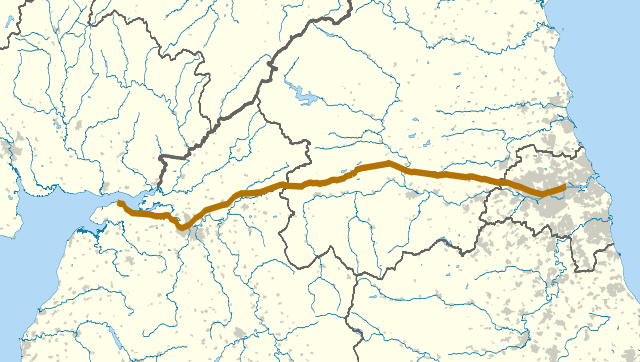
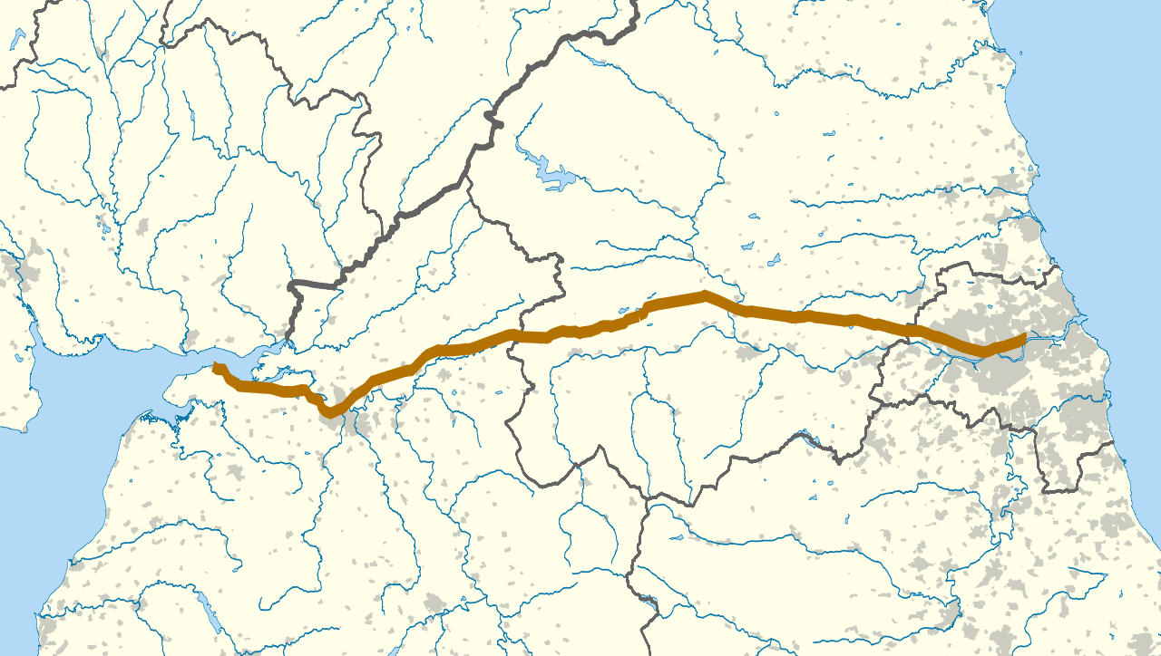
The route of Hadrian's Wall (in brown) in northern England. The background map shows modern counties and urban areas.
Geographic limits:
|
| 日期 | |
| 来源 |
|
| 作者 | Nilfanion |
| 授权 (二次使用本文件) |
本文件采用知识共享署名-相同方式共享 3.0 未本地化版本许可协议授权。
|
| 其他版本 | 此文件衍生的作品: Hadrian's Wall map A.svg |
文件历史
点击某个日期/时间查看对应时刻的文件。
| 日期/时间 | 缩略图 | 大小 | 用户 | 备注 | |
|---|---|---|---|---|---|
| 当前 | 2010年9月22日 (三) 22:06 | | 1,267 × 717(1.12 MB) | Nilfanion(留言 | 贡献) | darker urban area, wall thicker |
| 2010年9月22日 (三) 22:00 |  | 1,267 × 717(1.12 MB) | Nilfanion(留言 | 贡献) | {{Information |Description=The route of Hadrian's Wall (in brown) in northern England. The background map shows modern counties and urban areas. Equirectangular map projection on WGS 84 datum, with N/S stretched 170% Geographic lim |
您不可以覆盖此文件。
文件用途
以下页面使用本文件:
全域文件用途
以下其他wiki使用此文件:
- af.wikipedia.org上的用途
- en.wikipedia.org上的用途
- es.wikipedia.org上的用途
- it.wikipedia.org上的用途
- ko.wikipedia.org上的用途
- lv.wikipedia.org上的用途
- mk.wikipedia.org上的用途
- ms.wikipedia.org上的用途
- pt.wikipedia.org上的用途
- ro.wikipedia.org上的用途
- sl.wikipedia.org上的用途
- zh.wikipedia.org上的用途