File:Hallaton geograph-3592650-by-Ben-Brooksbank.jpg
Jump to navigation
Jump to search
Size of this preview: 800 × 502 pixels. Other resolutions: 320 × 201 pixels | 640 × 401 pixels | 1,024 × 642 pixels | 1,280 × 802 pixels | 2,391 × 1,499 pixels.
Original file (2,391 × 1,499 pixels, file size: 3.38 MB, MIME type: image/jpeg)
Captions
Captions
Add a one-line explanation of what this file represents
Summary[edit]
| Description |
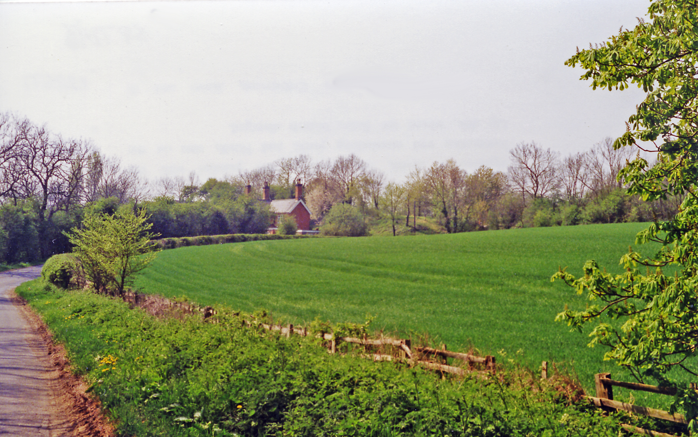
English: Approaching site of Hallaton station from the south, 1995. View northward, towards Melton Mowbray and Nottingham: ex-GN&LNE Joint line, Market Harborough - Melton Mowbray - Nottingham. Hallaton station closed when the passenger services ceased from 7/12/53, but freight traffic continued along the line until 11/67. The route had been important for coal traffic between Colwick (Nottingham) and Willesden (London). (Cf. 222677). |
| Date | |
| Source | From geograph.org.uk |
| Author | Ben Brooksbank |
| Permission (Reusing this file) |
Creative Commons Attribution Share-alike license 2.0 |
| Camera location | | View this and other nearby images on: OpenStreetMap |
|---|
Licensing[edit]

|
This image was taken from the Geograph project collection. See this photograph's page on the Geograph website for the photographer's contact details. The copyright on this image is owned by Ben Brooksbank and is licensed for reuse under the Creative Commons Attribution-ShareAlike 2.0 license.
|
This file is licensed under the Creative Commons Attribution-Share Alike 2.0 Generic license.
Attribution: Ben Brooksbank
- You are free:
- to share – to copy, distribute and transmit the work
- to remix – to adapt the work
- Under the following conditions:
- attribution – You must give appropriate credit, provide a link to the license, and indicate if changes were made. You may do so in any reasonable manner, but not in any way that suggests the licensor endorses you or your use.
- share alike – If you remix, transform, or build upon the material, you must distribute your contributions under the same or compatible license as the original.
File history
Click on a date/time to view the file as it appeared at that time.
| Date/Time | Thumbnail | Dimensions | User | Comment | |
|---|---|---|---|---|---|
| current | 10:41, 31 August 2013 | | 2,391 × 1,499 (3.38 MB) | Chevin (talk | contribs) | == {{int:filedesc}} == {{Information |Description={{en|1='''Approaching site of Hallaton station from the south, 1995.'''<br/> View northward, towards Melton Mowbray and Nottingham: ex-GN&LNE Joint line, Market Harborough - Melton Mowbray - Nottingham.... |
You cannot overwrite this file.
File usage on Commons
There are no pages that use this file.
File usage on other wikis
The following other wikis use this file:
- Usage on en.wikipedia.org