File:Hannover Stadtbahn A West.png
Jump to navigation
Jump to search

Size of this preview: 800 × 399 pixels. Other resolutions: 320 × 159 pixels | 640 × 319 pixels | 1,080 × 538 pixels.
Original file (1,080 × 538 pixels, file size: 270 KB, MIME type: image/png)
Captions
Captions
Add a one-line explanation of what this file represents
| Description |
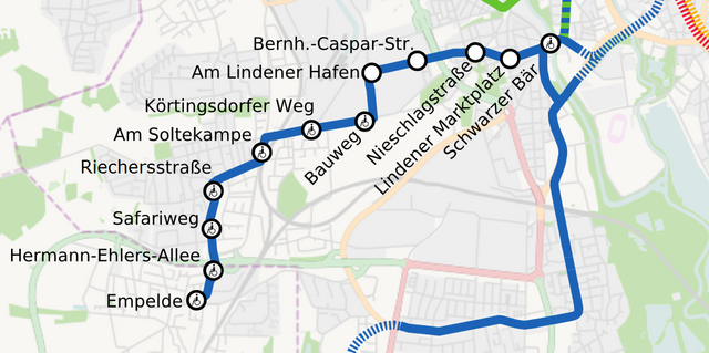
English: Light rail of Hannover, Germany. A West
Deutsch: Stadtbahn Hannover, Teilnetz A West |
||||||||||||
| Date | |||||||||||||
| Source | Own work, background: OpenStreetMap data | ||||||||||||
| Author | Jeremiah21 | ||||||||||||
| Permission (Reusing this file) |
|

|
This transport map image could be re-created using vector graphics as an SVG file. This has several advantages; see Commons:Media for cleanup for more information. If an SVG form of this image is available, please upload it and afterwards replace this template with
{{vector version available|new image name}}.
It is recommended to name the SVG file “Hannover Stadtbahn A West.svg”—then the template Vector version available (or Vva) does not need the new image name parameter. |

|
This map has been made or improved in the German Kartenwerkstatt (Map Lab). You can propose maps to improve as well.
|
File history
Click on a date/time to view the file as it appeared at that time.
| Date/Time | Thumbnail | Dimensions | User | Comment | |
|---|---|---|---|---|---|
| current | 17:59, 7 February 2024 | | 1,080 × 538 (270 KB) | NordNordWest (talk | contribs) | update for User:Nixblicker |
| 12:36, 22 December 2022 |  | 1,080 × 538 (361 KB) | Nixblicker (talk | contribs) | Hochbahnsteig Riechersstraße | |
| 11:49, 20 December 2021 |  | 1,080 × 538 (361 KB) | Nixblicker (talk | contribs) | Hochbahnsteig Hermann-Ehlers-Allee | |
| 23:14, 13 September 2018 |  | 1,080 × 538 (359 KB) | Nixblicker (talk | contribs) | Hochbahnsteig Am Soltekampe | |
| 21:31, 2 June 2017 |  | 1,080 × 538 (359 KB) | Nixblicker (talk | contribs) | Verbindungsstrecke A-D zweifarbig | |
| 00:09, 19 September 2013 |  | 1,080 × 538 (348 KB) | Nixblicker (talk | contribs) | Hochbahnsteig Schwarzer Bär ergänzt | |
| 15:55, 21 February 2010 |  | 1,080 × 538 (336 KB) | Jeremiah21 (talk | contribs) | corr | |
| 19:56, 19 February 2010 |  | 1,080 × 538 (338 KB) | Jeremiah21 (talk | contribs) | {{Information |Description={{en|1=Light rail of Hannover, Germany. A West}} {{de|1=Stadtbahn Hannover, Teilnetz A West}} |Source={{Own}}, background: OpenStreetMap data |Author={{U|Jeremiah21}} |Date=2010-02-19 |Permission={{OpenStreetMap}} |other_version |
You cannot overwrite this file.
File usage on Commons
The following 17 pages use this file:
- User:Chumwa/OgreBot/Potential transport maps/2017 June 1-10
- User:Chumwa/OgreBot/Potential transport maps/2018 September 11-20
- User:Chumwa/OgreBot/Public transport information/2017 June 1-10
- User:Chumwa/OgreBot/Public transport information/2018 September 11-20
- User:Chumwa/OgreBot/Public transport information/2021 December 11-20
- User:Chumwa/OgreBot/Public transport information/2022 December 21-31
- User:Chumwa/OgreBot/Public transport information/2024 February 1-9
- User:Chumwa/OgreBot/Transport Maps/2017 June 1-10
- User:Chumwa/OgreBot/Transport Maps/2018 September 11-20
- User:Chumwa/OgreBot/Transport Maps/2021 December 11-20
- User:Chumwa/OgreBot/Transport Maps/2022 December 21-31
- User:Chumwa/OgreBot/Transport Maps/2024 February 1-9
- User:Chumwa/OgreBot/Travel and communication maps/2017 June 1-10
- User:Chumwa/OgreBot/Travel and communication maps/2018 September 11-20
- User:Clic/Nahverkehr in Deutschland/2021 December 11-20
- User:Clic/Nahverkehr in Deutschland/2022 December 21-31
- User:Clic/Nahverkehr in Deutschland/2024 February 1-9
File usage on other wikis
The following other wikis use this file:
- Usage on de.wikipedia.org