File:Headcorn station geograph-3626165-by-Ben-Brooksbank.jpg
Jump to navigation
Jump to search
Size of this preview: 800 × 460 pixels. Other resolutions: 320 × 184 pixels | 640 × 368 pixels | 1,024 × 589 pixels | 1,280 × 736 pixels | 2,424 × 1,394 pixels.
Original file (2,424 × 1,394 pixels, file size: 3.87 MB, MIME type: image/jpeg)
Captions
Captions
Add a one-line explanation of what this file represents
Summary[edit]
| Description |
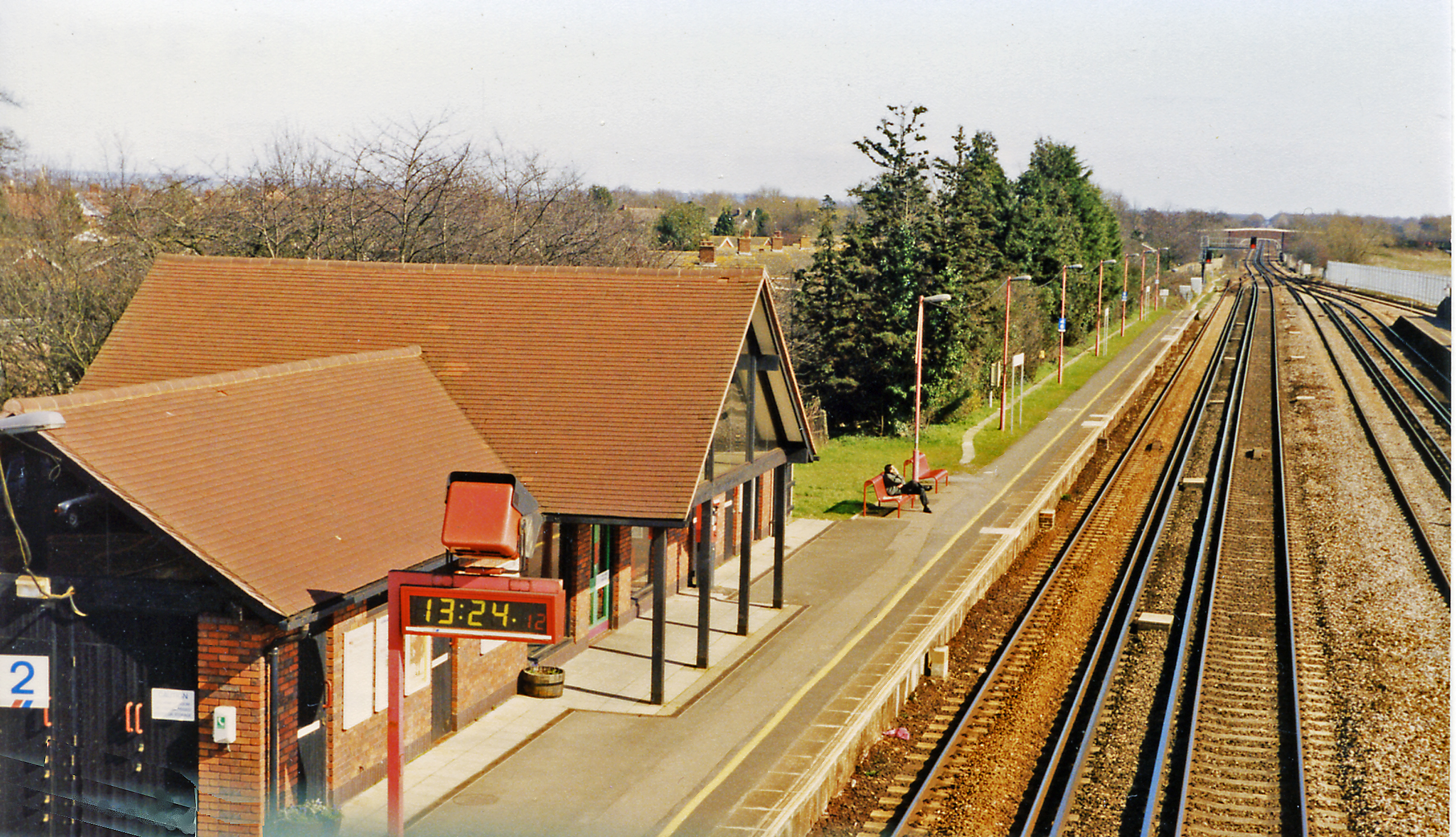
English: Headcorn station, 1995. View eastward, towards Ashford, Folkestone and Dover: ex-SE&CR London - Tonbridge - Ashford - Dover main line. Until 4/1/54, the Kent & East Sussex Light Railway to Tenterden and Robertsbridge had its own platform off to the right. The main line was electrified in June 1962, the station was rebuilt in May 1989 and the Up freight loop visible on the right was built for Channel Tunnel traffic in 1994. |
| Date | |
| Source | From geograph.org.uk |
| Author | Ben Brooksbank |
| Permission (Reusing this file) |
Creative Commons Attribution Share-alike license 2.0 |
| Attribution (required by the license) | Ben Brooksbank / Headcorn station, 1995 / |
| Camera location | | View this and other nearby images on: OpenStreetMap |
|---|
Licensing[edit]

|
This image was taken from the Geograph project collection. See this photograph's page on the Geograph website for the photographer's contact details. The copyright on this image is owned by Ben Brooksbank and is licensed for reuse under the Creative Commons Attribution-ShareAlike 2.0 license.
|
This file is licensed under the Creative Commons Attribution-Share Alike 2.0 Generic license.
Attribution: Ben Brooksbank
- You are free:
- to share – to copy, distribute and transmit the work
- to remix – to adapt the work
- Under the following conditions:
- attribution – You must give appropriate credit, provide a link to the license, and indicate if changes were made. You may do so in any reasonable manner, but not in any way that suggests the licensor endorses you or your use.
- share alike – If you remix, transform, or build upon the material, you must distribute your contributions under the same or compatible license as the original.
File history
Click on a date/time to view the file as it appeared at that time.
| Date/Time | Thumbnail | Dimensions | User | Comment | |
|---|---|---|---|---|---|
| current | 10:25, 28 September 2013 | | 2,424 × 1,394 (3.87 MB) | Chevin (talk | contribs) | {{Information |Description ={{en|1={{geograph|3626165|Ben Brooksbank}}}} |Source ={{geograph|3626165|Ben Brooksbank}} |Author ={{geograph|3626165|Ben Brooksbank}} |Date = |Permission = |other_versions = }} |
You cannot overwrite this file.
File usage on Commons
The following page uses this file:
File usage on other wikis
The following other wikis use this file:
- Usage on de.wikipedia.org
- Usage on en.wikipedia.org