File:Herefordshire UK locator map 2010.svg
Перейти к навигации
Перейти к поиску

Размер этого PNG-превью для исходного SVG-файла: 494 × 600 пкс. Другие разрешения: 198 × 240 пкс | 395 × 480 пкс | 633 × 768 пкс | 843 × 1024 пкс | 1687 × 2048 пкс | 1108 × 1345 пкс.
Исходный файл (SVG-файл, номинально 1108 × 1345 пкс, размер файла: 302 КБ)
Краткие подписи
Краткие подписи
Добавьте однострочное описание того, что собой представляет этот файл
Краткое описание[править]
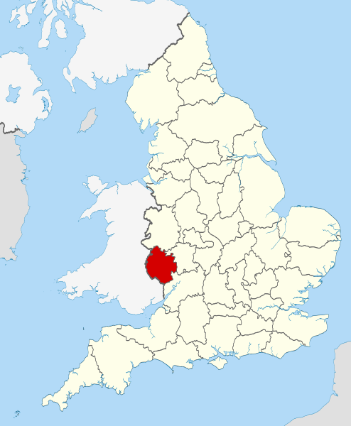
| Описание | Location of the ceremonial county of Herefordshire within England. |
| Дата | |
| Источник |
National Geospatial-Intelligence Agency
|
| Автор | Nilfanion |
Лицензирование[править]
Я, владелец авторских прав на это произведение, добровольно публикую его на условиях следующих лицензий:
Этот файл доступен по лицензии Creative Commons Attribution-Share Alike 3.0 Unported.
- Вы можете свободно:
- делиться произведением – копировать, распространять и передавать данное произведение
- создавать производные – переделывать данное произведение
- При соблюдении следующих условий:
- атрибуция – Вы должны указать авторство, предоставить ссылку на лицензию и указать, внёс ли автор какие-либо изменения. Это можно сделать любым разумным способом, но не создавая впечатление, что лицензиат поддерживает вас или использование вами данного произведения.
- распространение на тех же условиях – Если вы изменяете, преобразуете или создаёте иное произведение на основе данного, то обязаны использовать лицензию исходного произведения или лицензию, совместимую с исходной.

|
Разрешается копировать, распространять и/или изменять этот документ в соответствии с условиями GNU Free Documentation License версии 1.2 или более поздней, опубликованной Фондом свободного программного обеспечения, без неизменяемых разделов, без текстов, помещаемых на первой и последней обложке. Копия лицензии включена в раздел, озаглавленный GNU Free Documentation License. |
Вы можете выбрать любую из этих лицензий.

|
This is one of the images forming part of the Valued image set: Locator maps of the Ceremonial counties of England on Wikimedia Commons. The image set has been assessed under the valued image set criteria and is considered the most valued set on Commons within the scope:
Locator maps of the Ceremonial counties of England
Вы можете просмотреть его номинацию на странице Commons:Valued image candidates/Locator maps of English ceremonial counties. |
История файла
Нажмите на дату/время, чтобы увидеть версию файла от того времени.
| Дата/время | Миниатюра | Размеры | Участник | Примечание | |
|---|---|---|---|---|---|
| текущий | 22:38, 23 ноября 2010 | | 1108 × 1345 (302 КБ) | Nilfanion (обсуждение | вклад) | == Summary == {{Information |Description=Location of the ceremonial county of Herefordshire within England. |Source=Ordnance Survey [https://www.ordnancesurvey.co.uk/opendatadownload/products.html OpenData]: *Coun |
Вы не можете перезаписать этот файл.
Использование файла
Следующие 25 страниц используют этот файл:
- Valued image set: Locator maps of the Ceremonial counties of England
- Commons:Valued image candidates/Locator maps of English ceremonial counties
- Category:Almshouses in Herefordshire
- Category:Alumni by school in Herefordshire
- Category:Archaeological sites in Herefordshire
- Category:Births in Herefordshire
- Category:Bridges in Herefordshire
- Category:Canals in Herefordshire
- Category:Castles in Herefordshire
- Category:Herefordshire
- Category:Herefordshire in the 17th century
- Category:Herefordshire in the 19th century
- Category:Herefordshire in the 20th century
- Category:Herefordshire in the 21st century
- Category:Hospitals in Herefordshire
- Category:Maps of Herefordshire
- Category:Meadows in Herefordshire
- Category:People of Herefordshire
- Category:Populated places in Herefordshire
- Category:Rail transport in Herefordshire
- Category:Rivers of Herefordshire
- Category:Roads in Herefordshire
- Category:Tunnels in Herefordshire
- Category:Villages in Herefordshire
- Category:Visitor attractions in Herefordshire
Глобальное использование файла
Данный файл используется в следующих вики:
- Использование в af.wikipedia.org
- Использование в ar.wikipedia.org
- Использование в ast.wikipedia.org
- Использование в be-tarask.wikipedia.org
- Использование в bg.wikipedia.org
- Использование в br.wikipedia.org
- Использование в ca.wikipedia.org
- Использование в ceb.wikipedia.org
- Использование в cs.wikipedia.org
- Использование в dag.wikipedia.org
- Использование в en.wikipedia.org
- Dore Abbey
- Eye, Herefordshire
- Blackwardine
- Edvin Loach
- Herefordshire
- Hereford Cathedral
- Whitchurch, Herefordshire
- Combe, Herefordshire
- Much Dewchurch
- Thornbury, Herefordshire
- Grandmontines
- Hoarwithy, Herefordshire
- Abbey Dore
- Weston Beggard
- Aconbury
- Acton Beauchamp
- Acton Green, Herefordshire
- Birtley, Herefordshire
- Blakemere
- Yazor
- Little Hereford
- Preston on Wye
- Allensmore
- Ashperton
- Aymestrey
- Ballingham
- Bartestree
- Bishop's Frome
- Stoke Prior, Herefordshire
- Yarkhill
- Woolhope
- Wolferlow
- Whitney-on-Wye
- Belmont Rural
- Pipe and Lyde
- Haywood, Herefordshire
- Grafton, Herefordshire
Просмотреть глобальное использование этого файла.