File:Highway network of Europe 1933 (Auto-Karta Kratjevine Jugoslavije).jpg
Jump to navigation
Jump to search

Size of this preview: 731 × 600 pixels. Other resolutions: 293 × 240 pixels | 585 × 480 pixels | 937 × 768 pixels | 1,249 × 1,024 pixels | 2,224 × 1,824 pixels.
Original file (2,224 × 1,824 pixels, file size: 706 KB, MIME type: image/jpeg)
Captions
Captions
Add a one-line explanation of what this file represents
Summary
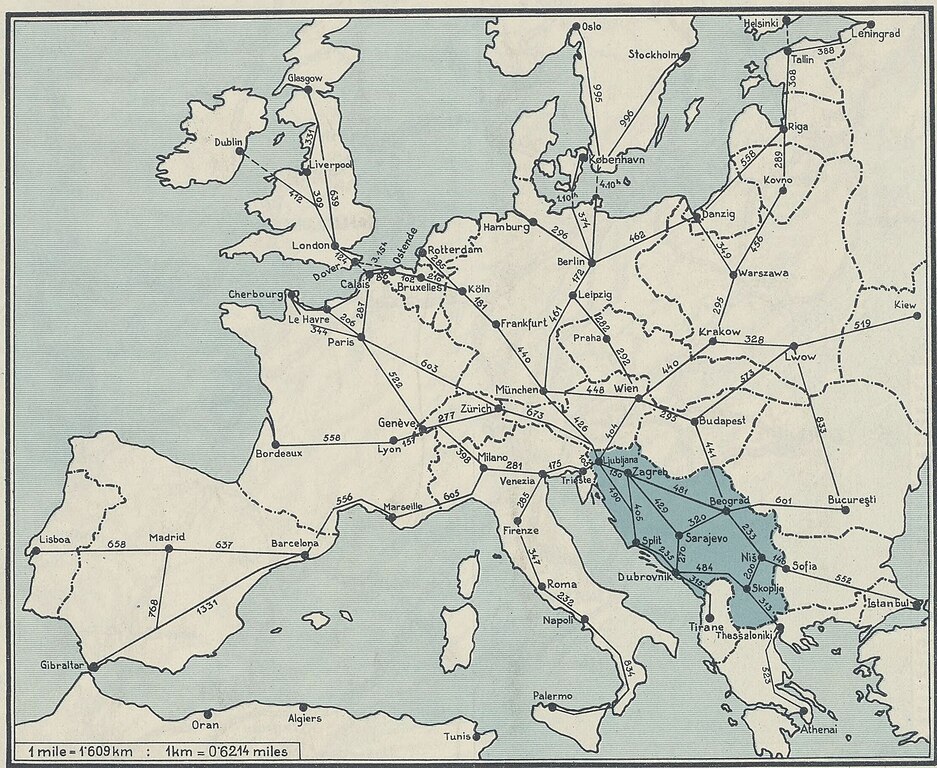
[edit]| Auto-Karta Kratjevine Jugoslavije... Itinéraires, hôtels, kilométrages, distances
( |
|||||||||||||||||||||||||||
|---|---|---|---|---|---|---|---|---|---|---|---|---|---|---|---|---|---|---|---|---|---|---|---|---|---|---|---|
| Title |
Auto-Karta Kratjevine Jugoslavije... Itinéraires, hôtels, kilométrages, distances |
||||||||||||||||||||||||||
| Description |
Français : Sujet : Yougoslavie -- Routes
Échelle(s) : 1:1 500 000 Langue : multilingue Éditeur : Jugoslovanska Tiskarna (V Ljubljani) |
||||||||||||||||||||||||||
| Date | 1933 | ||||||||||||||||||||||||||
| Dimensions | height: 50 cm (19.6 in); width: 82 cm (32.2 in) | ||||||||||||||||||||||||||
| Collection |
|
||||||||||||||||||||||||||
| Notes |
.jpg) |
||||||||||||||||||||||||||
| References |
Français : Notice du catalogue : http://catalogue.bnf.fr/ark:/12148/cb40736342h |
||||||||||||||||||||||||||
| Source/Photographer |
Français : Bibliothèque nationale de France, département Cartes et plans, GE C-5833
Bibliothèque nationale de France (2/2) |
||||||||||||||||||||||||||
| Permission (Reusing this file) |
|
||||||||||||||||||||||||||
| Other versions | |||||||||||||||||||||||||||

.jpg)
.jpg&action=edit§ion=1)
File history
Click on a date/time to view the file as it appeared at that time.
| Date/Time | Thumbnail | Dimensions | User | Comment | |
|---|---|---|---|---|---|
| current | 09:40, 14 August 2023 | | 2,224 × 1,824 (706 KB) | Enyavar (talk | contribs) | File:Auto-Karta Kratjevine Jugoslavije... Itinéraires, hôtels, kilométrages, distances - btv1b53066784w (2 of 2).jpg cropped 78 % horizontally, 70 % vertically, rotated 180.4° using CropTool with precise mode. |
You cannot overwrite this file.
File usage on Commons
The following 4 pages use this file:
- User:Chumwa/OgreBot/Transport Maps/2023 August 11-20
- User:Chumwa/OgreBot/Travel and communication maps/2023 August 11-20
- File:Auto-Karta Kratjevine Jugoslavije... Itinéraires, hôtels, kilométrages, distances - btv1b53066784w (2 of 2).jpg
- File:Highway network of Europe 1933 (Auto-Karta Kratjevine Jugoslavije).jpg
.jpg)
.jpg&oldid=869968692)