File:Hove Lagoon - geograph.org.uk - 489000.jpg
Jump to navigation
Jump to search
No higher resolution available.
Hove_Lagoon_-_geograph.org.uk_-_489000.jpg (640 × 479 pixels, file size: 128 KB, MIME type: image/jpeg)
Captions
Captions
Add a one-line explanation of what this file represents
Summary
[edit]
| Description |
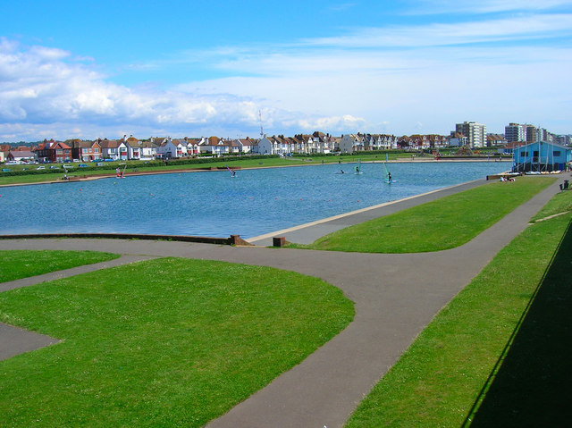
English: Hove Lagoon Once part of the River Adur and for the time close to its mouth. When The Canal was shut off in the 19th century this part remained marshy ground until 1930 when it was landscaped as it is today by the council. Used by windsurfers, rowers, canoeists and model boat users it is a popular meeting place in good weather. During the Second World War it was used by military vehicles to test the waterproofing. |
| Date | |
| Source | From geograph.org.uk |
| Author | Simon Carey |
| Attribution (required by the license) | Simon Carey / Hove Lagoon / |
| Camera location | | View this and other nearby images on: OpenStreetMap |
|---|
_heading:67.00&language=en)
| Object location | | View this and other nearby images on: OpenStreetMap |
|---|
_heading:67.00&language=en)
Licensing
[edit]

|
This image was taken from the Geograph project collection. See this photograph's page on the Geograph website for the photographer's contact details. The copyright on this image is owned by Simon Carey and is licensed for reuse under the Creative Commons Attribution-ShareAlike 2.0 license.
|
This file is licensed under the Creative Commons Attribution-Share Alike 2.0 Generic license.
Attribution: Simon Carey
- You are free:
- to share – to copy, distribute and transmit the work
- to remix – to adapt the work
- Under the following conditions:
- attribution – You must give appropriate credit, provide a link to the license, and indicate if changes were made. You may do so in any reasonable manner, but not in any way that suggests the licensor endorses you or your use.
- share alike – If you remix, transform, or build upon the material, you must distribute your contributions under the same or compatible license as the original.
- Remove redundant categories and try to put this image in the most specific category/categories
- Remove this template
- The location categories are based on information from this geonames tool and this OpenStreetMap tool combined with a database. You can also have a look at this tool from mysociety.
- The topic category from Geograph was Boating lake (find similar images lake at Geograph)
File history
Click on a date/time to view the file as it appeared at that time.
| Date/Time | Thumbnail | Dimensions | User | Comment | |
|---|---|---|---|---|---|
| current | 01:49, 5 February 2011 | | 640 × 479 (128 KB) | GeographBot (talk | contribs) | == {{int:filedesc}} == {{Information |description={{en|1=Hove Lagoon Once part of the River Adur and for the time close to its mouth. When The Canal was shut off in the 19th century this part remained marshy ground until 1930 when it was landscaped as it |
You cannot overwrite this file.
File usage on Commons
There are no pages that use this file.