File:Hyde from Werneth Low.jpg
跳至導覽
跳至搜尋
無更高解析度可提供。
Hyde_from_Werneth_Low.jpg (640 × 480 像素,檔案大小:90 KB,MIME 類型:image/jpeg)
說明
說明
添加單行說明來描述出檔案所代表的內容
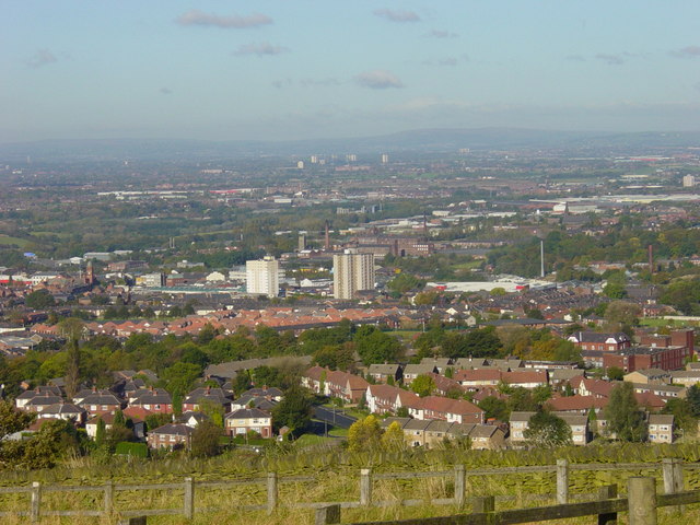
| 描述 | Hyde and Tameside from Werneth Low, in Greater Manchester, England. Hyde Town Hall is on the centre-left of this image. In the background is Dukinfield and Ashton-under-Lyne, both in Tameside. The Pennines are on the horizon. | ||
| 日期 | |||
| 來源 | geograph.org.uk | ||
| 作者 | Janine Cook | ||
| 授權許可 (重用此檔案) |
此檔案採用創用CC 姓名標示-相同方式分享 2.0 通用版授權條款。 姓名標示: Janine Cook
|
||
| 姓名標示 (由许可协议要求) | Janine Cook / View from Werneth Low on a sunny day / | ||

| 目標地點 | | 位於此地的本圖片與其他圖片: OpenStreetMap |
|---|
_heading:337.00&language=zh-hant)
檔案歷史
點選日期/時間以檢視該時間的檔案版本。
| 日期/時間 | 縮圖 | 尺寸 | 使用者 | 備註 | |
|---|---|---|---|---|---|
| 目前 | 2008年11月11日 (二) 16:25 | | 640 × 480(90 KB) | Jza84(留言 | 貢獻) | {{Information |Description=Hyde and Tameside from Werneth Low, in Greater Manchester, England. Hyde Town Hall is on the centre-left of this image. In the background is Dukinfield and Ashton-under-Lyne, both in Tameside. |Source=[http://www.geograph.org.u |
無法覆蓋此檔案。
檔案用途
全域檔案使用狀況
以下其他 wiki 使用了這個檔案:
- azb.wikipedia.org 的使用狀況
- ceb.wikipedia.org 的使用狀況
- cy.wikipedia.org 的使用狀況
- es.wikipedia.org 的使用狀況
- eu.wikipedia.org 的使用狀況
- fa.wikipedia.org 的使用狀況
- fr.wikipedia.org 的使用狀況
- ga.wikipedia.org 的使用狀況
- it.wikipedia.org 的使用狀況
- lld.wikipedia.org 的使用狀況
- nn.wikipedia.org 的使用狀況
- pl.wikipedia.org 的使用狀況
- ro.wikipedia.org 的使用狀況
- sh.wikipedia.org 的使用狀況
- uk.wikivoyage.org 的使用狀況
- www.wikidata.org 的使用狀況
- zh.wikipedia.org 的使用狀況