File:Iraq location map.svg
Zur Navigation springen
Zur Suche springen

Gröössi vor PNG-Vorschou vor SVG-Datei: 589 × 600 Pixel. Wyteri Ufflösige: 236 × 240 Pixel | 471 × 480 Pixel | 754 × 768 Pixel | 1.005 × 1.024 Pixel | 2.011 × 2.048 Pixel | 1.241 × 1.264 Pixel.
Originaldatei (SVG-Datei, Basisgrößi: 1.241 × 1.264 Pixel, Dateigrößi: 232 KB)
Bildtexte
Kurzbeschreibungen
Ergänze eine einzeilige Erklärung, was diese Datei darstellt.
Bschryybig[ändere]
| Bschryybig |
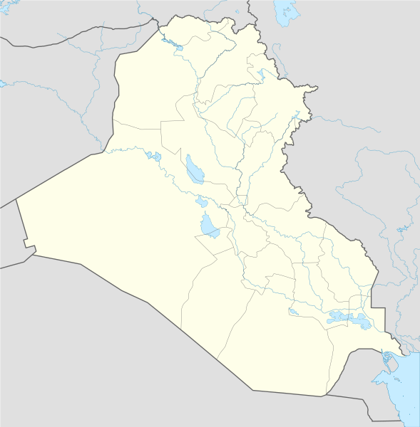
Deutsch: Positionskarte von Irak
Quadratische Plattkarte, N-S-Streckung 115 %. Geographische Begrenzung der Karte:
English: Location map of Iraq
Equirectangular projection, N/S stretching 115 %. Geographic limits of the map:
|
| Datum | |
| Quälle |
Eigenes Werk mittels:
|
| Urheber | NordNordWest |
| Anderi Versione |
Abgleiteti Wärk vo dere Datei: |

|
Diese Karte wurde in der Kartenwerkstatt erstellt oder verbessert. Auch du kannst dort Karten vorschlagen, die zu erstellen, verändern oder übersetzen sind.
|
Lizänzierig[ändere]
Ich haa s Urheberrächt an däm Wärch un vereffetlig s dodermit unter däne Lizänze:

|
Des Dokumänt derf kopiert, verbreitet un/oder bearbeitet wäre unter dr Bedingige vu dr GNU-Lizänz fir freji Dokumäntation, Version 1.2 oder ere spetere Version, vereffetligt dur Free Software Foundation. S het keini uuveränderlige Abschnitt, kei vordere Umschlagstext un kei hindere Umschlagstext. E Kopii vu dr Lizänz isch verfiegbar im Abschnitt GNU-Lizänz fir freji Dokumäntation. |
Die Datei isch lizänziert unter dr Creative-Commons-Lizenz Namensnännig – Wytergab unter glyche Bedingige 3.0 nit portiert.
- Du derfsch:
- des Wärch an anderi wytergee – des Wärch kopiere, verbreite un ibertrage
- des Wärch verändere – des Wärch aapasse
- Unter däne Bedingige:
- Namenännig – Du muesch aagmässeni Aagabe zum Urheber un dr Rächt mache, e Link zue dr Lizänz zuefiege un aagee, eb Änderige gmacht wore sin. Die Aagabe chenne in ere aagmässene Art gmacht wäre, aber nit eso, ass dr Yydruck entstoht, ass dr Lizänzgeber Dii oder Dyy Gebruch vum Wärch unterstitze un guetheiße.
- Wytergab unter glyche Bedingige – Wänn du des Wärch veränderesch, umwandlesch oder druf ufböusch, no derfsch s Ergebnis nume unter dr glyche oder ere kumpatible Lizänz wie s Orginal vereffetlige.
Du chasch sälber e Lizänz uuswehle.
Dateiversione
Klick uf e Zytpunkt zu aazeige, wie s dert usgsäh het.
| Version vom | Vorschaubild | Mäß | Benutzer | Kommentar | |
|---|---|---|---|---|---|
| aktuell | 14:01, 8. Nov. 2017 | | 1.241 × 1.264 (232 KB) | Rob984 (Diskussion | Byträg) | reduced intensity of rivers in line with location scheme |
| 18:54, 17. Jun. 2014 |  | 1.241 × 1.264 (377 KB) | Spesh531 (Diskussion | Byträg) | without Halabja, status disputed | |
| 03:13, 14. Jun. 2014 |  | 1.241 × 1.264 (377 KB) | Spesh531 (Diskussion | Byträg) | adding many rivers (that are at least shown on an average Iraqi map) | |
| 01:09, 13. Jun. 2014 |  | 1.241 × 1.264 (312 KB) | Spesh531 (Diskussion | Byträg) | additional lakes, and adding halabja | |
| 23:13, 12. Jun. 2014 |  | 1.241 × 1.264 (313 KB) | Spesh531 (Diskussion | Byträg) | lakes | |
| 20:36, 21. Aug. 2008 |  | 1.241 × 1.264 (316 KB) | NordNordWest (Diskussion | Byträg) | {{Information |Description= {{de|Positionskarte von Irak}} Quadratische Plattkarte, N-S-Streckung 115 %. Geographische Begrenzung der Karte: * N: 37.7° N * S: 28.4° N * W: 38.4° O * O: 48.9° O {{en|Location map of Iraq}} Equi |
Du chasch die Datei nit iberschryybe.
Verwändig vu dr Datei
Die 79 Syte bruuche die Datei:
- User:NordNordWest/Gallery/Location maps
- File:2005 Iraqi Kurdistan independence referendum map-ar.png
- File:2005 Iraqi Kurdistan independence referendum map.svg
- File:2005 Iraqi elections.svg
- File:2009 Iraqi elections.svg
- File:2010 Iraqi election map.svg
- File:2013 Iraqi governorate election status.svg
- File:2013 Iraqi governorate elections.svg
- File:Al-Anbar in Iraq.svg
- File:Al-Anbar map.svg
- File:Al-Basra map.svg
- File:Al-Basrah in Iraq.svg
- File:Al-Muthanna in Iraq.svg
- File:Al-Muthanna map.svg
- File:Al-Najaf map.svg
- File:Al-Qadisiya map.svg
- File:Al-Qadisiyyah in Iraq.svg
- File:An-Najaf in Iraq.svg
- File:Arbil in Iraq.svg
- File:Arbil map.svg
- File:As-Sulaymaniyyah in Iraq.svg
- File:Babil in Iraq.svg
- File:Babil map.svg
- File:Baghdad in Iraq.svg
- File:Baghdad map.svg
- File:Dhi Qar in Iraq.svg
- File:Dhi Qar map.svg
- File:Disputed areas in Iraq.svg
- File:Diyala in Iraq.svg
- File:Diyala map.svg
- File:Dohuk map.svg
- File:Duhok in Iraq.svg
- File:Emblem of the General Military Council for Iraqi Revolutionaries.svg
- File:Ethnoreligious Iraq.svg
- File:Flag of the Iraqi 2nd Infantry Division.svg
- File:Flag of the Iraqi 7th Infantry Division.svg
- File:Flag of the Iraqi Air Force.svg
- File:Flag of the Iraqi Ground Forces.svg
- File:Halabja in Iraq.svg
- File:Halabja map.svg
- File:Iraq 2018 election.svg
- File:Iraq Al-Qādisiyyah Governorate.svg
- File:Iraq Al Anbar Governorate.svg
- File:Iraq Al Muthanna Governorate.svg
- File:Iraq As Sulaymaniyah Governorate.svg
- File:Iraq Babil Governorate.svg
- File:Iraq Baghdad Governorate.svg
- File:Iraq Basra Governorate.svg
- File:Iraq Dahuk Governorate.svg
- File:Iraq Dec05 Elect.svg
- File:Iraq Dhi Qar Governorate.svg
- File:Iraq Diyala Governorate.svg
- File:Iraq Erbil Governorate.svg
- File:Iraq Karbala Governorate.svg
- File:Iraq Kirkuk Governorate.svg
- File:Iraq Maysan Governorate.svg
- File:Iraq Najaf Governorate.svg
- File:Iraq Ninawa Governorate.svg
- File:Iraq Parliament January 2005.svg
- File:Iraq Salah ad Din Governorate.svg
- File:Iraq Wasit Governorate.svg
- File:Iraq total fertility rate by region 2006.png
- File:Iraqi Air Defence Command Flag.svg
- File:Iraqi Governorates.svg
- File:Karbala in Iraq.svg
- File:Karbala map.svg
- File:Kirkuk in Iraq.svg
- File:Kirkuk map.svg
- File:Maysan in Iraq.svg
- File:Maysan map.svg
- File:Mesopotamia location map2.svg
- File:Mosul-Haifa oil pipeline.svg
- File:Ninawa in Iraq.svg
- File:Ninawa map.svg
- File:Salah Al-Din map.svg
- File:Salah ad-Din in Iraq.svg
- File:Sulaymaniyah map.svg
- File:Wasit in Iraq.svg
- File:Wasit map.svg
Wältwyti Dateinutzig
Die andere Wikis bruche die Datei:
- Gebruch uf af.wikipedia.org
- Gebruch uf als.wikipedia.org
- Gebruch uf ar.wikipedia.org
- العراق
- عبد الملك بن مروان
- أور
- إيسن
- إريدو
- كأس الخليج العربي 5
- دوري نجوم العراق
- الوركاء
- دير الربان هرمزد
- دير مار إيليا
- قائمة جامعات العراق
- أبو صلابيخ
- بحيرة ساوة
- عصر جمدة نصر
- سيبار
- دير مار متي
- قالب:خريطة مواقع العراق
- دير مار أوراها
- دير مار بهنام
- دير ناقورتايا
- قائمة سدود العراق
- كرسو
- شوروباك
- توتوب
- فترة أوروك
- تل عقير
- قاعدة القيارة الجوية
- قائمة مواقع التراث العالمي في العراق
- نفر
- قالب:خريطة مواقع الأندية العراقية
- وحدة:Location map/data/Iraq
- وحدة:Location map/data/Iraq/شرح
- قالب:المنشآت الجامعية في العراق
- قالب:خريطة مفصلة للتمرد العراقي
- قالب:خريطة مواقع التراث العالمي في العراق
- قالب:خريطة أهوار العراق
- مواجهات مطار سفوان
- تفجيرات بغداد (كانون الثاني 2017)
- بطولة اتحاد غرب آسيا لكرة القدم 2019
- هجوم صاروخي 2018 كردستان العراق
- اعتقال أمريكا لدبلوماسيين إيرانيين في أربيل
- تدافع كربلاء 2019
Wältwyti Verwändig vu däre Datei aaluege.