File:Ironwood Forest NM (9403760591).jpg

Original file (3,600 × 2,399 pixels, file size: 5.14 MB, MIME type: image/jpeg)
Captions
Captions
Summary
[edit].jpg&action=edit§ion=1)
| Description |
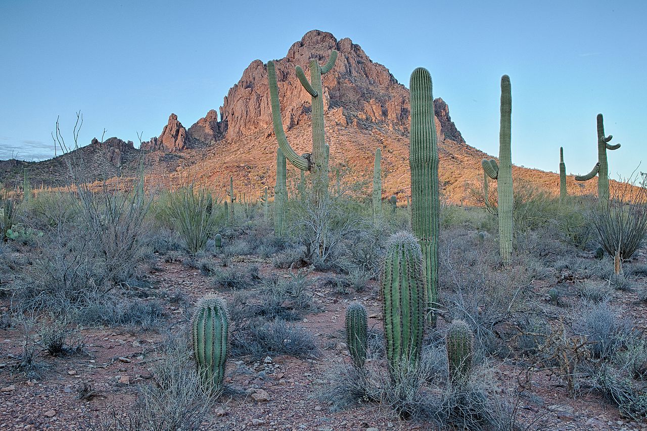
Taking its name from one of the longest living trees in the Arizona desert, the 129,000-acre Ironwood Forest National Monument is a true Sonoran Desert showcase. Keeping company with the ironwood trees are mesquite, palo verde, creosote, and saguaro, blanketing the monument floor beneath rugged mountain ranges named Silver Bell, Waterman and Sawtooth. In between, desert valleys lay quietly to complete the setting.Elevations here range from 1,800 to more than 4,200 feet. Three areas within the monument, the Los Robles Archeological District, the Mission of Santa Ana del Chiquiburitac and the Cocoraque Butte Archeological District, are listed on the National Register of Historic Places. Learn more about Ironwood Forest NM: www.blm.gov/az/st/en/prog/blm_special_areas/natmon/ironwo... Photo: Bob Wick, BLM California |
| Date | |
| Source | Ironwood Forest NM |
| Author | Bureau of Land Management |
Licensing
[edit].jpg&action=edit§ion=2)
- You are free:
- to share – to copy, distribute and transmit the work
- to remix – to adapt the work
- Under the following conditions:
- attribution – You must give appropriate credit, provide a link to the license, and indicate if changes were made. You may do so in any reasonable manner, but not in any way that suggests the licensor endorses you or your use.
| This image was originally posted to Flickr by mypubliclands at https://flickr.com/photos/91981596@N06/9403760591. It was reviewed on 4 August 2015 by FlickreviewR and was confirmed to be licensed under the terms of the cc-by-2.0. |
| This image is a work of a Bureau of Land Management* employee, taken or made as part of that person's official duties. As a work of the U.S. federal government, the image is in the public domain in the United States. *or predecessor organization |
File history
Click on a date/time to view the file as it appeared at that time.
| Date/Time | Thumbnail | Dimensions | User | Comment | |
|---|---|---|---|---|---|
| current | 20:36, 4 August 2015 | | 3,600 × 2,399 (5.14 MB) | Wilfredor (talk | contribs) | Transferred from Flickr via Flickr2Commons |
You cannot overwrite this file.
File usage on Commons
There are no pages that use this file.
File usage on other wikis
The following other wikis use this file:
- Usage on de.wikipedia.org
- Usage on de.wikivoyage.org
- Usage on en.wikipedia.org
.jpg&oldid=888012808)