File:Is it a path^ - geograph.org.uk - 1738145.jpg
Jump to navigation
Jump to search
No higher resolution available.
Is_it_a_path^_-_geograph.org.uk_-_1738145.jpg (640 × 512 pixels, file size: 125 KB, MIME type: image/jpeg)
Captions
Captions
Add a one-line explanation of what this file represents
Summary
[edit]| Description |
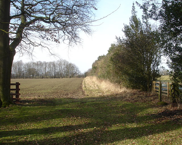
English: Is it a path? The 1:50000 map shows a public footpath following the track down to 556464, but not any further. There seemed to be no objection to walkers continuing down the track to 1738138. The map also shows a public footpath ending rather randomly at the north end of the strip of woodland seen in this photo. All logic would suggest that the northern edge of this field would be a public footpath joining these two loose ends together, but no signposts suggest either that this is the case or that the owners object to people assuming it is so. |
| Date | |
| Source | From geograph.org.uk |
| Author | Andy Waddington |
| Attribution (required by the license) | Andy Waddington / Is it a path? / |
| Camera location | | View this and other nearby images on: OpenStreetMap |
|---|
| Object location | | View this and other nearby images on: OpenStreetMap |
|---|
Licensing
[edit]
|
This image was taken from the Geograph project collection. See this photograph's page on the Geograph website for the photographer's contact details. The copyright on this image is owned by Andy Waddington and is licensed for reuse under the Creative Commons Attribution-ShareAlike 2.0 license.
|
This file is licensed under the Creative Commons Attribution-Share Alike 2.0 Generic license.
Attribution: Andy Waddington
- You are free:
- to share – to copy, distribute and transmit the work
- to remix – to adapt the work
- Under the following conditions:
- attribution – You must give appropriate credit, provide a link to the license, and indicate if changes were made. You may do so in any reasonable manner, but not in any way that suggests the licensor endorses you or your use.
- share alike – If you remix, transform, or build upon the material, you must distribute your contributions under the same or compatible license as the original.

_heading:270.00&language=en)
_heading:270.00&language=en)
File history
Click on a date/time to view the file as it appeared at that time.
| Date/Time | Thumbnail | Dimensions | User | Comment | |
|---|---|---|---|---|---|
| current | 15:33, 5 March 2011 | | 640 × 512 (125 KB) | GeographBot (talk | contribs) | == {{int:filedesc}} == {{Information |description={{en|1=Is it a path? The 1:50000 map shows a public footpath following the track down to [556464], but not any further. There seemed to be no objection to walkers continuing down the track to [[[173813 |
You cannot overwrite this file.
File usage on Commons
There are no pages that use this file.