File:Jishinnoben1855.jpg
Original file (2,967 × 4,048 pixels, file size: 3.58 MB, MIME type: image/jpeg)
Captions
Captions
| Description |
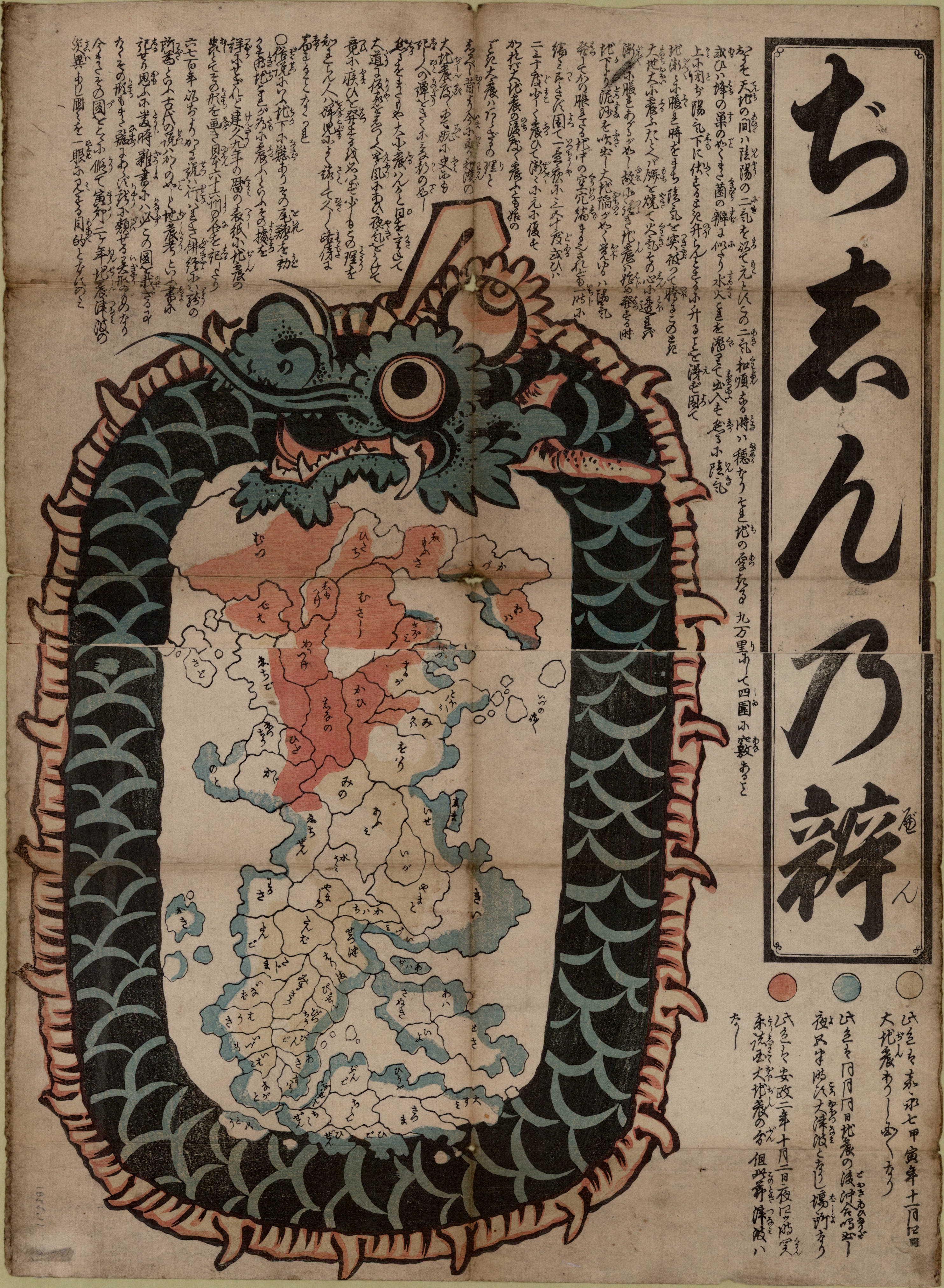
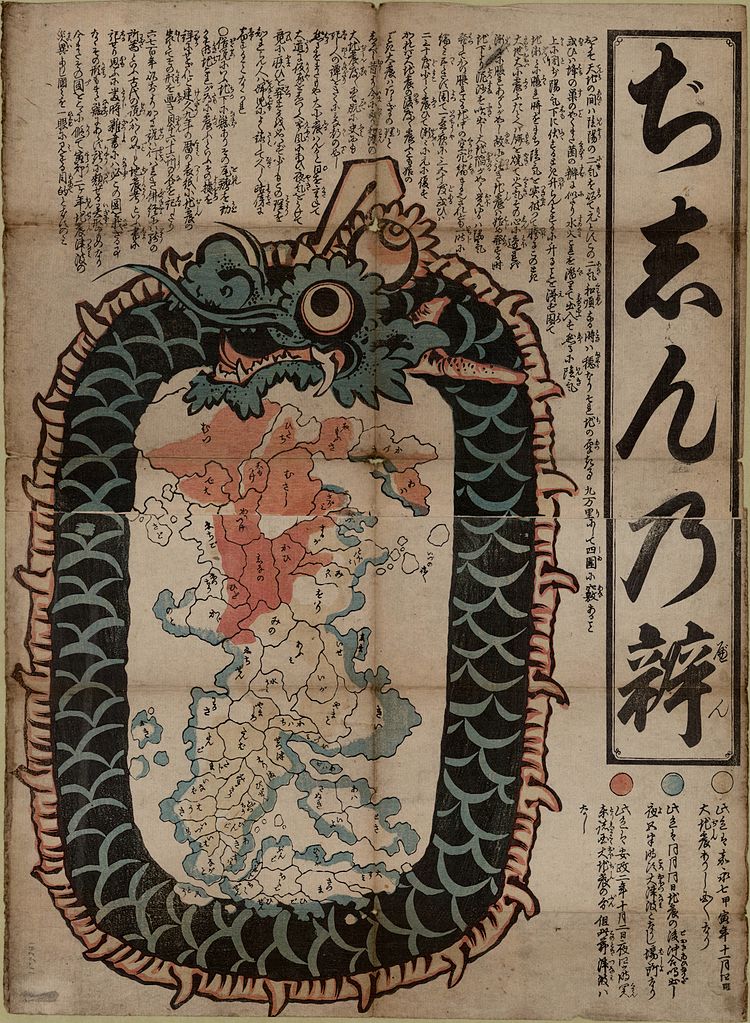
1 map : woodcut, col. ; 43.0 x 28.5 cm. on sheet 50.9 x 37.3 cm. Yellow denotes the areas damaged by earthquake in Kaei 7 (4 November 1854), blue the coasts inundated by the tidal wave of that year, and red the areas devastated by the earthquake of Ansei 2 (2 October 1855). |
|||
| Date | ||||
| Source | UBC Library | |||
| Author | Unknown author | |||
| Permission (Reusing this file) |
|

File history
Click on a date/time to view the file as it appeared at that time.
| Date/Time | Thumbnail | Dimensions | User | Comment | |
|---|---|---|---|---|---|
| current | 15:22, 25 July 2012 | | 2,967 × 4,048 (3.58 MB) | Nesnad (talk | contribs) | {{Information |Description=1 map : woodcut, col. ; 43.0 x 28.5 cm. on sheet 50.9 x 37.3 cm. <BR> Yellow denotes the areas damaged by earthquake in Kaei 7 (4 November 1854), blue the coasts inundated by the tidal wave of that year, and red the areas dev... |
You cannot overwrite this file.
File usage on Commons
There are no pages that use this file.
File usage on other wikis
The following other wikis use this file:
- Usage on it.wikipedia.org