File:KSFB airport diagram.pdf
Jump to navigation
Jump to search

Size of this JPG preview of this PDF file: 390 × 599 pixels. Other resolutions: 156 × 240 pixels | 313 × 480 pixels | 806 × 1,237 pixels.
Original file (806 × 1,237 pixels, file size: 188 KB, MIME type: application/pdf)
Captions
Captions
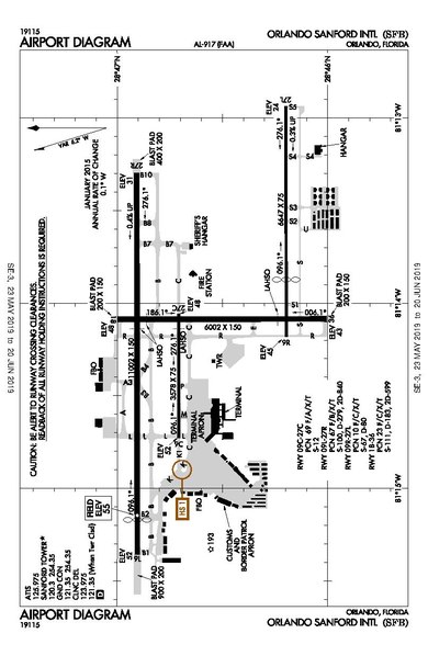
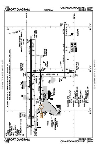
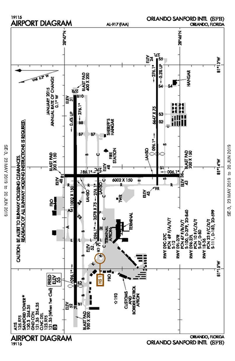
Airport map for KSFB (Orlando Sanford international airport)
Summary[edit]
| Description |
日本語: KSFBの空港地図です。 |
| Date | |
| Source | https://aeronav.faa.gov/d-tpp/1906/00917ad.pdf#nameddest=(SFB) |
| Author | Federal Aviation Administration |
Licensing[edit]
This image or file is a work of a Federal Aviation Administration employee, taken or made as part of that person's official duties. As a work of the U.S. federal government, the image is in the public domain in the United States.
|
 |
File history
Click on a date/time to view the file as it appeared at that time.
| Date/Time | Thumbnail | Dimensions | User | Comment | |
|---|---|---|---|---|---|
| current | 03:01, 12 June 2019 | 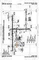 | 806 × 1,237 (188 KB) | ドクターイエロー923 (talk | contribs) | User created page with UploadWizard |
You cannot overwrite this file.
File usage on Commons
There are no pages that use this file.
File usage on other wikis
The following other wikis use this file:
- Usage on de.wikipedia.org
- Usage on en.wikipedia.org
- Usage on fr.wikipedia.org