File:Karte Gemeinden des Kantons Graubünden farbig 1923.png
Jump to navigation
Jump to search

Size of this preview: 800 × 574 pixels. Other resolutions: 320 × 229 pixels | 640 × 459 pixels | 1,024 × 734 pixels | 1,280 × 918 pixels | 2,560 × 1,836 pixels | 3,836 × 2,751 pixels.
Original file (3,836 × 2,751 pixels, file size: 2.42 MB, MIME type: image/png)
Captions
Captions
Add a one-line explanation of what this file represents
Summary[edit]
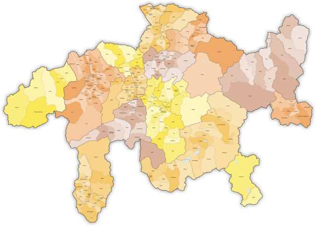
| Description | Municipalities in Canton Graubünden from 01.01.1923 to 31.12.1942 |
| Date | |
| Source | Own work |
| Author | Tschubby |
Licensing[edit]
I, the copyright holder of this work, hereby publish it under the following licenses:

|
Permission is granted to copy, distribute and/or modify this document under the terms of the GNU Free Documentation License, Version 1.2 or any later version published by the Free Software Foundation; with no Invariant Sections, no Front-Cover Texts, and no Back-Cover Texts. A copy of the license is included in the section entitled GNU Free Documentation License. |
This file is licensed under the Creative Commons Attribution-Share Alike 3.0 Unported, 2.5 Generic, 2.0 Generic and 1.0 Generic license.
- You are free:
- to share – to copy, distribute and transmit the work
- to remix – to adapt the work
- Under the following conditions:
- attribution – You must give appropriate credit, provide a link to the license, and indicate if changes were made. You may do so in any reasonable manner, but not in any way that suggests the licensor endorses you or your use.
- share alike – If you remix, transform, or build upon the material, you must distribute your contributions under the same or compatible license as the original.
You may select the license of your choice.
File history
Click on a date/time to view the file as it appeared at that time.
| Date/Time | Thumbnail | Dimensions | User | Comment | |
|---|---|---|---|---|---|
| current | 16:30, 30 April 2024 | | 3,836 × 2,751 (2.42 MB) | Tschubby (talk | contribs) | == {{int:filedesc}} == {{Information |Description= Municipalities in Canton Aargau from 01.01.1983 to 31.12.1996 |Source={{own}} |Date=1983-01-01 |Author=Tschubby |Permission= |other_versions= }} == {{int:license-header}} == {{self|GFDL|cc-by-sa-3.0,2.5,2.0,1.0}} Category:Blank maps of Switzerland to 1996 Category:Maps of the canton of Aargau to 1996 Aargau |
| 12:41, 19 April 2024 |  | 3,836 × 2,751 (2.42 MB) | Tschubby (talk | contribs) | == {{int:filedesc}} == {{Information |Description={{en|1=Districts and Sub Districts in Switzerland 1961}} {{de|1=Schweizer Bezirke und Kreise 1961}} |Source={{own}} |Author=Tschubby |Date=1961-01-01 |Permission= |other_versions= }} == {{int:license-header}} == {{self|GFDL|cc-by-sa-3.0,2.5,2.0,1.0}} Category:1975 maps of Switzerland 2.1 | |
| 11:46, 11 April 2024 |  | 3,836 × 2,751 (2.42 MB) | Tschubby (talk | contribs) | == {{int:filedesc}} == {{Information |Description= Municipalities in Canton Graubünden from 01.01.1923 to 31.12.1942 |Source={{own}} |Date=1923-01-01 |Author=Tschubby |Permission= |other_versions= }} == {{int:license-header}} == {{self|GFDL|cc-by-sa-3.0,2.5,2.0,1.0}} Category:1923 maps of Switzerland Category:Maps of the canton of Graubünden to 1942 Graubünden |
You cannot overwrite this file.
File usage on Commons
There are no pages that use this file.
File usage on other wikis
The following other wikis use this file:
- Usage on de.wikipedia.org