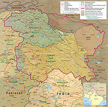
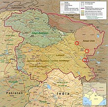
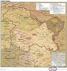
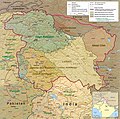
File:Kashmir Region November 2019.jpg

پروندهٔ اصلی (۱٬۵۷۹ × ۱٬۵۶۶ پیکسل، اندازهٔ پرونده: ۱٫۴۴ مگابایت، نوع MIME پرونده: image/jpeg)
گزینهها
عنوان
خلاصه[ویرایش]
| توضیحKashmir Region November 2019.jpg | . |
| تاریخ | |
| منبع | Map of Kashmir region created by the US Central Intelligence Agency, 2004; altered by Fowler&fowler (بحث) 06:29, 14 November 2019 (UTC) |
| پدیدآور | US Central Intelligence Agency |
| دیگر نسخهها |
   |
اجازهنامه[ویرایش]
| Public domainPublic domainfalsefalse |
| This image is a work of a Central Intelligence Agency employee, taken or made as part of that person's official duties. As a Work of the United States Government, this image or media is in the public domain in the United States.
čeština ∙ Deutsch ∙ eesti ∙ English ∙ español ∙ français ∙ italiano ∙ português ∙ polski ∙ sicilianu ∙ slovenščina ∙ suomi ∙ Tiếng Việt ∙ български ∙ македонски ∙ русский ∙ українська ∙ বাংলা ∙ മലയാളം ∙ 한국어 ∙ 日本語 ∙ 中文 ∙ 中文(简体) ∙ 中文(繁體) ∙ العربية ∙ پښتو ∙ +/− |

|
| برچسبها InfoField | این نگاره برچسپگذاری شدهاست: برچسپها را در ویکیانبار مشاهده کنید |
Gilgit (capital of Gilgit-Baltistan)
Muzaffarabad (capital of Azad Kashmir)
K2 (tallest mountain in Kashmir)
Srinagar (summer capital of Jammu and Kashmir)
Jammu (winter capital of Jammu and Kashmir)
Leh
Kargil
Pangong Tso
Aksai Chin Lake
Siachen Glacier
Wular Lake
- ↑ India Revokes Kashmir’s Special Status, Raising Fears of Unrest[1], New York Times, 5 August 2019
- ↑ Regan, Helen (31 October 2019) India downgrades Kashmir's status and takes greater control over contested region[2], CNN
- ↑ Ellis-Peterson, Hannah (31 October 2019) India strips Kashmir of special status and divides it in two[3], Guardian
- ↑ State No More: India Formally Ends Statehood for Jammu and Kashmir[4], Diplomat, 31 October 2019
تاریخچهٔ پرونده
روی تاریخ/زمانها کلیک کنید تا نسخهٔ مربوط به آن هنگام را ببینید.
| تاریخ/زمان | بندانگشتی | ابعاد | کاربر | توضیح | |
|---|---|---|---|---|---|
| کنونی | ۲ ژوئن ۲۰۲۲، ساعت ۰۹:۱۴ |  | ۱٬۵۷۹ در ۱٬۵۶۶ (۱٫۴۴ مگابایت) | Fowler&fowler (بحث | مشارکتها) | Reverted to version as of 04:58, 21 February 2022 (UTC) Again and for the last time, there is a WikiProjects India, Pakistan, and China consensus for this file to only appear in this form. It cannot be changed to highlight one portion or other for any of the subdivisions. If you persist, I will request administrative action |
| ۲۶ آوریل ۲۰۲۲، ساعت ۱۴:۴۴ |  | ۱٬۵۷۹ در ۱٬۵۶۶ (۲٫۱۵ مگابایت) | Aréat (بحث | مشارکتها) | updated the key. What's the problem with the colors for the up to date situation? It's a public domain file | |
| ۲۱ فوریهٔ ۲۰۲۲، ساعت ۰۴:۵۸ |  | ۱٬۵۷۹ در ۱٬۵۶۶ (۱٫۴۴ مگابایت) | Fowler&fowler (بحث | مشارکتها) | Reverted to version as of 14:08, 4 January 2021 (UTC). Sorry by a WikiProjects India-Pakistan consensus we cannot change the CIA maps and its colors; see "Indian-administered" color map on the top right. | |
| ۶ آوریل ۲۰۲۱، ساعت ۰۴:۰۴ |  | ۱٬۵۷۹ در ۱٬۵۶۶ (۲٫۰۹ مگابایت) | Aréat (بحث | مشارکتها) | Distinct colors for Ladakh and Jammu and Kashmir, sicne the map is used on their page, and the map as it was made it hard to see what their respective territory is | |
| ۴ ژانویهٔ ۲۰۲۱، ساعت ۱۴:۰۸ |  | ۱٬۵۷۹ در ۱٬۵۶۶ (۱٫۴۴ مگابایت) | Sbb1413 (بحث | مشارکتها) | Updated to include modern-day names of some provinces and states (e.g. North Western Frontier Province is now called Khyber Pakhtunkhwa, Uttaranchal is now called Uttarakhand). | |
| ۳ دسامبر ۲۰۲۰، ساعت ۰۶:۱۳ |  | ۱٬۵۷۹ در ۱٬۵۶۶ (۱٫۲۷ مگابایت) | Sbb1413 (بحث | مشارکتها) | Reverted to version as of 16:29, 25 November 2019 (UTC) | |
| ۳ دسامبر ۲۰۲۰، ساعت ۰۶:۰۵ |  | ۲٬۴۶۹ در ۲٬۴۴۹ (۱٬۰۲۳ کیلوبایت) | Sbb1413 (بحث | مشارکتها) | Added working boundary from File:File:Kashmir map big.jpg, also from CIA. | |
| ۲۵ نوامبر ۲۰۱۹، ساعت ۱۶:۲۹ |  | ۱٬۵۷۹ در ۱٬۵۶۶ (۱٫۲۷ مگابایت) | Fowler&fowler (بحث | مشارکتها) | Moving labels to less cluttered spots; making Aksai Chin as big as other labels; drawing the J&K and Ladakh boundaries in green as indicated in info on the top left; making that info conform to the name change: Northern Areas-->Gilgit-Baltistan | |
| ۱۴ نوامبر ۲۰۱۹، ساعت ۰۶:۲۹ |  | ۱٬۵۷۹ در ۱٬۵۶۷ (۱٫۳۵ مگابایت) | Fowler&fowler (بحث | مشارکتها) | User created page with UploadWizard |
شما نمیتوانید این پرونده را رونویسی کنید.
کاربرد پرونده
صفحههای زیر از این تصویر استفاده میکنند:
- Atlas of Kashmir
- Atlas of Pakistan
- User:Ixocactus/Favorites
- User talk:Aréat
- Commons:Files used on the OpenStreetMap Wiki/14
- File:Chinese irredentism-expansionism (nationalism).jpg
- File:Kashmir Region (2020 skirmish locations).jpg
- File:Kashmir region. LOC 2003626427 - showing sub-regions administered by different countries.jpg
- File:Kashmir region.jpg
- File:Kashmir region 2004.jpg
- File:Ladakh in Greater Kashmir.jpg
- Category:Kashmir conflict
کاربرد سراسری پرونده
ویکیهای دیگر زیر از این پرونده استفاده میکنند:
- کاربرد در ar.wikipedia.org
- کاربرد در as.wikipedia.org
- کاربرد در az.wikipedia.org
- کاربرد در bn.wikipedia.org
- کاربرد در ca.wikipedia.org
- کاربرد در de.wikipedia.org
- کاربرد در en.wikipedia.org
- Territorial dispute
- Line of Control
- Baltistan
- Line of Actual Control
- Skardu
- Trans-Karakoram Tract
- Talk:List of ongoing armed conflicts
- Dominion of India
- Kashgar Prefecture
- Frozen conflict
- History of Ladakh
- Talk:Robin Raphel
- Sino-Indian border dispute
- List of active separatist movements in Asia
- History of Azad Kashmir
- Jammu division
- Ministry of Kashmir Affairs and Gilgit-Baltistan
- Wikipedia talk:Noticeboard for India-related topics/Archive 69
- Talk:Ladakh/Archive 1
- Wikipedia talk:WikiProject Maps/Archive 2020
- User:DutchTreat/Projects/Maps
- Wikipedia:Noticeboard for Kashmir-related topics
- Portal:Kashmir
- Portal:Kashmir/Intro
- User talk:Kautilya3/Archives/Archive 17
- Talk:Azad Kashmir/Archives/2021
- Talk:Jammu and Kashmir (union territory)/Archive 1
- User talk:FacetsOfNonStickPans/Archive 9
- Wikipedia talk:Noticeboard for India-related topics/Archive 74
- Wikipedia:Top 25 Report/March 13 to 19, 2022
- Wikipedia:Top 25 Report/August 7 to 13, 2022
نمایش استفادههای سراسری از این پرونده.
فراداده
این پرونده حاوی اطلاعات اضافهایاست که احتمالاً دوربین دیجیتال یا پویشگری که در ایجاد یا دیجیتالیکردن آن به کار رفته آن را افزوده است. اگر پرونده از وضعیت ابتداییاش تغییر داده شده باشد آنگاه ممکن است شرح و تفصیلات موجود اطلاعات تصویر را تماماً بازتاب ندهد.
| تفکیکپذیری افقی | ۹۶ نقطه در اینچ |
|---|---|
| تفکیکپذیری عمودی | ۹۶ نقطه در اینچ |
| نرمافزار استفادهشده | paint.net 4.2.14 |