File:Kemyls Peth, descent into Coquetdale - geograph.org.uk - 1088620.jpg
Jump to navigation
Jump to search
No higher resolution available.
Kemyls_Peth,_descent_into_Coquetdale_-_geograph.org.uk_-_1088620.jpg (640 × 480 pixels, file size: 88 KB, MIME type: image/jpeg)
Captions
Captions
Add a one-line explanation of what this file represents
Summary[edit]
| Description |
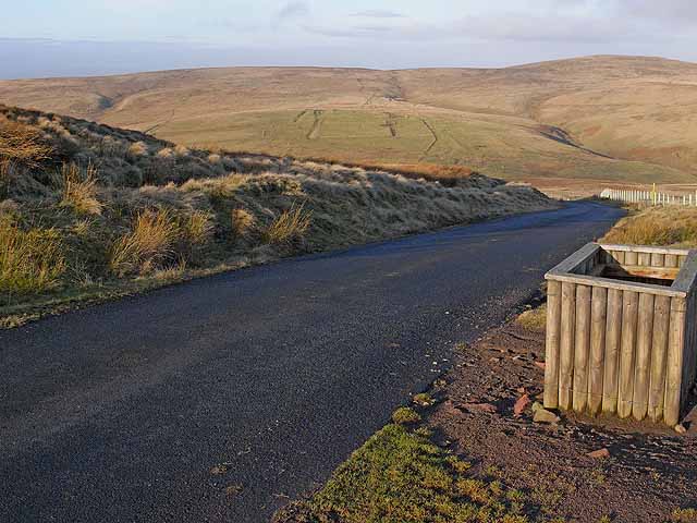
English: Kemyls Peth; descent into Coquetdale Part of the Otterburn Ranges http://www.otterburnranges.co.uk/ ; only open to the public for a limited period each year although this road between Cottonhopesburnfoot in Redesdale and Coquetdale is rarely closed. This section of road is the so-called Camel's Path (no doubt a corruption of Kemyls Peth), an ancient road which coincides approximately with the Roman Dere Street. The Pennine Way http://www.nationaltrail.co.uk/PennineWay/ skirts Brownhart Law NT7809 on the skyline. |
| Date | |
| Source | From geograph.org.uk |
| Author | Oliver Dixon |
| Attribution (required by the license) | Oliver Dixon / Kemyls Peth; descent into Coquetdale / |
| Camera location | | View this and other nearby images on: OpenStreetMap |
|---|
_heading:337.00&language=en)
| Object location | | View this and other nearby images on: OpenStreetMap |
|---|
_heading:337.00&language=en)
Licensing[edit]

|
This image was taken from the Geograph project collection. See this photograph's page on the Geograph website for the photographer's contact details. The copyright on this image is owned by Oliver Dixon and is licensed for reuse under the Creative Commons Attribution-ShareAlike 2.0 license.
|
This file is licensed under the Creative Commons Attribution-Share Alike 2.0 Generic license.
Attribution: Oliver Dixon
- You are free:
- to share – to copy, distribute and transmit the work
- to remix – to adapt the work
- Under the following conditions:
- attribution – You must give appropriate credit, provide a link to the license, and indicate if changes were made. You may do so in any reasonable manner, but not in any way that suggests the licensor endorses you or your use.
- share alike – If you remix, transform, or build upon the material, you must distribute your contributions under the same or compatible license as the original.
File history
Click on a date/time to view the file as it appeared at that time.
| Date/Time | Thumbnail | Dimensions | User | Comment | |
|---|---|---|---|---|---|
| current | 11:01, 24 February 2011 | | 640 × 480 (88 KB) | GeographBot (talk | contribs) | == {{int:filedesc}} == {{Information |description={{en|1=Kemyls Peth; descent into Coquetdale Part of the Otterburn Ranges http://www.otterburnranges.co.uk/ ; only open to the public for a limited period each year although this road between Cottonhopesbur |
You cannot overwrite this file.
File usage on Commons
There are no pages that use this file.
File usage on other wikis
The following other wikis use this file:
- Usage on no.wikipedia.org