File:Kirchberg am Wechsel - Hermannshöhle, Gesteinsbildungen (a).JPG
Jump to navigation
Jump to search
Size of this preview: 400 × 600 pixels. Other resolutions: 160 × 240 pixels | 320 × 480 pixels | 512 × 768 pixels | 683 × 1,024 pixels | 1,365 × 2,048 pixels | 2,987 × 4,480 pixels.
Original file (2,987 × 4,480 pixels, file size: 9.67 MB, MIME type: image/jpeg)
Captions
Captions
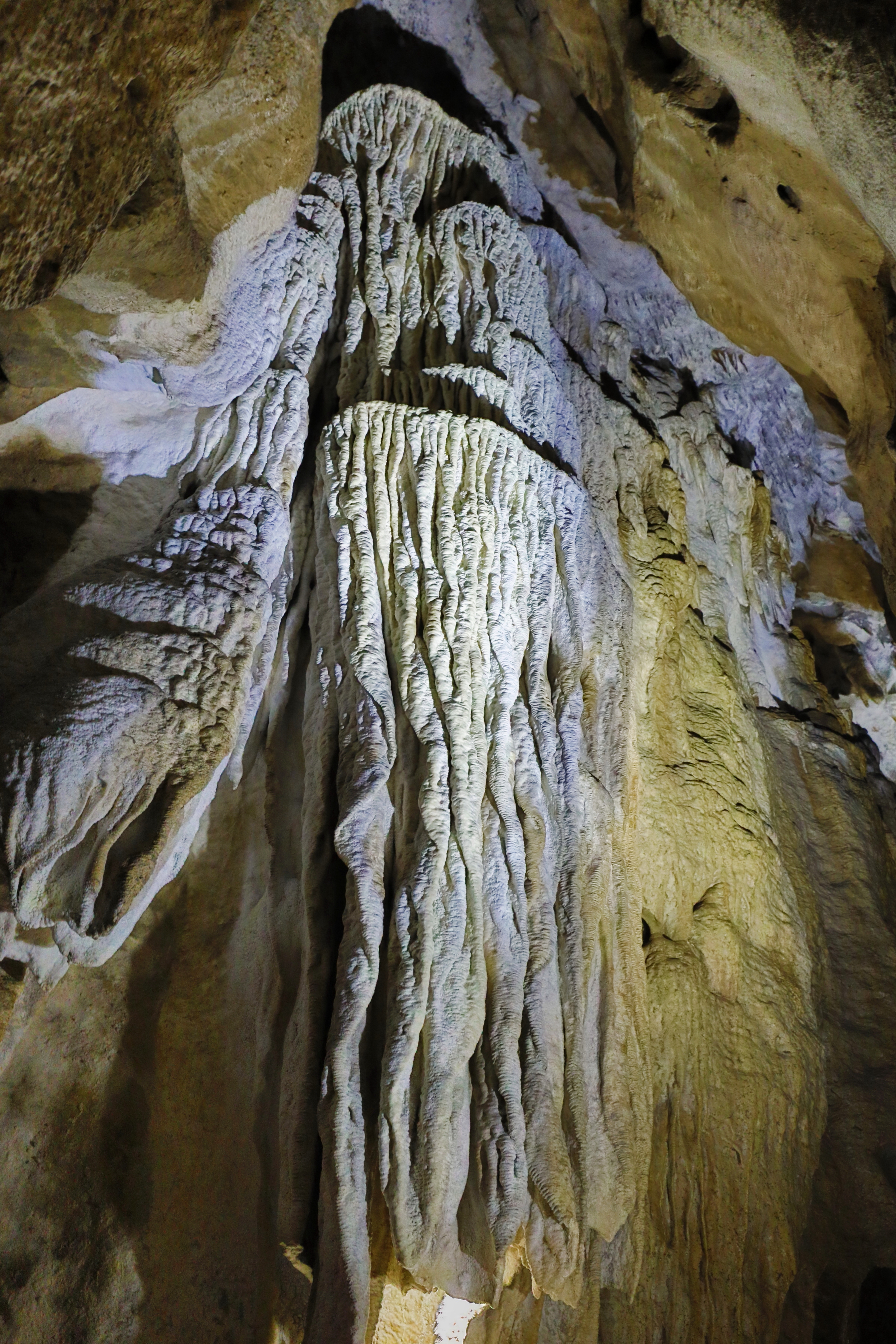
Hermann's Cave in Kirchberg am Wechsel, Lower Austria
Summary[edit]
| Description |
Deutsch: Gesteinsbildungen (Tropfstein-, Sinter- und Bergmilchbildungen) in der Hermannshöhle, eine Schauhöhle in der niederösterreichischen Marktgemeinde Kirchberg am Wechsel.
Die größte Tropfsteinhöhle Niederösterreichs wurde angeblich Ende des 18. Jahrhunderts entdeckt, weil ein Hüterbub ins „Taubenloch“ stürzte und man bei seiner Rettung feststellte, dass sich eine geräumige Höhle in die Tiefe fortsetzte. Namensgeber der Höhle ist ein Verwalter der Burg Feistritz, Hermann Steiger von Amstein, der 1843 die Höhle genauer untersuchte. Dabei fand er unter anderem den Durchstieg zum „Windloch“. Die Summe aller vermessenen Höhlengänge beträgt fast 4.500 Meter und der Höhenunterschied 73 Meter: [1]. Die Höhlenbesichtigungstour selbst führt vom „Windloch“ (Einstieg) hinauf zum 43 m höher gelegenen „Taubenloch“ (Ausstieg). Die Hermannshöhle ist auch eines der bedeutendsten Winterquartiere Niederösterreichs für Fledermäuse - bis zu 700 Tiere suchen in der kalten Jahreszeit darin Schutz. Sie beherbergt in der kalten Jahreszeit damit etwa ein Fünftel des österreichischen Bestandes: [2]. English: Hermann's Cave in Kirchberg am Wechsel, Lower Austria.
|
| Date | |
| Source | Own work |
| Author | C.Stadler/Bwag |
| Permission (Reusing this file) |
Deutsch: Hallo, du darfst mein Foto kostenlos nutzen, aber nenne mich bitte als Fotograf, beispielsweise „Foto: C.Stadler/Bwag“ oder © C.Stadler/Bwag; CC-BY-SA-4.0. Auf mehr Angaben bestehe ich nicht - im Gegensatz zu manch anderen, die die Vorgaben der unten angeführten Lizenzierung auf Punkt und Beistrich einfordern. English: Feel free to use my photos, but please mention me as the author like © C.Stadler/Bwag or © C.Stadler/Bwag; CC-BY-SA-4.0 (that's good enough) and if you want send me a message: bwag@gmx.net. |
| Other versions |
|

.JPG)
.JPG&action=edit§ion=1)
| Object location | | View this and other nearby images on: OpenStreetMap |
|---|
.JPG¶ms=047.616940_N_0015.982300_E_globe:Earth_class:object_type:object__&language=en)
| Camera location | | View this and other nearby images on: OpenStreetMap |
|---|
.JPG¶ms=047.616940_N_0015.982300_E_globe:Earth_type:camera__&language=en)
Licensing[edit]
.JPG&action=edit§ion=2)
I, the copyright holder of this work, hereby publish it under the following license:
This file is licensed under the Creative Commons Attribution-Share Alike 4.0 International license.
- You are free:
- to share – to copy, distribute and transmit the work
- to remix – to adapt the work
- Under the following conditions:
- attribution – You must give appropriate credit, provide a link to the license, and indicate if changes were made. You may do so in any reasonable manner, but not in any way that suggests the licensor endorses you or your use.
- share alike – If you remix, transform, or build upon the material, you must distribute your contributions under the same or compatible license as the original.

|
Diese Datei wurde im Rahmen von WikiDaheim 2021 in Österreich erstellt und hochgeladen. Sie wurde dem Themenbereich Naturschutz zugeordnet. |
This image was uploaded as part of Wiki Loves Earth 2021.
|
 |
File history
Click on a date/time to view the file as it appeared at that time.
| Date/Time | Thumbnail | Dimensions | User | Comment | |
|---|---|---|---|---|---|
| current | 16:09, 28 July 2021 | | 2,987 × 4,480 (9.67 MB) | Bwag (talk | contribs) | {{Information |Description= {{de|1= Gesteinsbildungen (Tropfstein-, Sinter- und Bergmilchbildungen) in der Hermannshöhle, eine Schauhöhle in der niederösterreichischen Marktgemeinde Kirchberg am Wechsel.<br/>Die größte Tropfsteinhöhle Niederösterreichs wurde angeblich Ende des 18. Jahrhunderts entdeckt, weil ein Hüterbub ins „Taubenloch“ stürzte und man bei seiner Rettung feststellte, dass sich eine geräumige Höhle in die Tiefe fortsetzte. Namensgeber der Höhle i... |
You cannot overwrite this file.
File usage on Commons
The following 2 pages use this file:
File usage on other wikis
The following other wikis use this file:
- Usage on de.wikipedia.org
- Usage on sv.wikipedia.org
.JPG&oldid=737790138)