File:Krems an der Donau - Kunsthalle.JPG
Jump to navigation
Jump to search

Size of this preview: 800 × 446 pixels. Other resolutions: 320 × 179 pixels | 640 × 357 pixels | 1,024 × 571 pixels | 1,280 × 714 pixels | 2,560 × 1,428 pixels | 4,134 × 2,306 pixels.
Original file (4,134 × 2,306 pixels, file size: 6.77 MB, MIME type: image/jpeg)
Captions
Captions
Add a one-line explanation of what this file represents
Summary
[edit]
| Description |
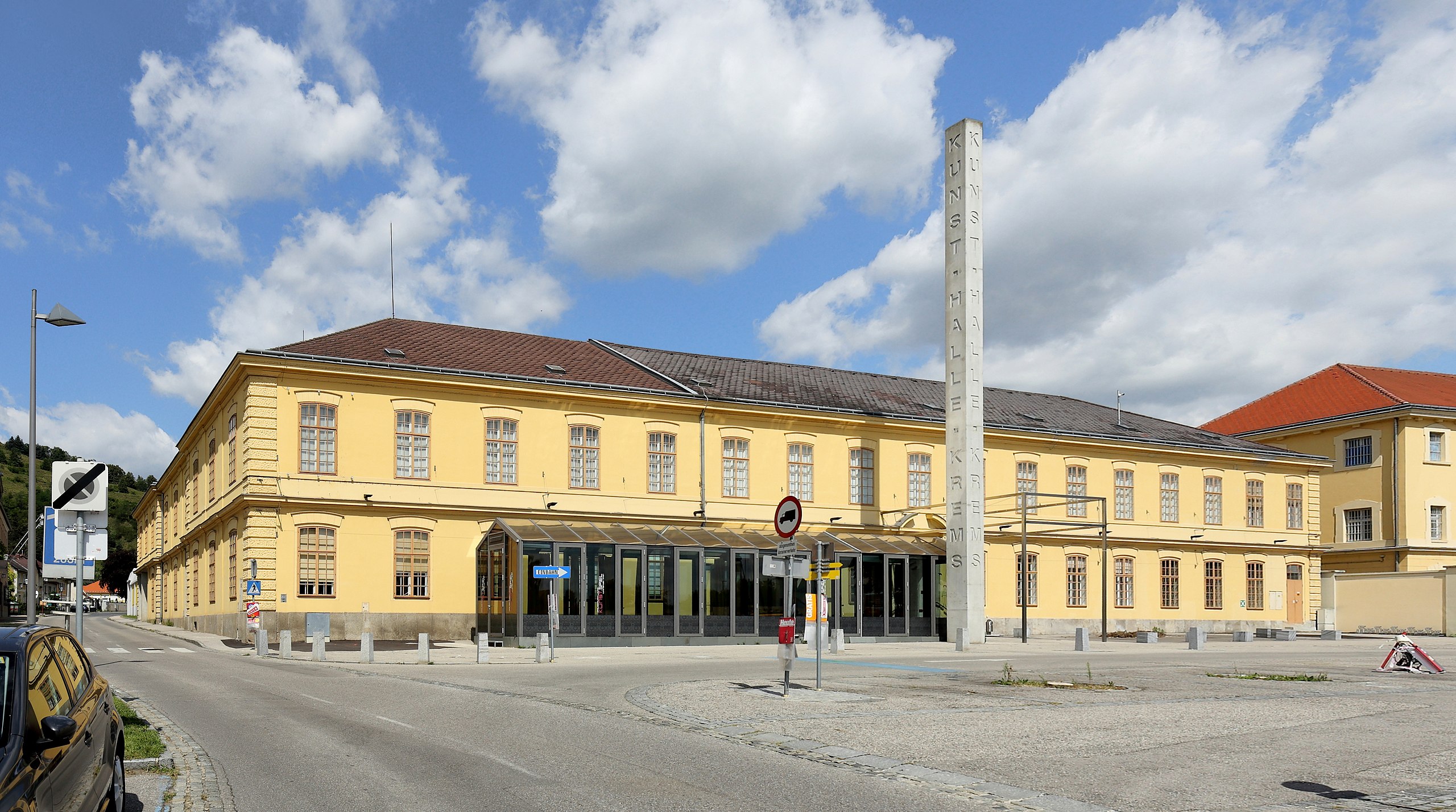
Deutsch: Die Kunsthalle Krems in Stein an der Donau, ein Ortsteil der niederösterreichischen Stadt Krems.
1850 wurde aufgrund der guten Verkehrslage an der Donau und der Nähe zu Wien die Zigarrenfabrik Stein zur Produktion von Virginier-Zigarren errichtet. Zu diesem Zwecke wurde ein Gasthof angekauft und von Adalbert Wohlschläger umgebaut, beziehungsweise das zweigeschossige Hauptgebäude mit hakenförmigen Grundriß errichtet. Nach dem Neubau der Fabrik in der Dr.-Karl-Dorrek-Straße von 1918 bis 1922 diente es als Rohstofflager. Später wurde es von der Firma Eybl genutzt. Von 1994 bis 1995 erfolgte durch Architekt Adolf Krischanitz ein Umbau zu einer Ausstellungshalle mit rd. 1400 m2 Ausstellungsfläche. Am 31. März 1995 fand mit der Ausstellung „Wasser und Wein“ die Eröffnung der Kunsthalle Krems statt. |
| Date | |
| Source | Own work |
| Author | C.Stadler/Bwag |
| Permission (Reusing this file) |
Deutsch: Hallo, du darfst mein Foto kostenlos nutzen, aber nenne mich bitte als Fotograf, beispielsweise „Foto: C.Stadler/Bwag“ oder © C.Stadler/Bwag; CC-BY-SA-4.0. Auf mehr Angaben bestehe ich nicht - im Gegensatz zu manch anderen, die die Vorgaben der unten angeführten Lizenzierung auf Punkt und Beistrich einfordern. English: Feel free to use my photos, but please mention me as the author like © C.Stadler/Bwag or © C.Stadler/Bwag; CC-BY-SA-4.0 (that's good enough) and if you want send me a message: bwag@gmx.net. |
| Object location | | View this and other nearby images on: OpenStreetMap |
|---|
| Camera location | | View this and other nearby images on: OpenStreetMap |
|---|
Licensing
[edit]
I, the copyright holder of this work, hereby publish it under the following license:
This file is licensed under the Creative Commons Attribution-Share Alike 4.0 International license.
- You are free:
- to share – to copy, distribute and transmit the work
- to remix – to adapt the work
- Under the following conditions:
- attribution – You must give appropriate credit, provide a link to the license, and indicate if changes were made. You may do so in any reasonable manner, but not in any way that suggests the licensor endorses you or your use.
- share alike – If you remix, transform, or build upon the material, you must distribute your contributions under the same or compatible license as the original.
File history
Click on a date/time to view the file as it appeared at that time.
| Date/Time | Thumbnail | Dimensions | User | Comment | |
|---|---|---|---|---|---|
| current | 14:36, 8 August 2016 | | 4,134 × 2,306 (6.77 MB) | Bwag (talk | contribs) | {{Information |Description= {{de|1= Die Kunsthalle Krems in Stein an der Donau, ein Ortsteil der niederösterreichischen Stadt Krems.<br/>Ursprünglich 1852 als Tabakfabrik... |
You cannot overwrite this file.
File usage on Commons
The following page uses this file:
File usage on other wikis
The following other wikis use this file:
- Usage on de.wikipedia.org
- Usage on en.wikipedia.org
- Usage on fi.wikipedia.org
- Usage on uk.wikipedia.org