File:LªCintura×AvRep1934(OSéculo).jpg
Original file (960 × 739 pixels, file size: 143 KB, MIME type: image/jpeg)
Captions
Captions
Summary
[edit].jpg&action=edit§ion=1)
| Description |
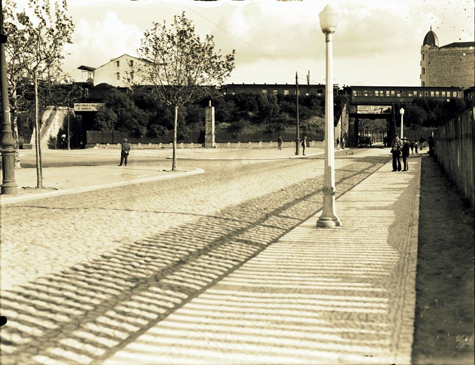
Português: Vista do aterro ferroviário da Av. República, em Lisboa. Fotografia do arquivo d’O Século. |
| Date | Taken in 1934 |
| Source | https://scontent.flis5-1.fna.fbcdn.net/v/t31.0-8/s960x960/12309680_1945078255717640_7792139671735128176_o.jpg?_nc_cat=103&_nc_sid=2d5d41&_nc_oc=AQl3tQVJPBlCv3CS2TVi9qECAxIV6y-SCljtQh3byx69x8XEy4UCaFhtah7JTeSYG5qYpzNsZwdF9vooDIkKKsgR&_nc_ht=scontent.flis5-1.fna&_nc_tp=7&oh=18899afcbfdfbfb8cf65bb571df9d173&oe=5F25FE3C |
| Author | Unknown author |
| Permission (Reusing this file) |
See below. |
| 1st uploaded as the | 62,578,938th file in Wikimedia Commons |
| Camera location | | View this and other nearby images on: OpenStreetMap |
|---|
.jpg¶ms=038.745820_N_-009.149910_E_globe:Earth_type:camera_heading:157.50&language=en)
Licensing
[edit].jpg&action=edit§ion=2)
|
This work is in the public domain in its country of origin and other countries and areas where the copyright term is the author's life plus 70 years or fewer.
| |
| This file has been identified as being free of known restrictions under copyright law, including all related and neighboring rights. | |
File history
Click on a date/time to view the file as it appeared at that time.
| Date/Time | Thumbnail | Dimensions | User | Comment | |
|---|---|---|---|---|---|
| current | 20:54, 5 July 2020 | | 960 × 739 (143 KB) | Tuvalkin (talk | contribs) | == {{int:filedesc}} == {{Information | description = {{pt|Mapa do cruzamento da Linha de Cintura com a Avenida da República, em Lisboa (frag. folha 10-M, des. Abel Santos, 1908); desorientado a 23°.}} | source = https://scontent.flis5-1.fna.fbcdn.net/v/t31.0-8/s960x960/12309680_1945078255717640_7792139671735128176_o.jpg?_nc_cat=103&_nc_sid=2d5d41&_nc_oc=AQl3tQVJPBlCv3CS2TVi9qECAxIV6y-SCljtQh3byx69x8XEy4UCaFhtah7JTeSYG5qYpzNsZwdF9vooDIkKKsgR&_nc_ht=scontent.flis5-1.fna&_nc_tp=7&oh=18899afcbfdf... |
You cannot overwrite this file.
File usage on Commons
The following page uses this file:
File usage on other wikis
The following other wikis use this file:
- Usage on pt.wikipedia.org
Metadata
.jpg&oldid=892347743)
- Avenida da República (Lisbon)
- Edifício na Avenida da República, 97
- Linha de Cintura
- Railway bridges in Portugal
- Black and white photographs of Lisbon in the 1930s
- Black and white photographs of Portugal in the 1930s
- 1934 in rail transport in Portugal
- Street lights in Lisbon
- Railway coaches of Portugal
- Traffic islands in Portugal