File:La souveraineté de Dombes.pdf
Jump to navigation
Jump to search

Size of this JPG preview of this PDF file: 734 × 600 pixels. Other resolutions: 294 × 240 pixels | 588 × 480 pixels | 940 × 768 pixels | 1,253 × 1,024 pixels | 2,133 × 1,743 pixels.
Original file (2,133 × 1,743 pixels, file size: 400 KB, MIME type: application/pdf)
Captions
Captions
Add a one-line explanation of what this file represents
Summary[edit]
| Description |
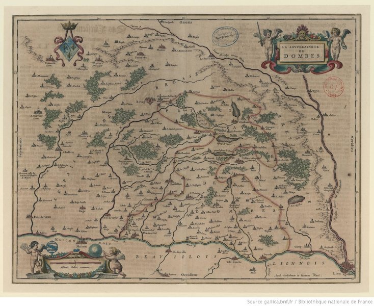
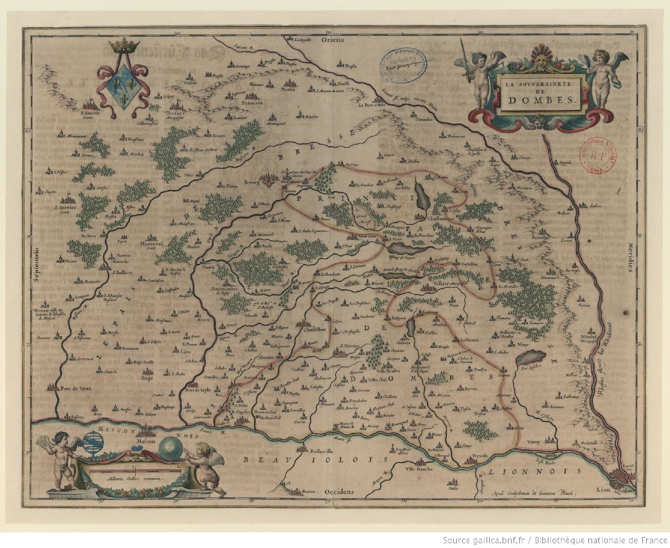
Français : Carte de la souveraineté de Dombes entre 1608 et 1627. Cette version colorisée est datée d’environ 1635. |
| Date | between 1608 and 1627 |
| Source | https://gallica.bnf.fr/ark:/12148/btv1b8592597f |
| Author | Joan Blaeu |
| Other versions |
|
_-_btv1b8592597f_(1_of_2).jpg)

Licensing[edit]
|
This work is in the public domain in its country of origin and other countries and areas where the copyright term is the author's life plus 100 years or fewer. | |
| This file has been identified as being free of known restrictions under copyright law, including all related and neighboring rights. | |
File history
Click on a date/time to view the file as it appeared at that time.
| Date/Time | Thumbnail | Dimensions | User | Comment | |
|---|---|---|---|---|---|
| current | 15:37, 11 November 2022 |  | 2,133 × 1,743 (400 KB) | Lyokoï (talk | contribs) | Uploaded a work by Joan Blaeu from https://gallica.bnf.fr/ark:/12148/btv1b8592597f with UploadWizard |
You cannot overwrite this file.
File usage on Commons
The following page uses this file: