File:Lancashire UK parish map (blank).svg
Siirry navigaatioon
Siirry hakuun

Tämän PNG-esikatselun koko koskien SVG-tiedostoa: 513 × 600 kuvapistettä. Muut resoluutiot: 205 × 240 kuvapistettä | 410 × 480 kuvapistettä | 657 × 768 kuvapistettä | 876 × 1 024 kuvapistettä | 1 751 × 2 048 kuvapistettä | 1 116 × 1 305 kuvapistettä.
Alkuperäinen tiedosto (SVG-tiedosto; oletustarkkuus 1 116 × 1 305 kuvapistettä; tiedostokoko 2,45 MiB)
Kuvatekstit
Kuvatekstit
Lisää yhden rivin pituinen kuvaus tästä tiedostosta
| Kuvaus |
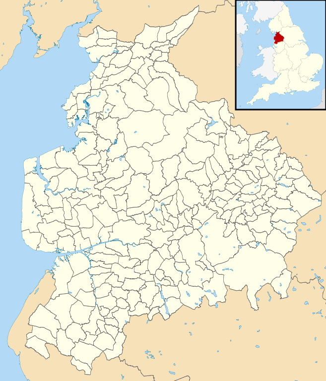
Blank map of the Lancashire, UK with civil parishes shown. Equirectangular map projection on WGS 84 datum, with N/S stretched 165% Geographic limits:
|
| Päiväys | |
| Lähde |
|
| Tekijä | Nilfanion, created using Ordnance Survey data |
| Käyttöoikeus (Tämän tiedoston uudelleenkäyttö) |
Tämä tiedosto on lisensoitu Creative Commons Nimeä-JaaSamoin 3.0 Ei sovitettu -lisenssillä. Nimeä: Contains Ordnance Survey data © Crown copyright and database right
|
| Muut versiot | Tämän tiedoston johdannaisteoksia: Lancashire parish map.svg |
Tiedoston historia
Päiväystä napsauttamalla näet, millainen tiedosto oli kyseisellä hetkellä.
| Päiväys | Pienoiskuva | Koko | Käyttäjä | Kommentti | |
|---|---|---|---|---|---|
| nykyinen | 12. lokakuuta 2010 kello 22.40 | | 1 116 × 1 305 (2,45 MiB) | Nilfanion (keskustelu | muokkaukset) | {{Information |Description=Blank map of the Lancashire, UK with civil parishes shown. Equirectangular map projection on WGS 84 datum, with N/S stretched 165% Geographic limits: *West: 3.13W *East: 2.03W *North: 54.25N *South: 53.47N |So |
Et voi tallentaa uutta tiedostoa tämän tilalle.
Tiedoston käyttö
Seuraavat 24 sivua käyttävät tätä tiedostoa:
- User:Nilfanion/Maps/Counties
- User:Nilfanion/Maps/England
- File:Blackburn with Darwen parishes map.svg
- File:Borough of Burnley parishes map.svg
- File:Borough of Chorley parishes map.svg
- File:Borough of Fylde parishes map.svg
- File:Borough of Hyndburn parishes map.svg
- File:Borough of Pendle parishes map.svg
- File:Borough of Ribble Valley parishes map.svg
- File:Borough of Rossendale parishes map.svg
- File:Borough of South Ribble parishes map.svg
- File:Borough of West Lancashire parishes map.svg
- File:Borough of Wyre parishes map.svg
- File:City of Lancaster parishes map.svg
- File:City of Lancaster parishes map 2018.svg
- File:City of Preston parishes, wards and divisions map.svg
- File:City of Preston parishes 2012 map.svg
- File:City of Preston parishes map.svg
- File:City of Preston parishes map without labels.svg
- File:Historic counties within Cumbria.svg
- File:Lancashire parish map.svg
- File:Lancashire parishes map.svg
- File:Location map United Kingdom Burnley.svg
- File:Location map United Kingdom Skelmersdale.svg
Tiedoston järjestelmänlaajuinen käyttö
Seuraavat muut wikit käyttävät tätä tiedostoa:
- Käyttö kohteessa es.wikipedia.org
- Käyttö kohteessa fi.wikipedia.org
.svg&oldid=714674615)