File:Leicestershire UK location map.svg
پرش به ناوبری
پرش به جستجو

حجم پیشنمایش PNG این SVG file:۷۶۱ × ۶۰۰ پیکسل کیفیتهای دیگر: ۳۰۵ × ۲۴۰ پیکسل | ۶۰۹ × ۴۸۰ پیکسل | ۹۷۵ × ۷۶۸ پیکسل | ۱٬۲۸۰ × ۱٬۰۰۹ پیکسل | ۲٬۵۶۰ × ۲٬۰۱۷ پیکسل | ۱٬۴۲۵ × ۱٬۱۲۳ پیکسل.
پروندهٔ اصلی (پروندهٔ اسویجی، با ابعاد ۱٬۴۲۵ × ۱٬۱۲۳ پیکسل، اندازهٔ پرونده: ۲٫۲۳ مگابایت)
گزینهها
عنوان
شرحی یکخطی از محتوای این فایل اضافه کنید
| توضیح |
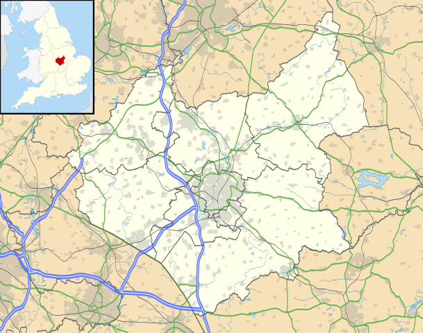
Map of Leicestershire, UK with the following information shown:
Equirectangular map projection on WGS 84 datum, with N/S stretched 160% Geographic limits:
|
| تاریخ | |
| منبع |
|
| پدیدآور | Nilfanion, created using Ordnance Survey data |
| اجازهنامه (استفادهٔ مجدد از این پرونده) |
این پرونده با اجازهنامهٔ کریتیو کامانز Attribution-Share Alike 3.0 سازگار نشده منتشر شده است. انتساب: Contains Ordnance Survey data © Crown copyright and database right
|
| دیگر نسخهها | File:Leicestershire UK district map (blank).svg - Blank map |
.svg)
تاریخچهٔ پرونده
روی تاریخ/زمانها کلیک کنید تا نسخهٔ مربوط به آن هنگام را ببینید.
| تاریخ/زمان | بندانگشتی | ابعاد | کاربر | توضیح | |
|---|---|---|---|---|---|
| کنونی | ۲۶ سپتامبر ۲۰۱۰، ساعت ۱۹:۰۰ | | ۱٬۴۲۵ در ۱٬۱۲۳ (۲٫۲۳ مگابایت) | Nilfanion (بحث | مشارکتها) | {{Information |Description=Map of Leicestershire, UK with the following information shown: *Administrative borders *Coastline, lakes and rivers *Roads and railways *Urban areas Equirectangular map projection on WGS 84 datum, with N/S |
نمیتوانید این پرونده را رونویسی کنید.
کاربرد پرونده
صفحهٔ زیر از این تصویر استفاده میکند:
کاربرد سراسری پرونده
ویکیهای دیگر زیر از این پرونده استفاده میکنند:
- کاربرد در ar.wikipedia.org
- کاربرد در bg.wikipedia.org
- کاربرد در bn.wikipedia.org
- کاربرد در ceb.wikipedia.org
- کاربرد در cs.wikipedia.org
- کاربرد در en.wikipedia.org
- Quorn, Leicestershire
- Walton, Leicestershire
- Belvoir Castle
- Ashby-de-la-Zouch
- Breedon on the Hill
- Kirby Muxloe
- Moira, Leicestershire
- Foxton Locks
- Market Harborough
- Lutterworth
- Ashby de la Zouch Castle
- Donisthorpe
- Loughborough
- Melton Mowbray
- East Midlands Airport
- Wigston
- Hinckley
- Coalville
- Earl Shilton
- Barwell
- Burbage, Leicestershire
- Glenfield, Leicestershire
- Bradgate Park
- Kegworth
- National Space Centre
- Oadby
- Market Bosworth
- Carlton, Leicestershire
- Frisby on the Wreake
- Shepshed
- Blaby
- Cotes, Leicestershire
- Twycross
- Dadlington
- Buckminster
- Sutton Cheney
- Wycomb
- Bruntingthorpe Aerodrome
- Foxton Inclined Plane
نمایش استفادههای سراسری از این پرونده.