File:Liechtenstein - Gemeinden mit Exklaven.png
Naviqasiyaya keç
Axtarışa keç

Sınaq göstərişi ölçüsü: 369 × 599 piksel. Digər ölçülər: 148 × 240 piksel | 296 × 480 piksel | 473 × 768 piksel | 631 × 1.024 piksel | 1.359 × 2.206 piksel.
Faylın orijinalı (1.359 × 2.206 piksel, fayl həcmi: 171 KB, MIME növü: image/png)
Captions
Captions
Add a one-line explanation of what this file represents
| İzah |
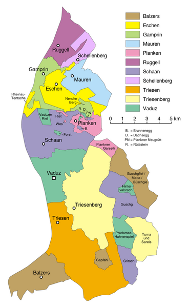
Deutsch: Gemeindekarte von Liechtenstein
English: Map of the municipalities of Liechtenstein
فارسی: نقشه شهرداریهای لیختن اشتاین |
|||
| Tarix | see file history | |||
| Mənbə | File:Liechtenstein-admin.png | |||
| Müəllif | Maximilian Dörrbecker (Chumwa) | |||
| İcazə (Faylın təkrar istifadəsi) |
I, the copyright holder of this work, hereby publish it under the following license: Bu fayl Creative Commons Attribution 2.5 Generik lisenziyası altında yayımlanır.
Sie dürfen das Bild zu den folgenden Bedingungen nutzen:
|
|||
| Digər versiyalar |
|


|
This locator map image could be re-created using vector graphics as an SVG file. This has several advantages; see Commons:Media for cleanup for more information. If an SVG form of this image is available, please upload it and afterwards replace this template with
{{vector version available|new image name}}.
It is recommended to name the SVG file “Liechtenstein - Gemeinden mit Exklaven.svg”—then the template Vector version available (or Vva) does not need the new image name parameter. |
Faylın tarixçəsi
Faylın əvvəlki versiyasını görmək üçün gün/tarix bölməsindəki tarixlərə klikləyin.
| Tarix/Vaxt | Kiçik şəkil | Ölçülər | İstifadəçi | Şərh | |
|---|---|---|---|---|---|
| indiki | 08:12, 19 avqust 2016 | | 1.359 × 2.206 (171 KB) | Lasunncty (müzakirə | töhfələr) | switched Gritsch and Guschg |
| 16:40, 28 sentyabr 2013 |  | 1.359 × 2.206 (232 KB) | Chumwa (müzakirə | töhfələr) | Exklaven beschriftet | |
| 15:34, 28 sentyabr 2013 |  | 1.359 × 2.206 (199 KB) | Chumwa (müzakirə | töhfələr) | {{Information |Description= {{de|1= Gemeindekarte Liechtenstein}} {{en|1= Map of the municipalities of Liechtenstein}} |Source={own} |Date=see file history |Author= Maximilian Dörrbecker (Chumwa) |Permission={{... |
Siz bu faylı yenidən yükləyə bilməzsiniz.
Fayl keçidləri
Aşağıdakı 8 səhifə bu faylı istifadə edir:
Faylın qlobal istifadəsi
Bu fayl aşağıdakı vikilərdə istifadə olunur:
- als.wikipedia.org layihəsində istifadəsi
- an.wikipedia.org layihəsində istifadəsi
- ar.wikipedia.org layihəsində istifadəsi
- ast.wikipedia.org layihəsində istifadəsi
- az.wikipedia.org layihəsində istifadəsi
- bat-smg.wikipedia.org layihəsində istifadəsi
- be.wikipedia.org layihəsində istifadəsi
- br.wikipedia.org layihəsində istifadəsi
- ca.wikipedia.org layihəsində istifadəsi
- ce.wikipedia.org layihəsində istifadəsi
- cs.wikipedia.org layihəsində istifadəsi
- da.wikipedia.org layihəsində istifadəsi
- de.wikipedia.org layihəsində istifadəsi
- en.wikipedia.org layihəsində istifadəsi
- Liechtenstein
- Demographics of Liechtenstein
- Municipalities of Liechtenstein
- Wikipedia:Unusual articles
- List of enclaves and exclaves
- National Police (Liechtenstein)
- User:Jonny-mt/Gallery of current first-level administrative country subdivisions maps
- Outline of Liechtenstein
- Wikipedia:Unusual articles/Places and infrastructure
- eo.wikipedia.org layihəsində istifadəsi
- es.wikipedia.org layihəsində istifadəsi
- es.wikivoyage.org layihəsində istifadəsi
- et.wikipedia.org layihəsində istifadəsi
- eu.wikipedia.org layihəsində istifadəsi
- fa.wikipedia.org layihəsində istifadəsi
- fi.wikipedia.org layihəsində istifadəsi
Bu faylın qlobal istifadəsinə baxın.