File:Loch Skerrow Station (geograph 6549513).jpg
Jump to navigation
Jump to search
Size of this preview: 796 × 600 pixels. Other resolutions: 319 × 240 pixels | 637 × 480 pixels | 1,019 × 768 pixels | 1,280 × 965 pixels | 1,600 × 1,206 pixels.
Original file (1,600 × 1,206 pixels, file size: 539 KB, MIME type: image/jpeg)
Captions
Captions
Add a one-line explanation of what this file represents
Summary
[edit].jpg&action=edit§ion=1)
| Description |
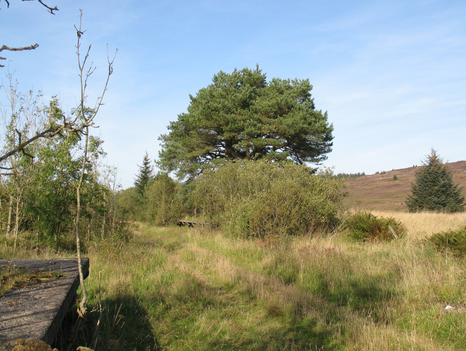
English: Loch Skerrow Station The remains of Loch Skerrow Station on the former Portpatrick and Wigtownshire Joint Railway. The partly demolished up platform is in the foreground. Loch Skerrow Station was without road access and was one of the most isolated stations in Scotland. Originally Loch Skerrow Halt, a private, untimetabled station primarily for the use of railway employees and their families, it was renamed Loch Skerrow on the 13 June 1955 at which time it became a public station. It closed to passengers just ten years later on the 14th June 1965. |
| Date | |
| Source | From geograph.org.uk |
| Author | Adrian Taylor |
| Permission (Reusing this file) |
Creative Commons Attribution Share-alike license 2.0 |
| Attribution (required by the license) | Adrian Taylor / Loch Skerrow Station / |
| Camera location | | View this and other nearby images on: OpenStreetMap |
|---|
.jpg¶ms=054.989542_N_-004.174962_E_globe:Earth_type:camera_source:geograph-osgb36(NX60946827)_heading:22.00&language=en)
| Object location | | View this and other nearby images on: OpenStreetMap |
|---|
.jpg¶ms=054.989910_N_-004.174510_E_globe:Earth_class:object_type:object_source:geograph-osgb36(NX60976831)_heading:22.00&language=en)
Licensing
[edit].jpg&action=edit§ion=2)

|
This image was taken from the Geograph project collection. See this photograph's page on the Geograph website for the photographer's contact details. The copyright on this image is owned by Adrian Taylor and is licensed for reuse under the Creative Commons Attribution-ShareAlike 2.0 license.
|
This file is licensed under the Creative Commons Attribution-Share Alike 2.0 Generic license.
Attribution: Adrian Taylor
- You are free:
- to share – to copy, distribute and transmit the work
- to remix – to adapt the work
- Under the following conditions:
- attribution – You must give appropriate credit, provide a link to the license, and indicate if changes were made. You may do so in any reasonable manner, but not in any way that suggests the licensor endorses you or your use.
- share alike – If you remix, transform, or build upon the material, you must distribute your contributions under the same or compatible license as the original.
File history
Click on a date/time to view the file as it appeared at that time.
| Date/Time | Thumbnail | Dimensions | User | Comment | |
|---|---|---|---|---|---|
| current | 16:37, 31 October 2020 | | 1,600 × 1,206 (539 KB) | Lamberhurst (talk | contribs) | Transferred from geograph.co.uk using [https://tools.wmflabs.org/geograph2commons/ geograph2commons] |
You cannot overwrite this file.
File usage on Commons
The following 2 pages use this file:
File usage on other wikis
The following other wikis use this file:
- Usage on en.wikipedia.org
- Usage on www.wikidata.org
.jpg&oldid=609157756)