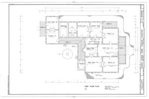
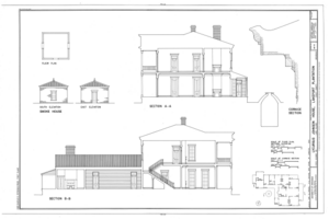
File:Lycurgus Johnson House, State Highway 142, Lake Village, Chicot County, AR HABS ARK,9-LAKVI,1- (sheet 1 of 11).tif

Original file (14,452 × 9,632 pixels, file size: 1.37 MB, MIME type: image/tiff)
Captions
Captions
Summary[edit]
| Warning | The original file is very high-resolution. It might not load properly or could cause your browser to freeze when opened at full size. |
|---|
| HABS ARK,9-LAKVI,1- (sheet 1 of 11) - Lycurgus Johnson House, State Highway 142, Lake Village, Chicot County, AR | |||||
|---|---|---|---|---|---|
| Photographer |
Related names:
|
||||
| Title |
HABS ARK,9-LAKVI,1- (sheet 1 of 11) - Lycurgus Johnson House, State Highway 142, Lake Village, Chicot County, AR |
||||
| Depicted place | Arkansas; Chicot County; Lake Village | ||||
| Date | Documentation compiled after 1933 | ||||
| Dimensions | 24 x 36 in. (D size) | ||||
| Current location |
Library of Congress Prints and Photographs Division Washington, D.C. 20540 USA http://hdl.loc.gov/loc.pnp/pp.print |
||||
| Accession number |
HABS ARK,9-LAKVI,1- (sheet 1 of 11) |
||||
| Credit line |
|
||||
| Notes |
|
||||
| Source | https://www.loc.gov/pictures/item/ar0028.sheet.00001a | ||||
| Permission (Reusing this file) |
|
||||
| Other versions |
           |
||||
| Object location | 33° 19′ 43″ N, 91° 16′ 54.01″ W | View this and other nearby images on: OpenStreetMap |
|---|
File history
Click on a date/time to view the file as it appeared at that time.
| Date/Time | Thumbnail | Dimensions | User | Comment | |
|---|---|---|---|---|---|
| current | 01:41, 27 June 2014 |  | 14,452 × 9,632 (1.37 MB) | Fæ (talk | contribs) | GWToolset: Creating mediafile for Fæ. HABS batch upload 26 June 2014 (151:200) |
You cannot overwrite this file.
File usage on Commons
The following 2 pages use this file:
Metadata
This file contains additional information such as Exif metadata which may have been added by the digital camera, scanner, or software program used to create or digitize it. If the file has been modified from its original state, some details such as the timestamp may not fully reflect those of the original file. The timestamp is only as accurate as the clock in the camera, and it may be completely wrong.
| Author | Library of Congress |
|---|---|
| Width | 14,452 px |
| Height | 9,632 px |
| Compression scheme | CCITT Group 4 fax encoding |
| Pixel composition | Black and white (White is 0) |
| Orientation | Normal |
| Number of components | 1 |
| Number of rows per strip | 4 |
| Horizontal resolution | 400 dpi |
| Vertical resolution | 400 dpi |
| Data arrangement | chunky format |
| File change date and time | 09:17, 23 August 2000 |

