File:Lyonshall railway station - geograph.org.uk - 786177.jpg
Jump to navigation
Jump to search
No higher resolution available.
Lyonshall_railway_station_-_geograph.org.uk_-_786177.jpg (640 × 445 pixels, file size: 102 KB, MIME type: image/jpeg)
Captions
Captions
Add a one-line explanation of what this file represents
Summary
[edit]
| Description |
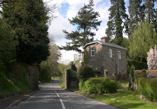
English: Lyonshall railway station Station and former rail overbridge on the GWR branch from Eardisley to Titley Junction. No trains have passed since 1st July 1940, when the line closed for a second and final time. |
| Date | |
| Source | From geograph.org.uk |
| Author | Philip Pankhurst |
| Attribution (required by the license) | Philip Pankhurst / Lyonshall railway station / |
| Camera location | | View this and other nearby images on: OpenStreetMap |
|---|
_heading:337.00&language=en)
| Object location | | View this and other nearby images on: OpenStreetMap |
|---|
_heading:337.00&language=en)
Licensing
[edit]

|
This image was taken from the Geograph project collection. See this photograph's page on the Geograph website for the photographer's contact details. The copyright on this image is owned by Philip Pankhurst and is licensed for reuse under the Creative Commons Attribution-ShareAlike 2.0 license.
|
This file is licensed under the Creative Commons Attribution-Share Alike 2.0 Generic license.
Attribution: Philip Pankhurst
- You are free:
- to share – to copy, distribute and transmit the work
- to remix – to adapt the work
- Under the following conditions:
- attribution – You must give appropriate credit, provide a link to the license, and indicate if changes were made. You may do so in any reasonable manner, but not in any way that suggests the licensor endorses you or your use.
- share alike – If you remix, transform, or build upon the material, you must distribute your contributions under the same or compatible license as the original.
File history
Click on a date/time to view the file as it appeared at that time.
| Date/Time | Thumbnail | Dimensions | User | Comment | |
|---|---|---|---|---|---|
| current | 01:47, 20 February 2011 | | 640 × 445 (102 KB) | GeographBot (talk | contribs) | == {{int:filedesc}} == {{Information |description={{en|1=Lyonshall railway station Station and former rail overbridge on the GWR branch from Eardisley to Titley Junction. No trains have passed since 1st July 1940, when the line closed for a second and fin |
You cannot overwrite this file.
File usage on Commons
The following page uses this file:
File usage on other wikis
The following other wikis use this file:
- Usage on en.wikipedia.org
- Usage on www.wikidata.org