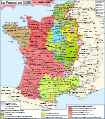
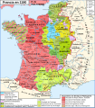
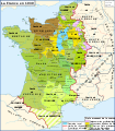
File:Map France 1180-fr.svg
来自Wikimedia Commons
跳转到导航
跳转到搜索

此SVG文件的PNG预览的大小:527 × 600像素。 其他分辨率:211 × 240像素 | 422 × 480像素 | 675 × 768像素 | 900 × 1,024像素 | 1,800 × 2,048像素 | 988 × 1,124像素。
原始文件 (SVG文件,尺寸为988 × 1,124像素,文件大小:1.88 MB)
文件信息
结构化数据
说明
说明
添加一行文字以描述该文件所表现的内容
Légende
[编辑]摘要
[编辑]| 描述Map France 1180-fr.svg |
English: Map of France in 1180
Français : Carte de la France en 1180 |
| 日期 | |
| 来源 |
English: Own work, from Image:France 12thC.jpg, in William R. Shepherd, The Historical Atlas, 1911
Data from the same and:
Français : Création personnelle, d'après Image:France 12thC.jpg, in William R. Shepherd, The Historical Atlas, 1911
Données d'après cette source et :
|
| 作者 | Zigeuner |
| 其他版本 |
[编辑]
Derivative works of this file:
|
| This SVG file contains embedded text that can be translated into your language, using any capable SVG editor, text editor or the SVG Translate tool. For more information see: About translating SVG files. |
许可协议
[编辑]我,本作品著作权人,特此采用以下许可协议发表本作品:

|
已授权您依据自由软件基金会发行的无固定段落及封面封底文字(Invariant Sections, Front-Cover Texts, and Back-Cover Texts)的GNU自由文件许可协议1.2版或任意后续版本的条款,复制、传播和/或修改本文件。该协议的副本请见“GNU Free Documentation License”。http://www.gnu.org/copyleft/fdl.htmlGFDLGNU Free Documentation Licensetruetrue |
- 您可以自由地:
- 共享 – 复制、发行并传播本作品
- 修改 – 改编作品
- 惟须遵守下列条件:
- 署名 – 您必须对作品进行署名,提供授权条款的链接,并说明是否对原始内容进行了更改。您可以用任何合理的方式来署名,但不得以任何方式表明许可人认可您或您的使用。
- 相同方式共享 – 如果您再混合、转换或者基于本作品进行创作,您必须以与原先许可协议相同或相兼容的许可协议分发您贡献的作品。
您可以选择您需要的许可协议。
文件历史
点击某个日期/时间查看对应时刻的文件。
| 日期/时间 | 缩略图 | 大小 | 用户 | 备注 | |
|---|---|---|---|---|---|
| 当前 | 2009年1月9日 (五) 11:35 |  | 988 × 1,124(1.88 MB) | ZigeunerAlt(留言 | 贡献) | + seigneurie de Montpensier, couleur du Velay, vicomté de Marsan |
| 2008年12月12日 (五) 15:51 |  | 988 × 1,124(1.88 MB) | ZigeunerAlt(留言 | 贡献) | Retour des limites d'arrière-fiefs dans le duché d'Aquitaine | |
| 2008年12月12日 (五) 14:07 |  | 988 × 1,124(1.88 MB) | ZigeunerAlt(留言 | 贡献) | + comté d'Alençon, seigneurie d'Harcourt (Normandie) | |
| 2008年12月6日 (六) 15:42 |  | 988 × 1,124(1.88 MB) | ZigeunerAlt(留言 | 贡献) | Tonnerre de la même couleur que Nevers et Auxerre | |
| 2008年12月5日 (五) 22:43 |  | 988 × 1,124(1.88 MB) | ZigeunerAlt(留言 | 贡献) | Couleurs identiques pour Flandres/Vermandois/Valois | |
| 2008年12月3日 (三) 15:02 |  | 988 × 1,124(1.88 MB) | ZigeunerAlt(留言 | 贡献) | {{Information |Description={{en|1=Map of the France in 1180}} {{fr|1=Carte de la France en 1180}} |Source=travail personnel (own work) |Author=Zigeuner |Date=3 XII 2008 |Permission= |other_versions=Image:Map France 1030-fr.svg }} <!--{{ |
您不可以覆盖此文件。
文件用途
以下15个页面使用本文件:
- Sancerre
- File:County of Soissons (1180).png
- File:France 12thC.jpg
- File:Frankreich 12. Jh (ohne Süd).png
- File:Frankreich 12. Jh 2021-08-03.png
- File:Map France 1030-fr.svg
- File:Map France 1180-br.svg
- File:Map France 1180-de.svg
- File:Map France 1180-es.svg
- File:Map France 1180-fr.svg
- File:Map France 1180-ru.svg
- File:Map France 1180-uk.svg
- File:Map of Poitou in 1180.png
- File:Pontigny1180.png
- Template:Other versions/Map France 1180
全域文件用途
以下其他wiki使用此文件:
- avk.wikipedia.org上的用途
- bg.wikipedia.org上的用途
- bn.wikibooks.org上的用途
- cs.wikipedia.org上的用途
- da.wikipedia.org上的用途
- de.wikipedia.org上的用途
- el.wikipedia.org上的用途
- en.wikipedia.org上的用途
- en.wikibooks.org上的用途
- eo.wikipedia.org上的用途
- es.wikipedia.org上的用途
- et.wikipedia.org上的用途
- eu.wikipedia.org上的用途
- fr.wikipedia.org上的用途
查看此文件的更多全域用途。
元数据
此文件含有额外信息,这些信息可能是创建或数字化该文件时使用的数码相机或扫描仪所添加的。如果文件已从其原始状态修改,某些详细信息可能无法完全反映修改后的文件。
| 宽度 | 987.60297 |
|---|---|
| 高度 | 1123.8518 |
结构化数据
此文件中描述的项目
描绘内容
知识共享署名-相同方式共享2.0通用 简体中文(已转写)
知识共享署名-相同方式共享3.0未本地化版本 简体中文(已转写)
知识共享署名-相同方式共享2.5通用 简体中文(已转写)
知识共享署名-相同方式共享1.0通用 简体中文(已转写)
GNU自由文档许可证1.2或更高版本 简体中文(已转写)
3 12 2008
数据大小 简体中文(已转写)
1,972,311 字节
1,124 像素
988 像素
image/svg+xml
分类:
- SVG maps of the history of France
- French-language SVG maps showing history
- Maps of France in the 12th century
- Angevin Empire
- County of Champagne
- Maps of the county of Flanders
- Duchy of Burgundy
- County of Burgundy
- Duchy of Brittany
- Maps of the history of Hainaut
- Maps of the history of Brabant
- Maps of the Duchy of Lorraine
- Duchy of Normandy
- Maine (province)
- County of Anjou
- Touraine
- Duchy of Aquitaine
- Nivernais
- Bourbonnais
- Maps of Poitou
- Angoumois
- County of Auvergne
- Maps of Dauphiné
- Maps of the Duchy of Savoy
- Maps of the history of Provence
- County of Toulouse
- County of Foix
- Roussillon
- Kingdom of Navarre
- Duchy of Luxembourg
- Astarac
- Geography of Béarn
- Bigorre
- Maps of Comminges
- Maps of Aunis
- Perche


