File:Map MetroRail Houston.svg
Jump to navigation
Jump to search

Size of this PNG preview of this SVG file: 800 × 569 pixels. Other resolutions: 320 × 228 pixels | 640 × 455 pixels | 1,024 × 728 pixels | 1,280 × 910 pixels | 2,560 × 1,821 pixels | 1,091 × 776 pixels.
Original file (SVG file, nominally 1,091 × 776 pixels, file size: 230 KB)
Captions
Captions
Add a one-line explanation of what this file represents
Summary[edit]
| Description |
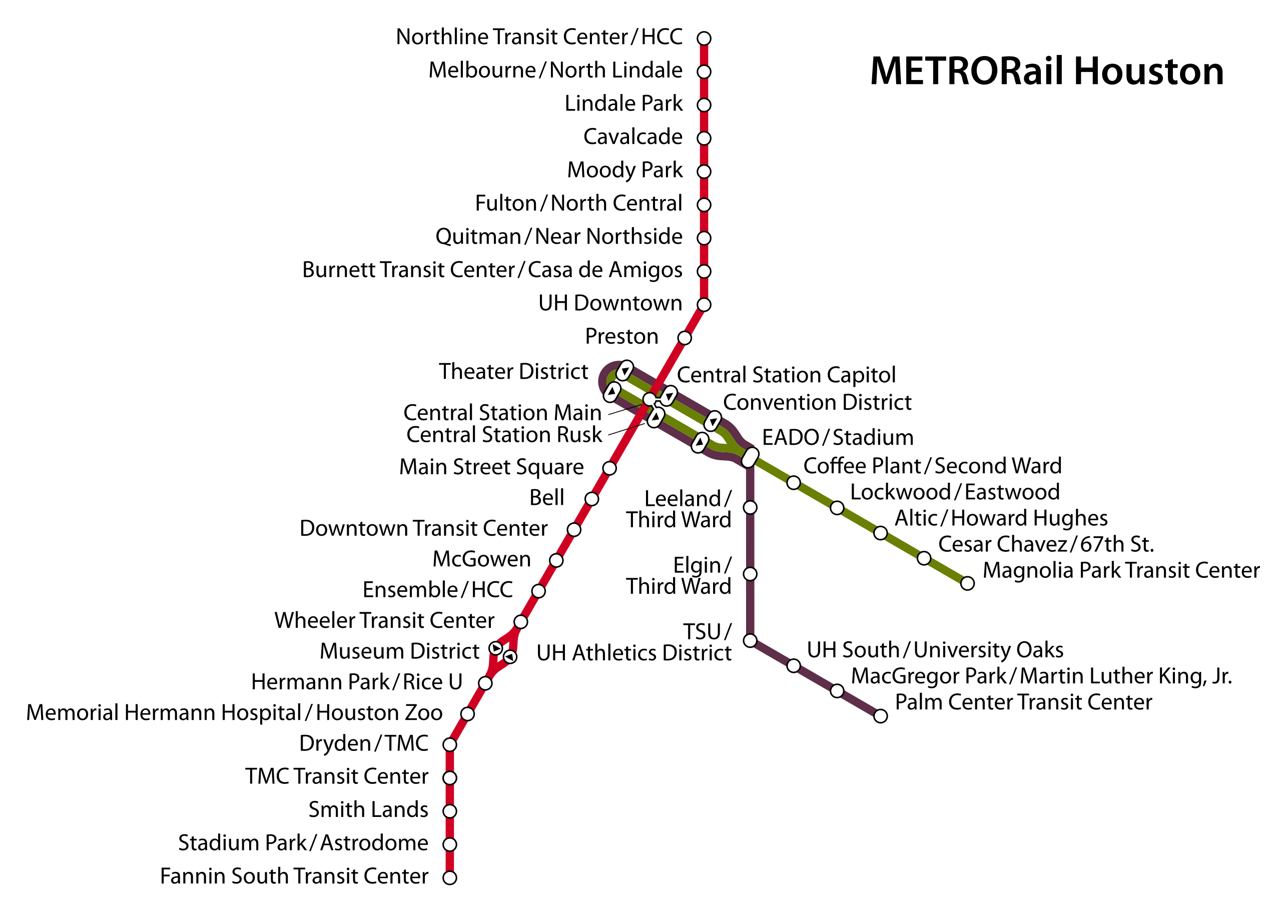
Deutsch: Netzplan der MetroRail Houston
Deutsch: Map of MetroRail Houston |
| Date | |
| Source | |
| Author | NordNordWest |

|
This map has been made or improved in the German Kartenwerkstatt (Map Lab). You can propose maps to improve as well.
|
Licensing[edit]
| This file is made available under the Creative Commons CC0 1.0 Universal Public Domain Dedication. | |
| The person who associated a work with this deed has dedicated the work to the public domain by waiving all of their rights to the work worldwide under copyright law, including all related and neighboring rights, to the extent allowed by law. You can copy, modify, distribute and perform the work, even for commercial purposes, all without asking permission.
|
File history
Click on a date/time to view the file as it appeared at that time.
| Date/Time | Thumbnail | Dimensions | User | Comment | |
|---|---|---|---|---|---|
| current | 19:05, 23 August 2021 | | 1,091 × 776 (230 KB) | NordNordWest (talk | contribs) | == {{int:filedesc}} == {{Information |description= {{de|1=Netzplan der MetroRail Houston}} {{de|1=Map of MetroRail Houston}} |source=* https://www.ridemetro.org/Pages/Rail.aspx |date={{Date|2021|08|23}} |author={{U|NordNordWest}} |permission= |other_versions= }} {{Kartenwerkstatt}} == {{int:license-header}} == {{CC-0}} Category:Tram maps of Houston Category:Files by NordNordWest |
You cannot overwrite this file.
File usage on Commons
The following 5 pages use this file:
File usage on other wikis
The following other wikis use this file:
- Usage on de.wikipedia.org
- Usage on en.wikipedia.org
- Usage on eo.wikipedia.org
- Usage on es.wikipedia.org
- Usage on fr.wikipedia.org
- Usage on tr.wikipedia.org
- Usage on uk.wikipedia.org
- Usage on www.wikidata.org