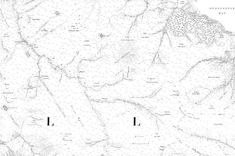
File:Map of Argyllshire Sheet 084, Ordnance Survey, 1868-1883.tiff
Jump to navigation
Jump to search
Size of this JPG preview of this TIF file: 800 × 531 pixels. Other resolutions: 320 × 213 pixels | 640 × 425 pixels | 1,024 × 680 pixels | 1,280 × 850 pixels | 2,560 × 1,701 pixels | 10,742 × 7,136 pixels.
Original file (10,742 × 7,136 pixels, file size: 219.31 MB, MIME type: image/tiff)
Captions
Captions
Add a one-line explanation of what this file represents
Summary[edit]
| Map of Argyllshire | |
|---|---|
| Author |
Ordnance Survey |
| Title |
Map of Argyllshire |
| Description |
English: Sheet 084 Gaodhail, PA72 6 |
| Date | between 1868 and 1883 |
| Source/Photographer | http://www.british-history.ac.uk/os-1-to-10560/argyllshire/084 |
Licensing[edit]
|
This is a faithful photographic reproduction of a two-dimensional, public domain work of art. The work of art itself is in the public domain for the following reason:
The official position taken by the Wikimedia Foundation is that "faithful reproductions of two-dimensional public domain works of art are public domain".
This photographic reproduction is therefore also considered to be in the public domain in the United States. In other jurisdictions, re-use of this content may be restricted; see Reuse of PD-Art photographs for details. | ||||
File history
Click on a date/time to view the file as it appeared at that time.
| Date/Time | Thumbnail | Dimensions | User | Comment | |
|---|---|---|---|---|---|
| current | 11:37, 2 September 2017 |  | 10,742 × 7,136 (219.31 MB) | Fæ (talk | contribs) | BHO TIFF http://www.british-history.ac.uk/os-1-to-10560/argyllshire/084 |
You cannot overwrite this file.
File usage on Commons
The following page uses this file: