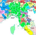
File:Map of Italy (1402)-ca.svg
Jump to navigation
Jump to search

Size of this PNG preview of this SVG file: 510 × 600 pixels. Other resolutions: 204 × 240 pixels | 408 × 480 pixels | 653 × 768 pixels | 871 × 1,024 pixels | 1,742 × 2,048 pixels | 3,264 × 3,837 pixels.
Original file (SVG file, nominally 3,264 × 3,837 pixels, file size: 322 KB)
Categories:
- Maps showing 1402
- SVG maps of the history of Italy
- Territorial evolution of Italy
- 1402 in Italy
- Maps of Italy in the 15th century
- Maps of the County of Nice
- County of Savoy
- Roman Catholic Diocese of Chur
- Maps of the Duchy of Milan
- Maps of the Papal States
- Papal States in the 1400s
- Marquisate of Saluzzo
- Patriarchate of Aquileia
- Republic of Florence
- Maps of the Republic of Genoa
- Maps of the Republic of Venice
- Maps of the Kingdom of Naples
- Maps of the Kingdom of Sicily
- County of Gorizia
- Catalan-language SVG maps showing history


