File:Map of eastern Virginia LOC 2006629773.tif
Jump to navigation
Jump to search

Size of this JPG preview of this TIF file: 484 × 599 pixels. Other resolutions: 194 × 240 pixels | 388 × 480 pixels | 620 × 768 pixels | 827 × 1,024 pixels | 1,654 × 2,048 pixels | 6,127 × 7,586 pixels.
Original file (6,127 × 7,586 pixels, file size: 132.98 MB, MIME type: image/tiff)
Captions
Captions
Add a one-line explanation of what this file represents
Summary
[edit]| Description |
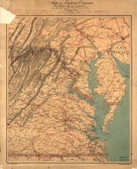
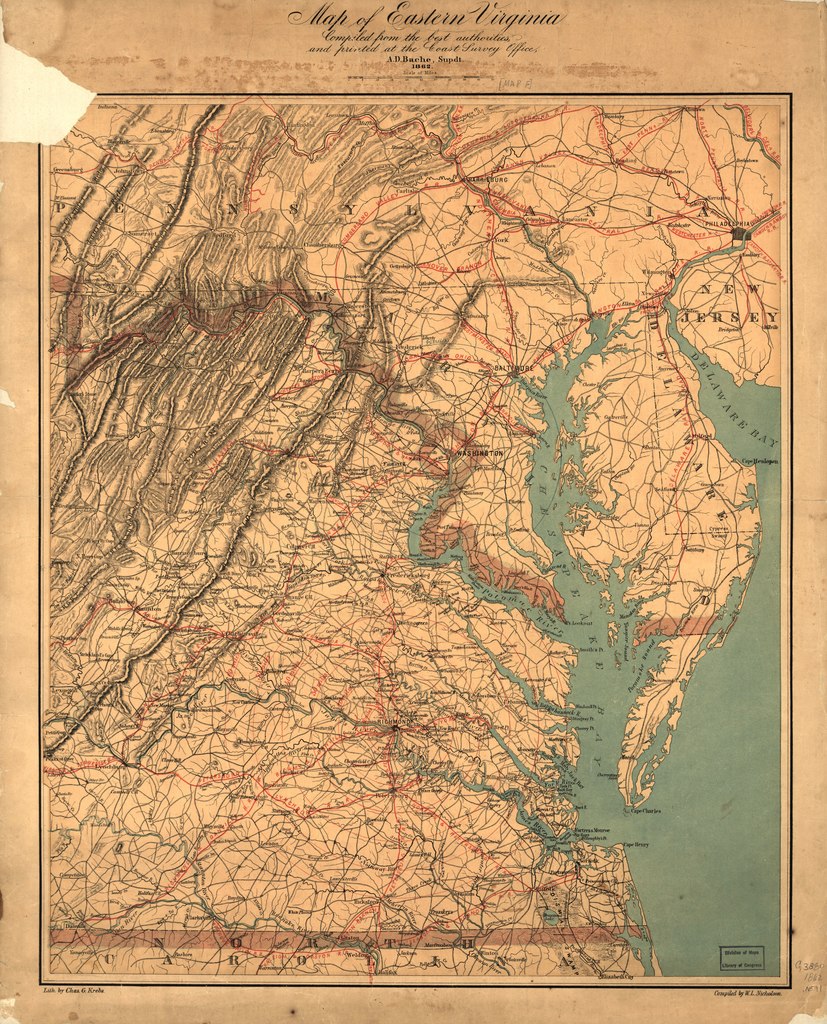
English: Relief shown by hachures. General map of eastern Virginia showing cities and towns, roads, and rivers. The map is overprinted in red to indicate railroads and concentric circles centered on Richmond. Circles are at intervals of ten miles. In his report to the Superintendent of the Coast survey dated November 1, 1862, Nicholson notes that "In addition to the printing of our charts proper, a map representing the seat of war in Virginia was, at the suggestion of the Superintendent, compiled by myself during the past year, and printed in colors, partly as an experiment in that class of work, and partly to meet the popular demand for information on the movements of our armies. This map has met with unexpected success, and has been much called for, and copies quite freely distributed; but, in order to cover the expenses of its getting up and printing, a number of copies have been placed in the hands of our sale agents, the proceeds of which have more than covered expenses; in all, some five thousand five hundred copies have been printed, over twenty-five hundred sold, and nearly three thousand copies gratuitously distributed." (Report of the Superintendent of the Coast Survey, showing the Progress of the Survey during the Year 1862 (Washington: Government Printing Office, 1864). p. 151.) LC Copy lacks upper lefthand corner. This is one of seven issues in the Library of Congress, published in 1862. This issue is similar to G3880 1862 .N58 CW 465.3, except blue concentric circles have been added around Washington, D.C. at 10 mile intervals. LC Civil War Maps (2nd ed.), 465.4 Available also through the Library of Congress Web site as a raster image. |
||
| Title | Map of eastern Virginia | ||
| Shelf ID | G3880 1862 .N591 G3880 1862 .N591 CW 465.4 | ||
| Date | |||
| Source | https://www.loc.gov/item/2006629773/ | ||
| Author | Nicholson, W. L. | ||
| Permission (Reusing this file) |
|
||
| Other versions |
|
||
| Location | United States · Virginia | ||
| Part of | Military Battles And Campaigns · American Memory · Civil War Maps · Catalog · Geography And Map Division | ||
| Subject | United States · Maps · Virginia |


Licensing
[edit]|
This is a faithful photographic reproduction of a two-dimensional, public domain work of art. The work of art itself is in the public domain for the following reason:
The official position taken by the Wikimedia Foundation is that "faithful reproductions of two-dimensional public domain works of art are public domain".
This photographic reproduction is therefore also considered to be in the public domain in the United States. In other jurisdictions, re-use of this content may be restricted; see Reuse of PD-Art photographs for details. | ||||
File history
Click on a date/time to view the file as it appeared at that time.
| Date/Time | Thumbnail | Dimensions | User | Comment | |
|---|---|---|---|---|---|
| current | 00:35, 17 June 2018 |  | 6,127 × 7,586 (132.98 MB) | Fæ (talk | contribs) | LOC Maps https://www.loc.gov/item/2006629773/ #17893 |
You cannot overwrite this file.
File usage on Commons
The following page uses this file: