File:Map of the Cleveland and Mahoning Rail Road and its connections, Edward Warner Chief Engineer, 1853. LOC 98688635.tif
Jump to navigation
Jump to search

Size of this JPG preview of this TIF file: 800 × 401 pixels. Other resolutions: 320 × 160 pixels | 640 × 321 pixels | 1,024 × 513 pixels | 1,280 × 642 pixels | 2,560 × 1,283 pixels | 8,536 × 4,279 pixels.
Original file (8,536 × 4,279 pixels, file size: 104.5 MB, MIME type: image/tiff)
Captions
Captions
Add a one-line explanation of what this file represents
Summary
[edit]| Description |
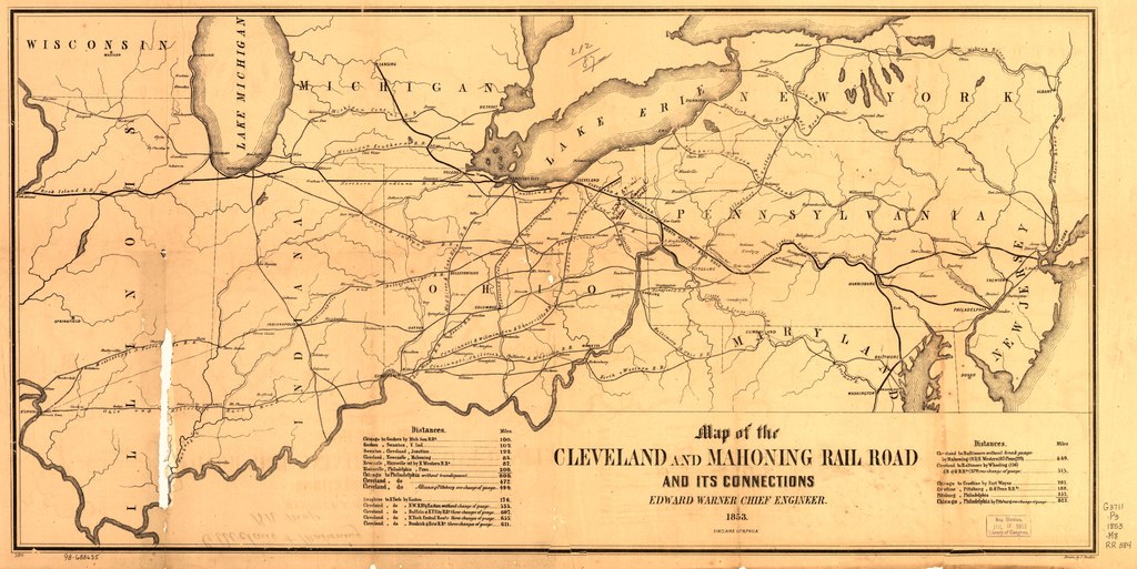
English: Sketch map of the north-central and middle Atlantic states showing the railroad network, major cities, rivers, and state boundaries. Tables of distances appear on both sides of title. Chartered on February 22, 1848. |
||
| Title | Map of the Cleveland and Mahoning Rail Road and its connections, Edward Warner Chief Engineer, 1853. | ||
| Shelf ID | G3711.P3 1853 .M8 | ||
| Date | |||
| Source | https://www.loc.gov/item/98688635/ | ||
| Author | Mueller, J. (John); Cleveland And Mahoning Rail Road Company; Mueller, J. | ||
| Permission (Reusing this file) |
|
||
| Other versions |
|
||
| Location | Northeastern States · United States | ||
| Part of | American Memory · Catalog · Railroad Maps, 1828-1900 · Geography And Map Division · Transportation And Communication | ||
| Subject | Northeastern States · Maps · Railroads · United States · Cleveland And Mahoning Rail Road Company |


Licensing
[edit]|
This is a faithful photographic reproduction of a two-dimensional, public domain work of art. The work of art itself is in the public domain for the following reason:
The official position taken by the Wikimedia Foundation is that "faithful reproductions of two-dimensional public domain works of art are public domain".
This photographic reproduction is therefore also considered to be in the public domain in the United States. In other jurisdictions, re-use of this content may be restricted; see Reuse of PD-Art photographs for details. | ||||
File history
Click on a date/time to view the file as it appeared at that time.
| Date/Time | Thumbnail | Dimensions | User | Comment | |
|---|---|---|---|---|---|
| current | 20:45, 20 May 2018 |  | 8,536 × 4,279 (104.5 MB) | Fæ (talk | contribs) | LOC Maps https://www.loc.gov/item/98688635/ #12476 |
You cannot overwrite this file.
File usage on Commons
The following page uses this file: