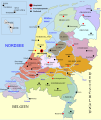
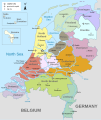
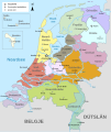
File:Map provinces Netherlands-de.svg
來自Wikimedia Commons
跳去導覽
跳去搵嘢

呢個「SVG」檔案嘅呢個「PNG」預覽嘅大細:506 × 600 像素。 第啲解像度:202 × 240 像素 | 405 × 480 像素 | 648 × 768 像素 | 864 × 1,024 像素 | 1,727 × 2,048 像素 | 743 × 881 像素。
原本檔案 (SVG檔案,表面大細: 743 × 881 像素,檔案大細:516 KB)
File information
Structured data
Captions
Captions
Add a one-line explanation of what this file represents
This W3C-unspecified vector image was created with Inkscape .
| This SVG file contains embedded text that can be translated into your language, using any capable SVG editor, text editor or the SVG Translate tool. For more information see: About translating SVG files. |
摘要
[編輯]| 描述Map provinces Netherlands-de.svg |
Deutsch: Karte der Niederlande, mit den Provinzen, den Karibischen Niederlanden, den Großstädten, den Flüssen und den Seen. Die deutsche Version.
English: Map of the Netherlands (including the special municipalities of Saba, Saint Eustatius and Bonaire; the Caribbean Netherlands), showing provinces, large cities, rivers and lakes. German Version. |
| 來源 | 自己作品 |
| 作者 | Alphathon |
| Other versions |
[改]
|
協議
[編輯]I, the copyright holder of this work, hereby publish it under the following licenses:
呢個檔案用共享創意 姓名標示-非商業性-相同方式分享3.0 未本地化版本條款授權。
- 你可以:
- 去分享 – 複製、發佈同傳播呢個作品
- 再改 – 創作演繹作品
- 要遵照下面嘅條件:
- 署名 – 你一定要畀合適嘅表彰、畀返指向呢個授權條款嘅連結,同埋寫明有無改過嚟。你可以用任何合理方式去做,但唔可以用任何方式暗示授權人認可咗你或者你嘅使用方式。
- 相同方式分享 – 如果你用任何方式改過呢個作品,你必須要用返原本或者相似嘅條款發佈。

|
根據自由軟體基金會發佈嘅無固定段落、封面文字同封底文字GNU自由文件授權條款第1.2或打後嘅版本,你獲授權可以重製、散佈同埋修改爾份文件。授權條款嘅副本喺章節GNU自由文件授權條款。http://www.gnu.org/copyleft/fdl.htmlGFDLGNU Free Documentation Licensetruetrue |
你可以揀你想用嘅牌照。
檔案歷史
撳個日期/時間去睇響嗰個時間出現過嘅檔案。
| 日期/時間 | 縮圖 | 尺寸 | 用戶 | 註解 | |
|---|---|---|---|---|---|
| 現時 | 2016年3月24號 (四) 21:03 |  | 743 × 881(516 KB) | Furfur(傾偈 | 貢獻) | Scheldt -> Schelde, Nether Rhein -> Niederrhein, Antwerp -> Antwerpen |
| 2015年11月14號 (六) 14:42 |  | 743 × 881(888 KB) | Timmaexx(傾偈 | 貢獻) | Rhine -> Rhein | |
| 2014年10月15號 (三) 08:40 |  | 743 × 881(888 KB) | Bibi Saint-Pol(傾偈 | 貢獻) | s/GroßStadt/Großstadt/ | |
| 2014年10月14號 (二) 16:54 |  | 743 × 881(888 KB) | Bibi Saint-Pol(傾偈 | 貢獻) | Improve map with conventional colors and markers, using Liberation fonts for optimal Mediawiki rendering | |
| 2012年7月25號 (三) 21:22 |  | 743 × 881(1.34 MB) | Thomas5388(傾偈 | 貢獻) | Meuse -> Maas | |
| 2011年2月10號 (四) 23:15 |  | 743 × 881(1.34 MB) | Alphathon(傾偈 | 貢獻) | New version with fixed borders and special municipalities | |
| 2010年8月30號 (一) 11:53 |  | 743 × 881(698 KB) | Alphathon(傾偈 | 貢獻) | Fixed error and "Vlissingen" label | |
| 2010年8月30號 (一) 11:48 |  | 743 × 881(697 KB) | Alphathon(傾偈 | 貢獻) | Fixed "Schelde" labels | |
| 2010年8月30號 (一) 11:38 |  | 743 × 881(698 KB) | Alphathon(傾偈 | 貢獻) | Accidental removal of objects | |
| 2010年8月30號 (一) 11:36 |  | 743 × 881(698 KB) | Alphathon(傾偈 | 貢獻) | EN: Made all province shapes representative of actual shape; previously there were hidden sections underneath other provinces |
你無得衾咗個檔案。
檔案用途
以下嘅16版用到呢個檔:
- Atlas of the Netherlands
- User:Chumwa/OgreBot/Potential transport maps/2016 March 21-31
- File:Karte der Provinzen (Niederlande).svg(檔案跳轉)
- File:Map provinces Netherlands-de.svg
- File:Map provinces Netherlands-el.svg
- File:Map provinces Netherlands-en.svg
- File:Map provinces Netherlands-es.svg
- File:Map provinces Netherlands-fr.svg
- File:Map provinces Netherlands-fy.svg
- File:Map provinces Netherlands-he.svg
- File:Map provinces Netherlands-it.svg
- File:Map provinces Netherlands-ja.svg
- File:Map provinces Netherlands-mk.svg
- File:Map provinces Netherlands-nl.svg
- File:Netherlands Map (Without Islands).svg
- Template:Other versions/Map provinces Netherlands
全域檔案使用情況
下面嘅維基都用緊呢個檔案:
- bar.wikipedia.org嘅使用情況
- de.wikipedia.org嘅使用情況
- de.wikivoyage.org嘅使用情況
- de.wiktionary.org嘅使用情況
- frr.wikipedia.org嘅使用情況
- lb.wikipedia.org嘅使用情況
- nds.wikipedia.org嘅使用情況
Metadata
呢個檔案有額外嘅資料。佢應該係數碼相機或者掃描器整出來嘅。如果佢整咗之後畀人改過,裏面嘅資料未必同改過之後相符。
| 闊 | 743px |
|---|---|
| 高 | 881px |


