File:Mapa de Provincias Corea.svg
Jump to navigation
Jump to search

Size of this PNG preview of this SVG file: 320 × 599 pixels. Other resolutions: 256 × 480 pixels | 410 × 768 pixels | 547 × 1,024 pixels | 1,094 × 2,048 pixels | 716 × 1,340 pixels.
Original file (SVG file, nominally 716 × 1,340 pixels, file size: 353 KB)
Captions
Captions
Add a one-line explanation of what this file represents
Summary[edit]
| Description |
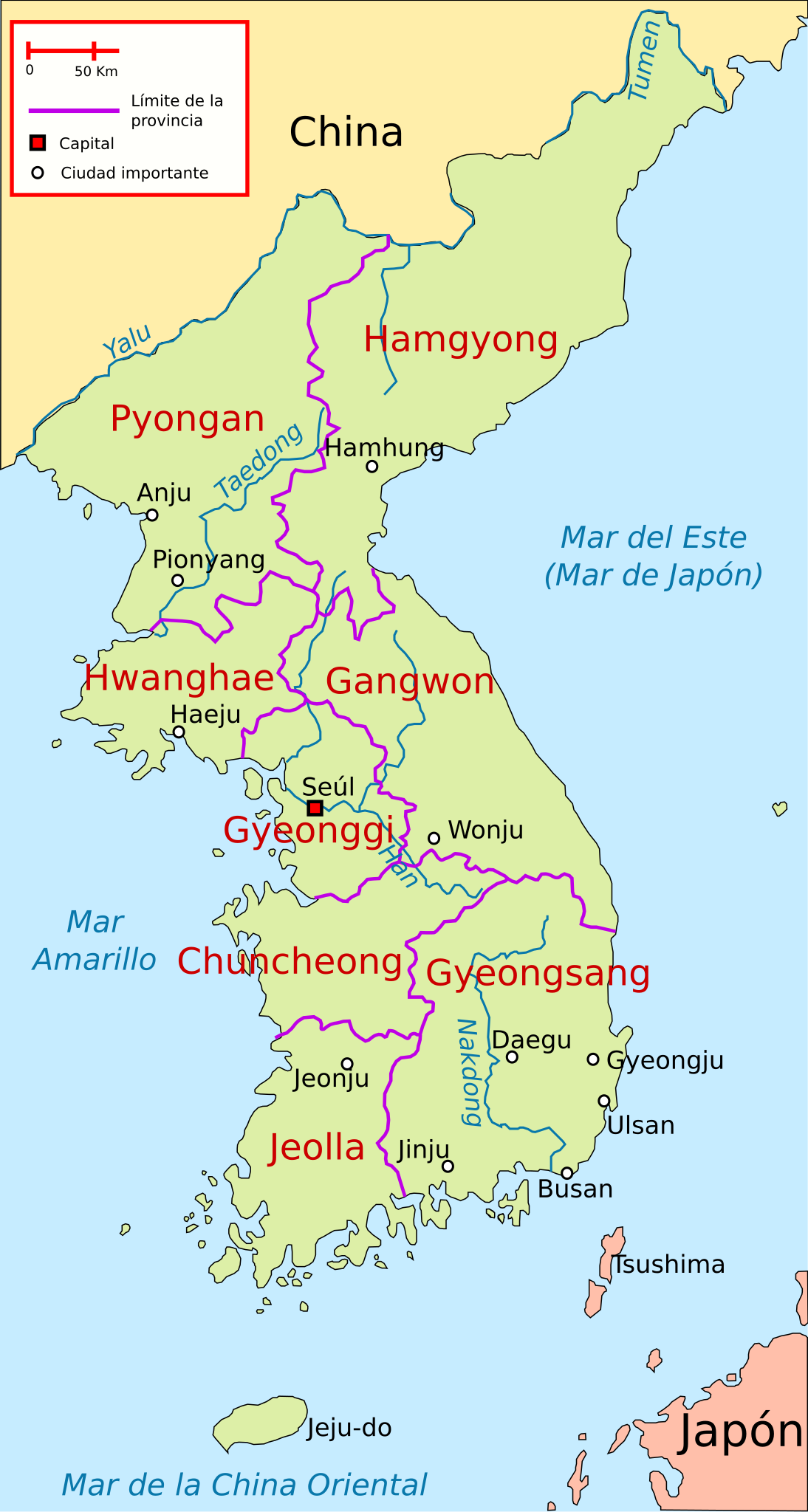
Español: Ubicación de las antiguas 8 provincias de Corea y las principales ciudades |
| Date | |
| Source | Own work, based on Image:Map of korea.png (deleted) and Image:Korea-8provinces.jpg |
| Author | Rage against |
| SVG development |
Licensing[edit]
I, the copyright holder of this work, hereby publish it under the following licenses:

|
Permission is granted to copy, distribute and/or modify this document under the terms of the GNU Free Documentation License, Version 1.2 or any later version published by the Free Software Foundation; with no Invariant Sections, no Front-Cover Texts, and no Back-Cover Texts. A copy of the license is included in the section entitled GNU Free Documentation License. |
This file is licensed under the Creative Commons Attribution 3.0 Unported license.
- You are free:
- to share – to copy, distribute and transmit the work
- to remix – to adapt the work
- Under the following conditions:
- attribution – You must give appropriate credit, provide a link to the license, and indicate if changes were made. You may do so in any reasonable manner, but not in any way that suggests the licensor endorses you or your use.
You may select the license of your choice.
File history
Click on a date/time to view the file as it appeared at that time.
| Date/Time | Thumbnail | Dimensions | User | Comment | |
|---|---|---|---|---|---|
| current | 23:14, 28 July 2019 | | 716 × 1,340 (353 KB) | Rowanwindwhistler (talk | contribs) | Minor changes |
| 05:22, 16 March 2010 |  | 716 × 1,340 (108 KB) | Rαge (talk | contribs) | + Mar del Este | |
| 10:25, 31 January 2009 |  | 716 × 1,340 (107 KB) | Valentim (talk | contribs) | Minor corrections | |
| 10:19, 31 January 2009 |  | 716 × 1,340 (108 KB) | Valentim (talk | contribs) | Unnecessary informations deleted (less informations make pictures more transparent) + "Mar de la China Oriental" | |
| 17:52, 19 January 2009 |  | 716 × 1,340 (107 KB) | Rαge (talk | contribs) | {{Information |Description= |Source= |Date= |Author= |Permission= |other_versions= }} | |
| 00:23, 23 October 2008 |  | 716 × 1,340 (107 KB) | Rαge (talk | contribs) | {{Information |Description={{es|1=Ubicación de las antiguas 8 provincias de Corea y las principales ciudades}} |Source=trabajo propio (own work), based on Image:Map_of_korea.png and Image:Korea-8provinces.jpg |Author=[[User:Rage against|Rage ag |
You cannot overwrite this file.
File usage on Commons
There are no pages that use this file.
File usage on other wikis
The following other wikis use this file:
- Usage on es.wikipedia.org