File:Mapa de la República de Bolivia, 1859.jpg
Original file (4,639 × 5,755 pixels, file size: 5.03 MB, MIME type: image/jpeg)
Captions
Captions
Summary
[edit]
| Artist |
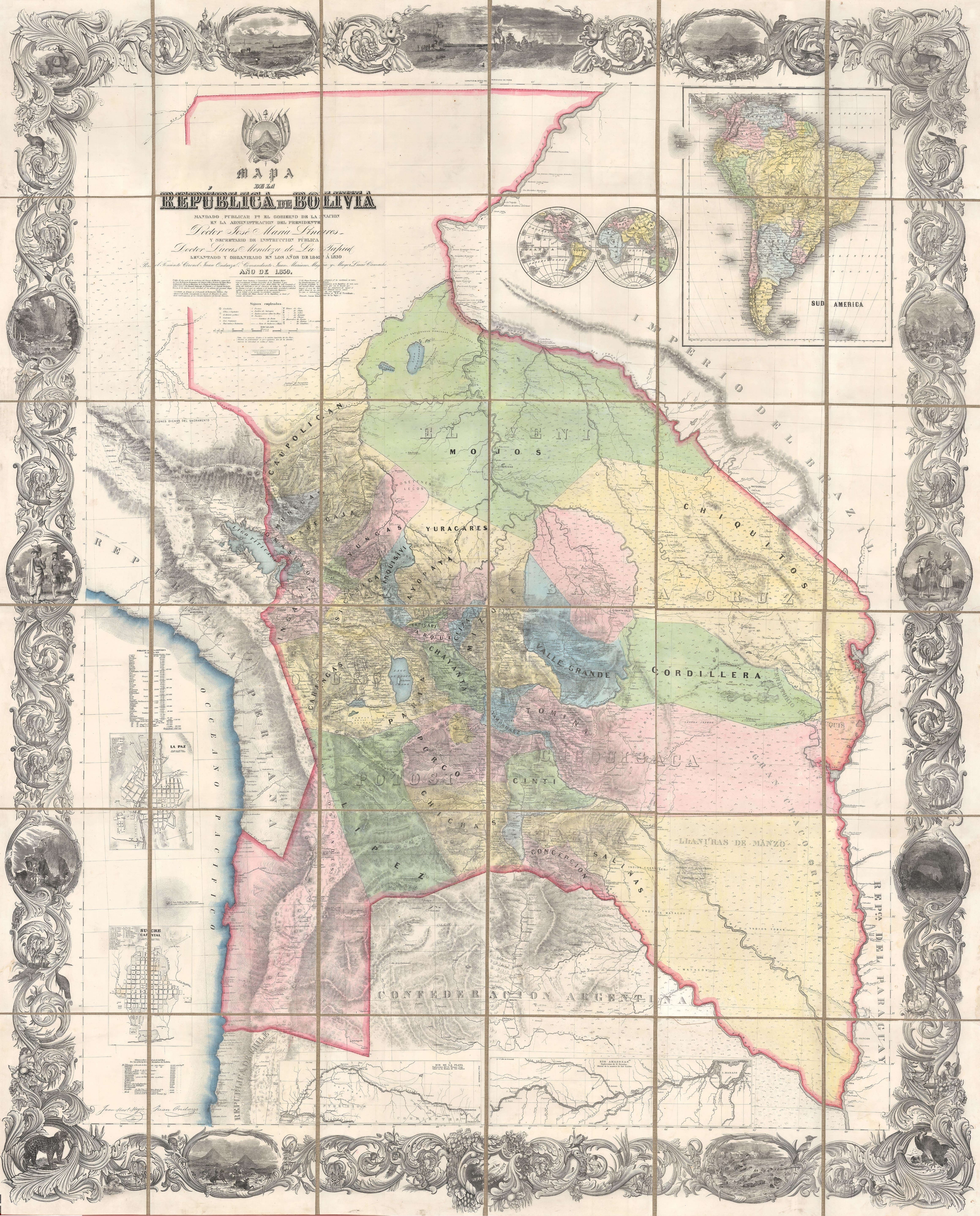
J.H. Colton and Juan Ondarza |
||||
| Title |
Mapa de la Republica de Bolivia mandado publicar pr el Gobierno de la Nacion en la Administracion del Presidente Doctor José Maria Linares. Levantado y organizado en los años de 1842 à 1859 Por el Teniente Coronel Juan Ondarza, Commandante Juan Mariano Mujia y Mayor Lucio Camacho |
||||
| Description |
English: This is J. H. Colton and Juan Ondarza Lara's great 1859 national map of Bolivia. This map is highly significant and influential on multiple levels. First, it is the largest and most important map of Bolivia to appear in the 19th century. Second, it is the second national map produced by an American commercial publisher, J. H. Colton, at the behest of a foreign government. Third, (and unfortunately) Colton was never paid for this map, which forced him into bankruptcy in 1859 and thus into a business arrangement with A. J. Johnson, whose use of Colton's map plates catalyzed his rise to become, for a time, the world's largest map publisher. |
||||
| Date | 1859 | ||||
| Dimensions | height: 71.5 in (181.6 cm); width: 58 in (147.3 cm) | ||||
| Accession number |
Geographicus link: bolivia-colton-1859-3 |
||||
| Source/Photographer |
|
||||
| Permission (Reusing this file) |
|
||||
File history
Click on a date/time to view the file as it appeared at that time.
| Date/Time | Thumbnail | Dimensions | User | Comment | |
|---|---|---|---|---|---|
| current | 20:00, 2 November 2023 | | 4,639 × 5,755 (5.03 MB) | Babelia (talk | contribs) | Uploaded a work by J.H. Colton and Juan Ondarza from Geographicus with UploadWizard |
You cannot overwrite this file.
File usage on Commons
The following page uses this file: