File:Massachusetts congressional districts large.pdf
Jump to navigation
Jump to search

Size of this JPG preview of this PDF file: 776 × 600 pixels. Other resolutions: 311 × 240 pixels | 621 × 480 pixels | 994 × 768 pixels | 1,280 × 989 pixels | 1,650 × 1,275 pixels.
Original file (1,650 × 1,275 pixels, file size: 334 KB, MIME type: application/pdf)
Captions
Captions
Add a one-line explanation of what this file represents
Summary[edit]
| Description |
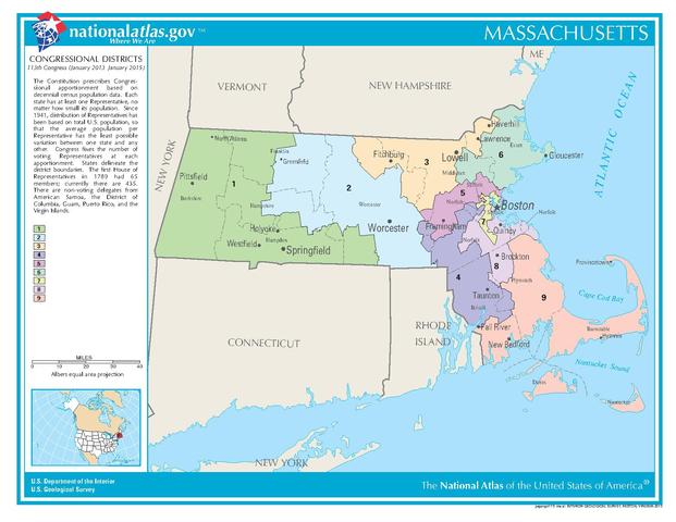
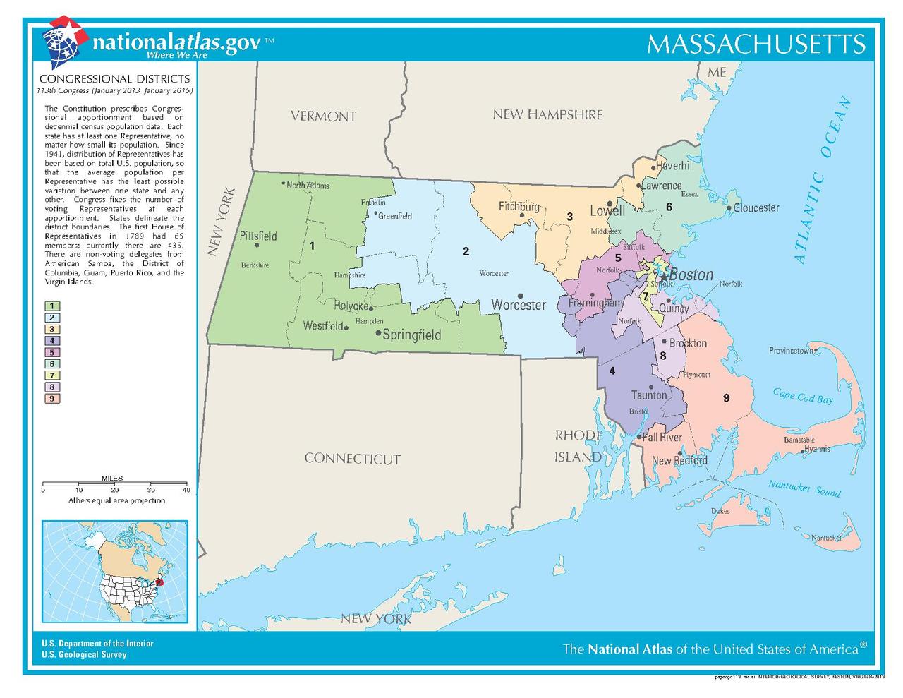
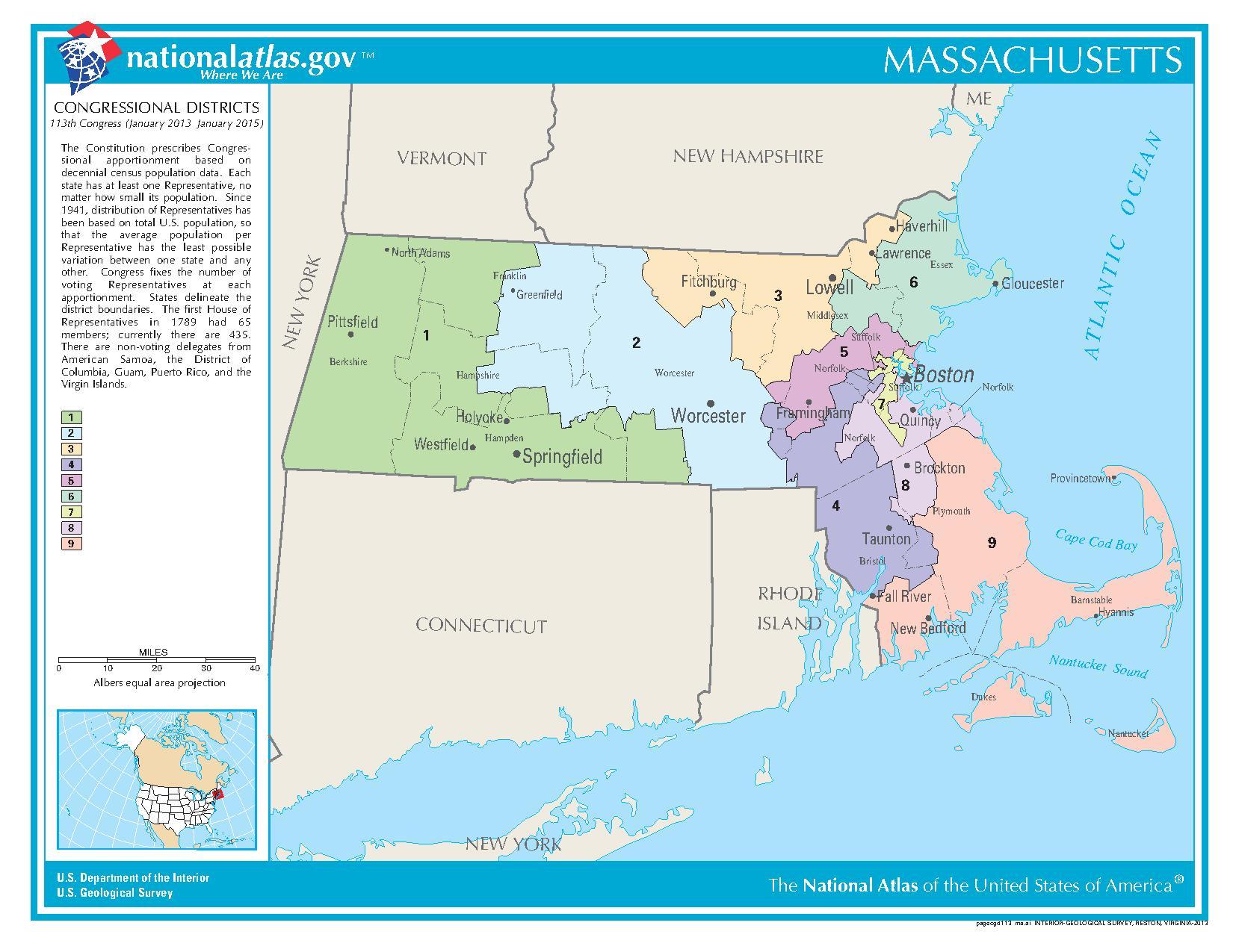
English: U.S. congressional district map of Massachusetts, 2013–2023 |
| Date | |
| Source | http://nationalatlas.gov/printable/images/pdf/congdist/pagecgd113_ma.pdf |
| Author | U.S. Geological Survey / U.S. Department of the Interior |
Licensing[edit]
This map was obtained from an edition of the National Atlas of the United States. Like almost all works of the U.S. federal government, works from the National Atlas are in the public domain in the United States.
Online access: NationalAtlas.gov | 1970 print edition: Library of Congress, Perry-Castañeda Library
|
File history
Click on a date/time to view the file as it appeared at that time.
| Date/Time | Thumbnail | Dimensions | User | Comment | |
|---|---|---|---|---|---|
| current | 19:45, 5 October 2013 |  | 1,650 × 1,275 (334 KB) | GoldRingChip (talk | contribs) | User created page with UploadWizard |
You cannot overwrite this file.
File usage on Commons
The following page uses this file:
File usage on other wikis
The following other wikis use this file:
- Usage on en.wikipedia.org
- Massachusetts's 11th congressional district
- Massachusetts's 10th congressional district
- Massachusetts's 14th congressional district
- Massachusetts's 12th congressional district
- Massachusetts's 13th congressional district
- Massachusetts's 16th congressional district
- Massachusetts's 19th congressional district
- Massachusetts's 18th congressional district
- Massachusetts's 17th congressional district
- Massachusetts's 15th congressional district
- Usage on fa.wikipedia.org
- Usage on fr.wikipedia.org
- Usage on ru.wikipedia.org
- Usage on uk.wikipedia.org
- Usage on zh.wikipedia.org