File:Mauerbach - Hotel Schlosspark.JPG
Jump to navigation
Jump to search

Size of this preview: 800 × 523 pixels. Other resolutions: 320 × 209 pixels | 640 × 419 pixels | 1,024 × 670 pixels | 1,280 × 837 pixels | 2,560 × 1,675 pixels | 4,280 × 2,800 pixels.
Original file (4,280 × 2,800 pixels, file size: 9.88 MB, MIME type: image/jpeg)
Captions
Captions
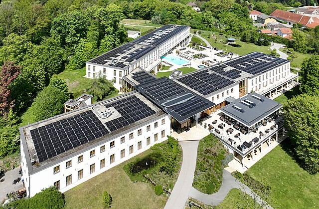
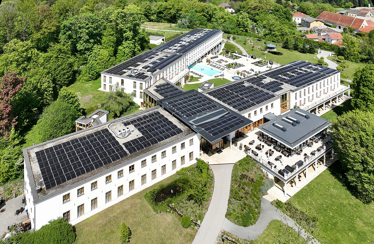
Aerial view of the Hotel Schlosspark Mauerbach in Lower Austria.
Summary
[edit]
| Description |
Deutsch: Das Hotel Schlosspark in der niederösterreichischen Marktgemeinde Mauerbach.
1833 erwarb Georg Simon Freiherr von Sina das Grundstück. Er kultivierte das Gelände, gestaltete es zu einer Parklandschaft und ließ auf einer der Terrassen eine herrschaftliche Villa errichten, die fortan als „das Schloss“ bezeichnet wurde. Im Jahr 1957 wurde das mittlerweile baufällige „Schloss“, dem in den Besatzungsjahren übel mitgespielt worden war, abgerissen. Das Parkgelände verwilderte zusehends. Nach mehrfachem Besitzerwechsel wurde der Schlosspark 2003 von der MESONIC Holding GmbH erworben, die dann ab 2007 darauf das Seminar Hotel Restaurant Schlosspark Mauerbach errichtete und im August 2008 eröffnete. Im Jahr 2016 wurde die Anlage erweitert und feierlich am 22. September von Finanzminister Schelling eröffnetː [1], [2]. English: Aerial view of the Hotel Schlosspark Mauerbach in Lower Austria. |
| Date | |
| Source | Own work |
| Author | C.Stadler/Bwag |
| Permission (Reusing this file) |
Deutsch: Hallo, du darfst mein Foto kostenlos nutzen, aber nenne mich bitte als Fotograf, beispielsweise „Foto: C.Stadler/Bwag“ oder © C.Stadler/Bwag; CC-BY-SA-4.0. Auf mehr Angaben bestehe ich nicht - im Gegensatz zu manch anderen, die die Vorgaben der unten angeführten Lizenzierung auf Punkt und Beistrich einfordern. English: Feel free to use my photos, but please mention me as the author like © C.Stadler/Bwag or © C.Stadler/Bwag; CC-BY-SA-4.0 (that's good enough) and if you want send me a message: bwag@gmx.net. |
| Object location | | View this and other nearby images on: OpenStreetMap |
|---|
| Camera location | | View this and other nearby images on: OpenStreetMap |
|---|
Licensing
[edit]
I, the copyright holder of this work, hereby publish it under the following license:
This file is licensed under the Creative Commons Attribution-Share Alike 4.0 International license.
- You are free:
- to share – to copy, distribute and transmit the work
- to remix – to adapt the work
- Under the following conditions:
- attribution – You must give appropriate credit, provide a link to the license, and indicate if changes were made. You may do so in any reasonable manner, but not in any way that suggests the licensor endorses you or your use.
- share alike – If you remix, transform, or build upon the material, you must distribute your contributions under the same or compatible license as the original.
File history
Click on a date/time to view the file as it appeared at that time.
| Date/Time | Thumbnail | Dimensions | User | Comment | |
|---|---|---|---|---|---|
| current | 10:21, 23 April 2024 | | 4,280 × 2,800 (9.88 MB) | Bwag (talk | contribs) | == {{int:filedesc}} == {{Information |Description= {{de|1= Das Hotel Schlosspark in der niederösterreichischen Marktgemeinde Mauerbach.<br/>1833 erwarb Georg Simon Freiherr von Sina das Grundstück. Er kultivierte das Gelände, gestaltete es zu einer Parklandschaft und ließ auf einer der Terrassen eine herrschaftliche Villa errichten, die fortan als „das Schloss“ bezeichnet wurde. Im Jahr 1957 wurde das mittlerweile baufällige „Schloss“, dem in den Besatzungsjahren übel mitgespielt worden war,... |
You cannot overwrite this file.
File usage on Commons
The following page uses this file:
File usage on other wikis
The following other wikis use this file:
- Usage on de.wikipedia.org
- Usage on www.wikidata.org