File:Mauerbach - Kartause (e).JPG
Jump to navigation
Jump to search

Size of this preview: 800 × 491 pixels. Other resolutions: 320 × 196 pixels | 640 × 393 pixels | 1,024 × 628 pixels | 1,280 × 785 pixels | 2,560 × 1,570 pixels | 4,825 × 2,960 pixels.
Original file (4,825 × 2,960 pixels, file size: 9.92 MB, MIME type: image/jpeg)
Captions
Captions
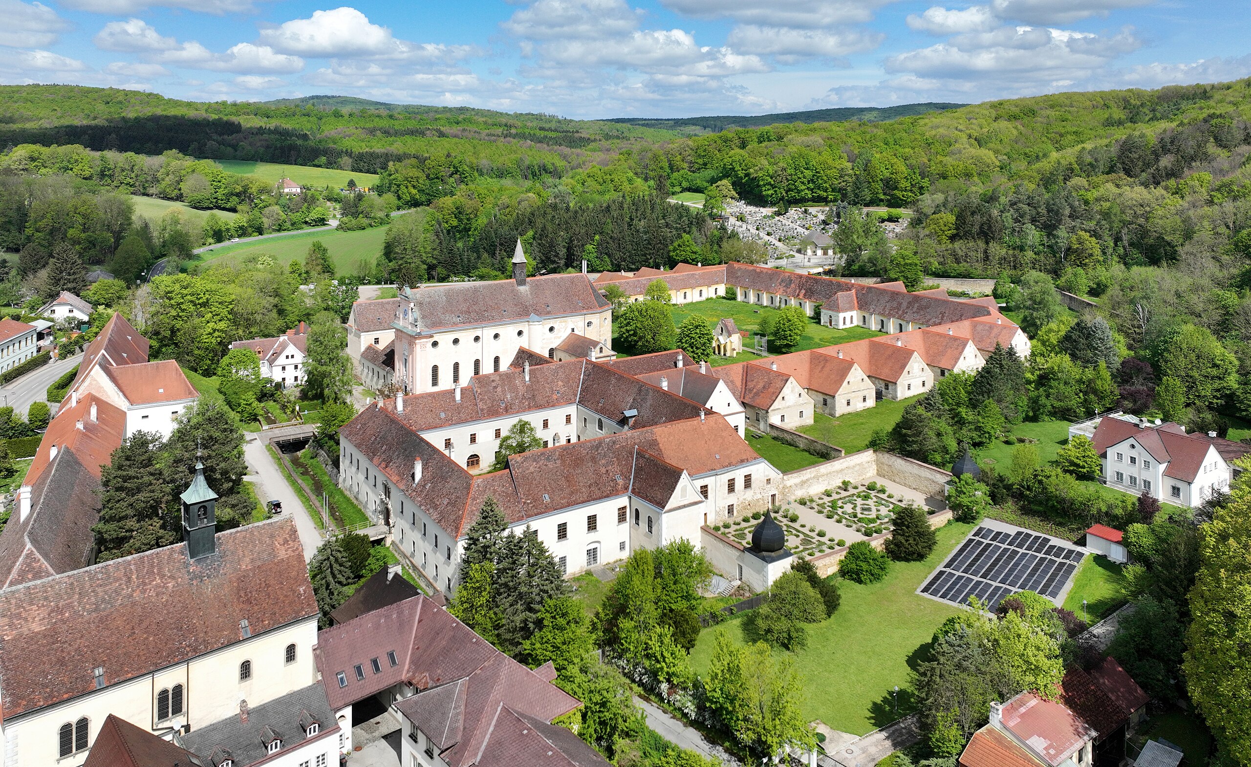
South view of the Mauerbach Charterhouse in Lower Austria.
Summary[edit]
| Description |
Deutsch: Südansicht der Kartause in der niederösterreichischen Marktgemeinde Mauerbach.
Die Kartause wurde um 1315 durch Herzog Friedrich den Schönen gestiftet und 1782 im Zuge der josephinischen Kirchenreformen durch Kaiser Joseph II. aufgelöst. Anschließend diente der Baukomplex als Versorgungshaus der Commune Wien. Von 1945 bis 1961 war er ein Obdachlosenheim und kam anschließend wegen dem Konkordat in Bundesbesitzː [1]. English: South view of the Mauerbach Charterhouse in Lower Austria. |
| Date | |
| Source | Own work |
| Author | C.Stadler/Bwag |
| Permission (Reusing this file) |
Deutsch: Hallo, du darfst mein Foto kostenlos nutzen, aber nenne mich bitte als Fotograf, beispielsweise „Foto: C.Stadler/Bwag“ oder © C.Stadler/Bwag; CC-BY-SA-4.0. Auf mehr Angaben bestehe ich nicht - im Gegensatz zu manch anderen, die die Vorgaben der unten angeführten Lizenzierung auf Punkt und Beistrich einfordern. English: Feel free to use my photos, but please mention me as the author like © C.Stadler/Bwag or © C.Stadler/Bwag; CC-BY-SA-4.0 (that's good enough) and if you want send me a message: bwag@gmx.net. |
| Other versions |
|
.JPG)
.JPG)

.JPG&action=edit§ion=1)
| Object location | | View this and other nearby images on: OpenStreetMap |
|---|
.JPG¶ms=048.251010_N_0016.167790_E_globe:Earth_class:object_type:object__&language=en)
| Camera location | | View this and other nearby images on: OpenStreetMap |
|---|
.JPG¶ms=048.248780_N_0016.167970_E_globe:Earth_type:camera_heading:0.00&language=en)
Licensing[edit]
.JPG&action=edit§ion=2)
I, the copyright holder of this work, hereby publish it under the following license:
This file is licensed under the Creative Commons Attribution-Share Alike 4.0 International license.
- You are free:
- to share – to copy, distribute and transmit the work
- to remix – to adapt the work
- Under the following conditions:
- attribution – You must give appropriate credit, provide a link to the license, and indicate if changes were made. You may do so in any reasonable manner, but not in any way that suggests the licensor endorses you or your use.
- share alike – If you remix, transform, or build upon the material, you must distribute your contributions under the same or compatible license as the original.
File history
Click on a date/time to view the file as it appeared at that time.
| Date/Time | Thumbnail | Dimensions | User | Comment | |
|---|---|---|---|---|---|
| current | 20:47, 23 April 2024 | | 4,825 × 2,960 (9.92 MB) | Bwag (talk | contribs) | == {{int:filedesc}} == {{Information |Description= {{de|1= Südansicht der Kartause in der niederösterreichischen Marktgemeinde Mauerbach.<br/>Die Kartause wurde um 1315 durch Herzog Friedrich den Schönen gestiftet und 1782 im Zuge der josephinischen Kirchenreformen durch Kaiser Joseph II. aufgelöst. Anschließend diente der Baukomplex als Versorgungshaus der Commune Wien. Von 1945 bis 1961 war er ein Obdachlosenheim und kam anschließend wegen dem Konkordat in Bundesbesitzː [https://www.bda.g... |
You cannot overwrite this file.
File usage on Commons
The following 4 pages use this file:
.JPG)
File usage on other wikis
The following other wikis use this file:
- Usage on de.wikipedia.org
- Usage on fr.wikipedia.org
.JPG&oldid=870657452)