File:Meall Greigh - geograph.org.uk - 1362915.jpg
Jump to navigation
Jump to search
No higher resolution available.
Meall_Greigh_-_geograph.org.uk_-_1362915.jpg (640 × 360 pixels, file size: 53 KB, MIME type: image/jpeg)
Captions
Captions
Add a one-line explanation of what this file represents
Summary
[edit]| Description |
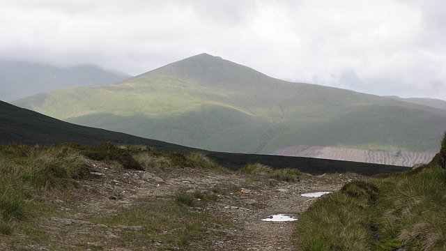
English: Meall Greigh Meall Greigh often gets lost amongst the other tops of the Lawers Range, but with all other hills in cloud, it stands out well here. The forest to its east has been felled since my last visit to the hill leaving a light coloured patch above a hidden Loch Tay. |
| Date | |
| Source | From geograph.org.uk |
| Author | Richard Webb |
| Attribution (required by the license) | Richard Webb / Meall Greigh / |
| Camera location | | View this and other nearby images on: OpenStreetMap |
|---|
Licensing
[edit]
|
This image was taken from the Geograph project collection. See this photograph's page on the Geograph website for the photographer's contact details. The copyright on this image is owned by Richard Webb and is licensed for reuse under the Creative Commons Attribution-ShareAlike 2.0 license.
|
This file is licensed under the Creative Commons Attribution-Share Alike 2.0 Generic license.
Attribution: Richard Webb
- You are free:
- to share – to copy, distribute and transmit the work
- to remix – to adapt the work
- Under the following conditions:
- attribution – You must give appropriate credit, provide a link to the license, and indicate if changes were made. You may do so in any reasonable manner, but not in any way that suggests the licensor endorses you or your use.
- share alike – If you remix, transform, or build upon the material, you must distribute your contributions under the same or compatible license as the original.

_heading:315.00&language=en)
File history
Click on a date/time to view the file as it appeared at that time.
| Date/Time | Thumbnail | Dimensions | User | Comment | |
|---|---|---|---|---|---|
| current | 11:44, 28 February 2011 | | 640 × 360 (53 KB) | GeographBot (talk | contribs) | == {{int:filedesc}} == {{Information |description={{en|1=Meall Greigh Meall Greigh often gets lost amongst the other tops of the Lawers Range, but with all other hills in cloud, it stands out well here. The forest to its east has been felled since my last |
You cannot overwrite this file.
File usage on Commons
There are no pages that use this file.
File usage on other wikis
The following other wikis use this file:
- Usage on ceb.wikipedia.org
- Usage on sv.wikipedia.org
- Usage on www.wikidata.org