File:Mill Lane, Clanfield - geograph.org.uk - 894651.jpg
Jump to navigation
Jump to search
No higher resolution available.
Mill_Lane,_Clanfield_-_geograph.org.uk_-_894651.jpg (640 × 480 pixels, file size: 108 KB, MIME type: image/jpeg)
Captions
Captions
Add a one-line explanation of what this file represents
Summary[edit]
| Description |
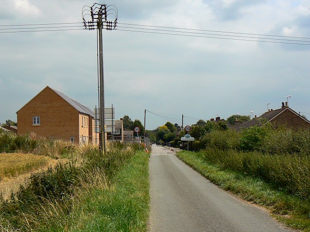
English: Mill Lane, Clanfield The electricity pole sits about 2 metres outside the square. The houses on the left are being built for a housing association. They don't show on the maps and the Google plane hasn't been over since construction started. Update 15 September 2008: These houses have had to be demolished because '[builders] drilled down into the water table causing the ground to fill with moisture and rise dramatically.' (Oxford Mail) |
| Date | |
| Source | From geograph.org.uk |
| Author | Brian Robert Marshall |
| Attribution (required by the license) | Brian Robert Marshall / Mill Lane, Clanfield / |
| Camera location | | View this and other nearby images on: OpenStreetMap |
|---|
| Object location | | View this and other nearby images on: OpenStreetMap |
|---|
Licensing[edit]

|
This image was taken from the Geograph project collection. See this photograph's page on the Geograph website for the photographer's contact details. The copyright on this image is owned by Brian Robert Marshall and is licensed for reuse under the Creative Commons Attribution-ShareAlike 2.0 license.
|
This file is licensed under the Creative Commons Attribution-Share Alike 2.0 Generic license.
Attribution: Brian Robert Marshall
- You are free:
- to share – to copy, distribute and transmit the work
- to remix – to adapt the work
- Under the following conditions:
- attribution – You must give appropriate credit, provide a link to the license, and indicate if changes were made. You may do so in any reasonable manner, but not in any way that suggests the licensor endorses you or your use.
- share alike – If you remix, transform, or build upon the material, you must distribute your contributions under the same or compatible license as the original.

_heading:112.00&language=en)
_heading:112.00&language=en)
File history
Click on a date/time to view the file as it appeared at that time.
| Date/Time | Thumbnail | Dimensions | User | Comment | |
|---|---|---|---|---|---|
| current | 16:34, 21 February 2011 | | 640 × 480 (108 KB) | GeographBot (talk | contribs) | == {{int:filedesc}} == {{Information |description={{en|1=Mill Lane, Clanfield The electricity pole sits about 2 metres outside the square. The houses on the left are being built for a housing association. They don't show on the maps and the Google plane h |
You cannot overwrite this file.
File usage on Commons
There are no pages that use this file.