File:Mine shaft on Carn Marth - geograph.org.uk - 1312654.jpg
Jump to navigation
Jump to search
No higher resolution available.
Mine_shaft_on_Carn_Marth_-_geograph.org.uk_-_1312654.jpg (640 × 480 pixels, file size: 85 KB, MIME type: image/jpeg)
Captions
Captions
Add a one-line explanation of what this file represents
Summary[edit]
| Description |
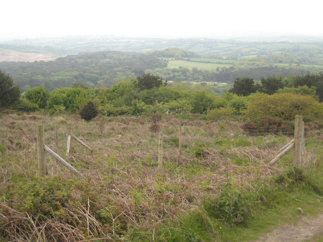
English: Mine shaft on Carn Marth. The fence surrounds an open mine shaft, a common feature in this heavily mined area. The woodland in the distance is on the Trevince estate 755571 and the brown bare area to the left of this is the landfill site at United Downs which is in the process of being landscaped. On a clear day there are views from here to the sea beyond Falmouth. |
| Date | |
| Source | From geograph.org.uk |
| Author | Rod Allday |
| Attribution (required by the license) | Rod Allday / Mine shaft on Carn Marth / |
| Camera location | | View this and other nearby images on: OpenStreetMap |
|---|
_heading:112.00&language=en)
| Object location | | View this and other nearby images on: OpenStreetMap |
|---|
_heading:112.00&language=en)
Licensing[edit]

|
This image was taken from the Geograph project collection. See this photograph's page on the Geograph website for the photographer's contact details. The copyright on this image is owned by Rod Allday and is licensed for reuse under the Creative Commons Attribution-ShareAlike 2.0 license.
|
This file is licensed under the Creative Commons Attribution-Share Alike 2.0 Generic license.
Attribution: Rod Allday
- You are free:
- to share – to copy, distribute and transmit the work
- to remix – to adapt the work
- Under the following conditions:
- attribution – You must give appropriate credit, provide a link to the license, and indicate if changes were made. You may do so in any reasonable manner, but not in any way that suggests the licensor endorses you or your use.
- share alike – If you remix, transform, or build upon the material, you must distribute your contributions under the same or compatible license as the original.
File history
Click on a date/time to view the file as it appeared at that time.
| Date/Time | Thumbnail | Dimensions | User | Comment | |
|---|---|---|---|---|---|
| current | 17:26, 27 February 2011 | | 640 × 480 (85 KB) | GeographBot (talk | contribs) | == {{int:filedesc}} == {{Information |description={{en|1=Mine shaft on Carn Marth The fence surrounds an open mine shaft, a common feature in this heavily mined area. The woodland in the distance is on the Trevince estate 755571 and the brown bare are |
You cannot overwrite this file.
File usage on Commons
There are no pages that use this file.