File:Mural in town touting the community of Terrell, Texas, east of Dallas, and its tie to England LCCN2014633650.tif
![File:Mural in town touting the community of Terrell, Texas, east of Dallas, and its tie to England LCCN2014633650.tif](https://upload.wikimedia.org/wikipedia/commons/thumb/3/38/Mural_in_town_touting_the_community_of_Terrell%2C_Texas%2C_east_of_Dallas%2C_and_its_tie_to_England_LCCN2014633650.tif/lossy-page1-800px-Mural_in_town_touting_the_community_of_Terrell%2C_Texas%2C_east_of_Dallas%2C_and_its_tie_to_England_LCCN2014633650.tif.jpg?20160908000220)
Original file (7,360 × 4,912 pixels, file size: 206.9 MB, MIME type: image/tiff)
Captions
Captions
Summary
[edit]DescriptionMural in town touting the community of Terrell, Texas, east of Dallas, and its tie to England LCCN2014633650.tif |
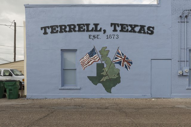
English: Title: Mural in town touting the community of Terrell, Texas, east of Dallas, and its tie to England
Physical description: 1 photograph : digital, tiff file, color. Notes: Forms part of: Lyda Hill Texas Collection of Photographs in Carol M. Highsmith's America Project in the Carol M. Highsmith Archive.; Sunny DeLipsey was commissioned by the Terrell Heritage Society to paint this mural from the design provided by NETFAA (Source: Terrell Heritage Society website, 2014); Title, date, and keywords based on information provided by the photographer.; Terrell was home to No. 1 British Flying Training School (BFTS) during WWII.; Gift; The Lyda Hill Foundation; 2014; (DLC/PP-2014:054).; Credit line: The Lyda Hill Texas Collection of Photographs in Carol M. Highsmith's America Project, Library of Congress, Prints and Photographs Division. |
||||||||||||||||||||||||||
Date | Taken on 30 May 2014, 17:12 (according to Exif data) | ||||||||||||||||||||||||||
Source |
Library of Congress
|
||||||||||||||||||||||||||
Author |
creator QS:P170,Q5044454 |
||||||||||||||||||||||||||
Permission (Reusing this file) |
No known restrictions on publication.
|
Camera location | 32° 44′ 13.35″ N, 96° 16′ 43.26″ W ![]() | View this and other nearby images on: OpenStreetMap | ![]() |
---|
Licensing
[edit]Public domainPublic domainfalsefalse |
![]() |
This work is from the Carol M. Highsmith Archive collection at the Library of Congress. According to the library, there are no known copyright restrictions on the use of this work. Carol M. Highsmith has stipulated that her photographs are in the public domain. Photographs of sculpture or other works of art may be restricted by the copyright of the artist; see Commons:FOP US#Artworks and sculptures for more information. |
![]() |
File history
Click on a date/time to view the file as it appeared at that time.
Date/Time | Thumbnail | Dimensions | User | Comment | |
---|---|---|---|---|---|
current | 00:02, 8 September 2016 | ![]() | 7,360 × 4,912 (206.9 MB) | Fæ (talk | contribs) | LOC 2014633650, Carol M. Highsmith collection. P149.12399 TIFF (206.9mb) |
You cannot overwrite this file.
File usage on Commons
There are no pages that use this file.
Metadata
This file contains additional information such as Exif metadata which may have been added by the digital camera, scanner, or software program used to create or digitize it. If the file has been modified from its original state, some details such as the timestamp may not fully reflect those of the original file. The timestamp is only as accurate as the clock in the camera, and it may be completely wrong.
Image title | Mural in town touting the community of Terrell, Texas, east of Dallas, and its tie to England. According to the Terrell Heritage Society, "Prior to the U. S. entering WWII, England needed a place to train its pilots. Several training centers were opened in the United States; the Terrell center became No.1 British Flying Training School (BFTS). The English cadets came to the United States through Canada in civilian clothes and then were trained to be pilots under the auspices of the "Lend-Lease Act," which was signed March 11, 1941. Several young cadets perished in accidents and as is British tradition were buried where they fell in a plot of land donated by Oakland Memorial Cemetery. Several British pilots-in-training married Terrell women. There is a book, "The Royal Air Force in Texas," authored by Navarro College history professor Tom Killebrew. Terrell has an annual "Fly-In" Dinner Dance, and holds graveside services honoring our relationship with England and the cadets who lived and died here. Canadian and British dignitaries often attend. The deceased cadets are also honored at our Terrell Veterans Memorial. "The maps shown on the mural depict the relationship between England and Texas and are taken from an actual flight-training map at the No. 1 British Flying Training Museum, which is located near our airport. Terrell and London are occupying the same spot on the map. It helped give the cadets a feel for how their flights would be when they returned home." |
---|---|
Camera manufacturer | NIKON CORPORATION |
Camera model | NIKON D800 |
Author | Photographer: Carol M. Highsmith |
Exposure time | 1/80 sec (0.0125) |
F-number | f/10 |
ISO speed rating | 100 |
Date and time of data generation | 17:12, 30 May 2014 |
Lens focal length | 31 mm |
Latitude | 32° 44′ 13.36″ N |
Longitude | 96° 16′ 43.26″ W |
Altitude | 168 meters above sea level |
Width | 7,360 px |
Height | 4,912 px |
Bits per component |
|
Compression scheme | Uncompressed |
Pixel composition | RGB |
Image data location | 30,934 |
Orientation | Normal |
Number of components | 3 |
Number of rows per strip | 4,912 |
Bytes per compressed strip | 216,913,920 |
Horizontal resolution | 300 dpi |
Vertical resolution | 300 dpi |
Data arrangement | chunky format |
Software used | Ver.1.02 |
File change date and time | 06:11, 25 June 2014 |
Exposure Program | Manual |
Exif version | 2.21 |
Date and time of digitizing | 17:12, 30 May 2014 |
APEX shutter speed | 6.321928 |
APEX aperture | 6.643856 |
APEX exposure bias | 0 |
Maximum land aperture | 3 APEX (f/2.83) |
Metering mode | Pattern |
Light source | Unknown |
Flash | Flash did not fire, compulsory flash suppression |
DateTimeOriginal subseconds | 6 |
Color space | Uncalibrated |
Focal plane X resolution | 2,048.4022216797 |
Focal plane Y resolution | 2,048.4022216797 |
Focal plane resolution unit | 3 |
Sensing method | One-chip color area sensor |
File source | Digital still camera |
Scene type | A directly photographed image |
Custom image processing | Normal process |
Exposure mode | Manual exposure |
White balance | Auto white balance |
Digital zoom ratio | 1 |
Focal length in 35 mm film | 31 mm |
Scene capture type | Standard |
Scene control | None |
Contrast | Normal |
Saturation | Normal |
Sharpness | Normal |
Subject distance range | Unknown |
GPS time (atomic clock) | 22:12:34.54 |
Satellites used for measurement | 07 |
Geodetic survey data used | WGS84 |
GPS date | 30 May 2014 |
GPS tag version | 2.3.0.0 |
- United States photographs taken on 2014-05-30
- Images from the Library of Congress
- Files with coordinates missing SDC location of creation
- Library of Congress-no known copyright restrictions
- PD-Highsmith
- Images uploaded by Fæ
- Lyda Hill Texas Collection of Photographs in Carol M. Highsmith's America Project in the Carol M. Highsmith Archive
- The Lyda Hill Texas Collection of Photographs in Carol M. Highsmith's America Project, Library of Congress, Prints and Photographs Division
- Photographs by Carol M. Highsmith
- Photographs by Carol M. Highsmith needing review
- Taken with Nikon D800