File:Northamptonshire UK location map (1974-2021).svg
(Reindirizzamento da File:Northamptonshire UK location map.svg)

Dimensioni di questa anteprima PNG per questo file SVG: 524 × 600 pixel. Altre risoluzioni: 210 × 240 pixel | 419 × 480 pixel | 671 × 768 pixel | 895 × 1 024 pixel | 1 789 × 2 048 pixel | 1 106 × 1 266 pixel.
File originale (file in formato SVG, dimensioni nominali 1 106 × 1 266 pixel, dimensione del file: 2 MB)
Didascalie
Didascalie
Aggiungi una brevissima spiegazione di ciò che questo file rappresenta
| Descrizione |
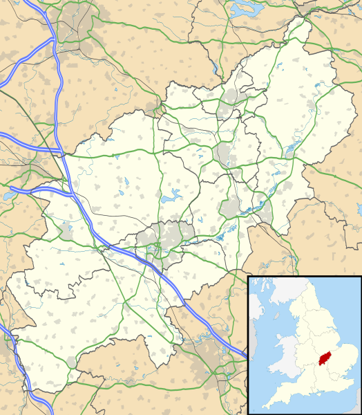
Map of Northamptonshire, UK with the following information shown:
Equirectangular map projection on WGS 84 datum, with N/S stretched 160% Geographic limits:
|
| Data | |
| Fonte |
|
| Autore | Nilfanion, created using Ordnance Survey data |
| Licenza (Riusare questo file) |
Questo file è disponibile in base alla licenza Creative Commons Attribuzione-Condividi allo stesso modo 3.0 Unported Attribuzione: Contains Ordnance Survey data © Crown copyright and database right
|
| Altre versioni | File:Northamptonshire UK district map (blank).svg - Blank map |
.svg)
Cronologia del file
Fare clic su un gruppo data/ora per vedere il file come si presentava nel momento indicato.
| Data/Ora | Miniatura | Dimensioni | Utente | Commento | |
|---|---|---|---|---|---|
| attuale | 20:59, 21 giu 2022 | | 1 106 × 1 266 (2 MB) | G-13114 (discussione | contributi) | Reverted to version as of 19:07, 26 September 2010 (UTC) |
| 20:58, 21 giu 2022 |  | 1 383 × 1 583 (59 KB) | G-13114 (discussione | contributi) | Update to reflect local government boundary changes in 2021 | |
| 19:07, 26 set 2010 |  | 1 106 × 1 266 (2 MB) | Nilfanion (discussione | contributi) | {{Information |Description=Map of Northamptonshire, UK with the following information shown: *Administrative borders *Coastline, lakes and rivers *Roads and railways *Urban areas Equirectangular map projection on WGS 84 datum, with |
Impossibile sovrascrivere questo file.
Utilizzo del file
Le seguenti 4 pagine usano questo file:
Utilizzo globale del file
Anche i seguenti wiki usano questo file:
- Usato nelle seguenti pagine di ar.wikipedia.org:
- Usato nelle seguenti pagine di bg.wikipedia.org:
- Usato nelle seguenti pagine di ceb.wikipedia.org:
- Usato nelle seguenti pagine di cy.wikipedia.org:
- Usato nelle seguenti pagine di es.wikipedia.org:
- Northampton
- Northamptonshire
- Silverstone
- Corby
- Plantilla:Mapa de localización de Northamptonshire
- Rockingham (Northamptonshire)
- Cottingham (Northamptonshire)
- Middleton (Northamptonshire)
- Weldon (Northamptonshire)
- Gretton (Northamptonshire)
- Stanion
- East Carlton
- Wilbarston
- Weston by Welland
- Weekley
- Warkton
- Thorpe Malsor
- Stoke Albany
- Harrington (Northamptonshire)
- Harringworth
- Earls Barton
- East Farndon
- East Haddon
- Easton on the Hill
- Ecton
- Evenley
- Everdon
- Eydon
- Quinton (Northamptonshire)
- Guilsborough
- Aynho
- Aston le Walls
- Yardley Gobion
- Irchester
- Isham
- Scaldwell
- Shutlanger
- Sibbertoft
- Islip (Northamptonshire)
- Yardley Hastings
- Yarwell
- Yelvertoft
- Wilby (Northamptonshire)
- Badby
- Barby (Northamptonshire)
- Barnwell (Northamptonshire)
Visualizza l'utilizzo globale di questo file.
.svg)
.svg&oldid=737313553)