File:Official map of Columbia County, Washington - compiled from U.S. Government and rail road surveys and the county records of said county LOC 2012593140.tif
Jump to navigation
Jump to search

Size of this JPG preview of this TIF file: 414 × 599 pixels. Other resolutions: 166 × 240 pixels | 331 × 480 pixels | 530 × 768 pixels | 707 × 1,024 pixels | 1,415 × 2,048 pixels | 13,246 × 19,171 pixels.
Original file (13,246 × 19,171 pixels, file size: 726.53 MB, MIME type: image/tiff)
Captions
Captions
Add a one-line explanation of what this file represents
Summary
[edit]| Warning | The original file is very high-resolution. It might not load properly or could cause your browser to freeze when opened at full size. |
|---|
| Description |
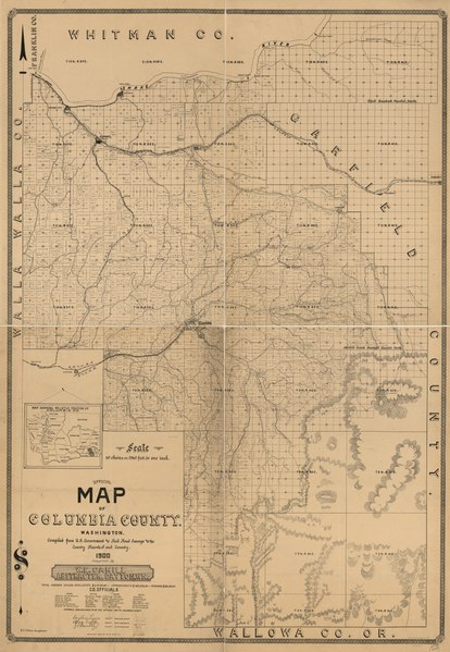
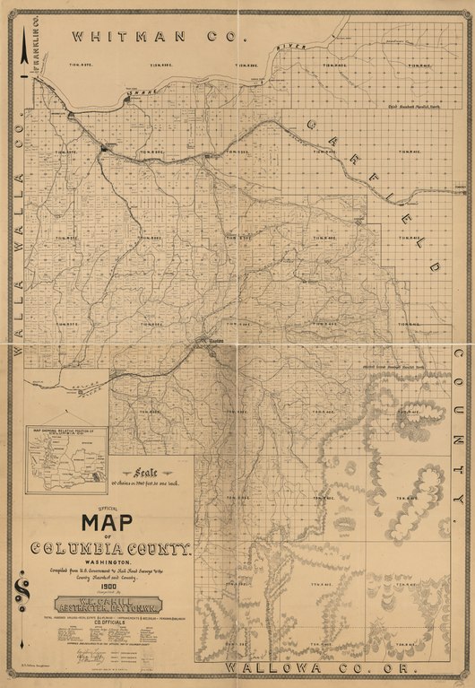
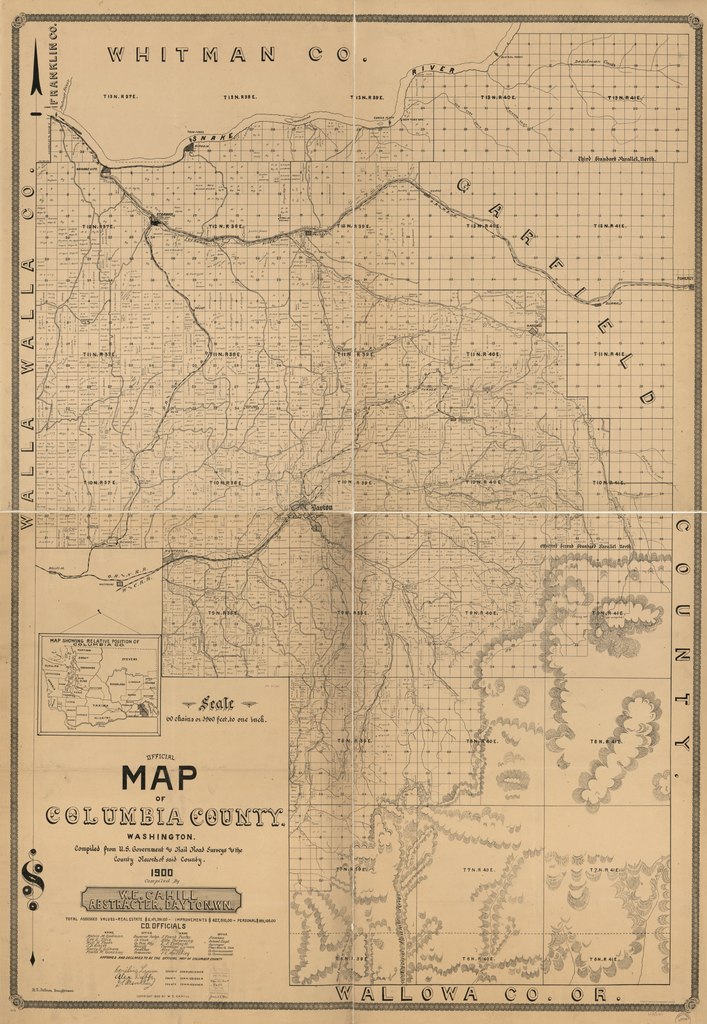
English: Shows names of some residents. Relief shown by hachures. Includes location map. LC Land ownership maps, 1371 Available also through the Library of Congress Web site as a raster image. Mounted on cloth back and sectioned in 2 parts. |
||
| Title | Official map of Columbia County, Washington : compiled from U.S. Government and rail road surveys and the county records of said county | ||
| Shelf ID | G4283.C6G46 1900 .C3 | ||
| Date | |||
| Source | https://www.loc.gov/item/2012593140/ | ||
| Author | Cahill, W. E.; Britton & Rey | ||
| Permission (Reusing this file) |
|
||
| Other versions |
|
||
| Location | Columbia County. · United States · Washington (State) · Columbia County · Washington · United States · Washington (State) | ||
| Part of | American Memory · Catalog · County Landownership Maps · Geography And Map Division · Cultural Landscapes | ||
| Subject | Cadastral Maps · Washington (State) · Columbia County · United States · Maps · Real Property · Landowners · Columbia County (Wash.) |


Licensing
[edit]|
This is a faithful photographic reproduction of a two-dimensional, public domain work of art. The work of art itself is in the public domain for the following reason:
The official position taken by the Wikimedia Foundation is that "faithful reproductions of two-dimensional public domain works of art are public domain".
This photographic reproduction is therefore also considered to be in the public domain in the United States. In other jurisdictions, re-use of this content may be restricted; see Reuse of PD-Art photographs for details. | ||||
File history
Click on a date/time to view the file as it appeared at that time.
| Date/Time | Thumbnail | Dimensions | User | Comment | |
|---|---|---|---|---|---|
| current | 13:04, 10 June 2018 |  | 13,246 × 19,171 (726.53 MB) | Fæ (talk | contribs) | LOC Maps https://www.loc.gov/item/2012593140/ #25944 |
You cannot overwrite this file.
File usage on Commons
The following page uses this file: