File:Old Town Field - geograph.org.uk - 1742946.jpg
Jump to navigation
Jump to search

Size of this preview: 800 × 600 pixels. Other resolutions: 320 × 240 pixels | 640 × 480 pixels | 1,024 × 768 pixels.
Original file (1,024 × 768 pixels, file size: 244 KB, MIME type: image/jpeg)
Captions
Captions
Add a one-line explanation of what this file represents
Summary
[edit]| Description |
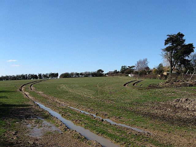
English: Old Town Field The name of the field according to the 1843 tithe map. The name indicates that the field was near or the site of the former settlement of Barnhorn. The manor of the same name had its boundaries drawn out by a charter of 772 and by the medieval period had fallen into ownership of the monks of Battle Abbey. It was they who began reclamation of the marshes to the south and built the settlement to provide housing for those who needed to build and maintain the dykes and sea walls as well as those who were to farm it. The settlement itself lasted until the 14th century when it disappeared probably a mixture of the Black Death, coastal storms and a change in agriculture away from cereal production to sheep farming that was far less labour intensive. Only the name remains as a reminder. |
| Date | |
| Source | From geograph.org.uk |
| Author | Simon Carey |
| Attribution (required by the license) | Simon Carey / Old Town Field / |
| Camera location | | View this and other nearby images on: OpenStreetMap |
|---|
| Object location | | View this and other nearby images on: OpenStreetMap |
|---|
Licensing
[edit]
|
This image was taken from the Geograph project collection. See this photograph's page on the Geograph website for the photographer's contact details. The copyright on this image is owned by Simon Carey and is licensed for reuse under the Creative Commons Attribution-ShareAlike 2.0 license.
|
This file is licensed under the Creative Commons Attribution-Share Alike 2.0 Generic license.
Attribution: Simon Carey
- You are free:
- to share – to copy, distribute and transmit the work
- to remix – to adapt the work
- Under the following conditions:
- attribution – You must give appropriate credit, provide a link to the license, and indicate if changes were made. You may do so in any reasonable manner, but not in any way that suggests the licensor endorses you or your use.
- share alike – If you remix, transform, or build upon the material, you must distribute your contributions under the same or compatible license as the original.

_heading:292.00&language=en)
_heading:292.00&language=en)
File history
Click on a date/time to view the file as it appeared at that time.
| Date/Time | Thumbnail | Dimensions | User | Comment | |
|---|---|---|---|---|---|
| current | 19:39, 5 March 2011 | | 1,024 × 768 (244 KB) | GeographBot (talk | contribs) | == {{int:filedesc}} == {{Information |description={{en|1=Old Town Field The name of the field according to the 1843 tithe map. The name indicates that the field was near or the site of the former settlement of Barnhorn. The manor of the same name had its |
You cannot overwrite this file.
File usage on Commons
There are no pages that use this file.