File:Oregon DEM relief map.png
Aller à la navigation
Aller à la recherche

Taille de cet aperçu : 800 × 588 pixels. Autres résolutions : 320 × 235 pixels | 640 × 470 pixels | 1 024 × 752 pixels | 1 086 × 798 pixels.
Fichier d’origine (1 086 × 798 pixels, taille du fichier : 327 kio, type MIME : image/png)
Légendes
Légendes
Ajoutez en une ligne la description de ce que représente ce fichier
Description[modifier]
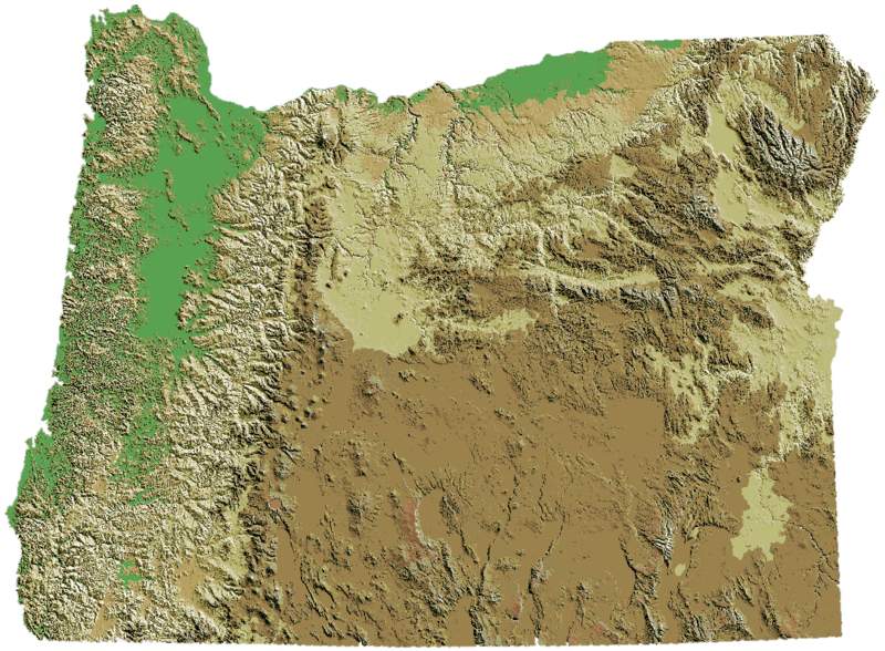
| Description | Oregon DEM relief map |
| Date | |
| Source | cropped and 5° ccw rotated image:Oregon_DEM_relief_map.gif to level southern border. |
| Auteur | USGS + EncMstr |
Oregon DEM relief map, key.
Conditions d’utilisation[modifier]
Cette image est placée dans le domaine public parce qu'elle contient des éléments issus de l'United States Geological Survey, une agence du Département de l'Intérieur des États-Unis. Pour plus d'information, consultez la politique officielle de copyright de l'USGS (en anglais)
|
Source[modifier]
- Website: http://wwwflag.wr.usgs.gov/USGSFlag/Data/maps/OregonDEM.html (link out of date, unable to find new URL)
- Image: http://wwwflag.wr.usgs.gov/USGSFlag/Data/maps/Oregon.gif (link out of date, unable to find new URL)
Historique du fichier
Cliquer sur une date et heure pour voir le fichier tel qu'il était à ce moment-là.
| Date et heure | Vignette | Dimensions | Utilisateur | Commentaire | |
|---|---|---|---|---|---|
| actuel | 23 mai 2007 à 01:59 | | 1 086 × 798 (327 kio) | Peteforsyth (d | contributions) | copied Cacophany's color-reversal into the PNG version |
| 24 février 2007 à 01:22 |  | 1 074 × 790 (319 kio) | Cacophony (d | contributions) | Transparent borders | |
| 26 novembre 2006 à 21:10 |  | 1 097 × 806 (418 kio) | EncMstr (d | contributions) | {{Information |Description=Oregon DEM relief map |Source=cropped and 5° ccw rotated image:Oregon_DEM_relief_map.gif to level southern border. |date=2006-11-26 | author=USGS + EncMstr}} Category:Oregon maps Oregon DEM relief map, [[:Image:Elevl |
Vous ne pouvez pas remplacer ce fichier.
Utilisations locales du fichier
Plus de 100 pages utilisent ce fichier. La liste suivante affiche seulement les 100 premières pages qui utilisent ce fichier. Une liste complète est disponible.
- Talk:Oregon State University
- File talk:Centuryride1.JPG
- File talk:Miracle Theater- Frida Un Retalbo performance, enlarged stage.jpg
- File talk:Miracle Theatre headquarters Portland, Oregon.JPG
- File talk:Miracletheaterfrida.JPG
- Template:WikiProject Oregon
- Category talk:2008 in Corvallis, Oregon
- Category talk:2017 in Albany, Oregon
- Category talk:2017 in Astoria, Oregon
- Category talk:2017 in Bend, Oregon
- Category talk:2017 in Burns, Oregon
- Category talk:2017 in Corvallis, Oregon
- Category talk:2017 in Oregon by city
- Category talk:Albany Downtown Commercial Historic District
- Category talk:Albany Hebrew Cemetery
- Category talk:Albany Municipal Airport (Oregon)
- Category talk:Alumni of Oregon State University
- Category talk:Arbuthnot Dairy Center
- Category talk:Avery-Helm Historic District
- Category talk:Benton County Courthouse (Corvallis, Oregon)
- Category talk:Bexell Hall
- Category talk:Buildings in Corvallis, Oregon
- Category talk:Catalogue of the Oregon Agricultural College
- Category talk:College Hill West Historic District
- Category talk:Corvallis, Oregon
- Category talk:Corvallis, Oregon by year
- Category talk:Crabtree Creek-Hoffman Covered Bridge
- Category talk:Crawfordsville Bridge
- Category talk:Dixon Recreation Center
- Category talk:Faculty of Oregon State University
- Category talk:Fish Lake Guard Station
- Category talk:Fort Yamhill
- Category talk:Fort Yamhill Blockhouse in Dayton, Oregon
- Category talk:Georgia Pacific No 5
- Category talk:Gill Coliseum
- Category talk:Hackleman Historic District
- Category talk:Hannah Bridge
- Category talk:Hannah and Eliza Gorman House
- Category talk:Harrison Brunk House
- Category talk:Historical images of Oregon
- Category talk:Historical photographs of Mount Hood
- Category talk:Historical photographs of Oregon
- Category talk:Historical photographs of volcanoes in Oregon
- Category talk:History of Corvallis, Oregon
- Category talk:History of Linn County, Oregon
- Category talk:History of Oregon
- Category talk:History of Oregon by location
- Category talk:History of Polk County, Oregon
- Category talk:Hotels in Corvallis, Oregon
- Category talk:Independence Historic District (Oregon)
- Category talk:Independence National Bank
- Category talk:Irish Bend Covered Bridge
- Category talk:James W. Seavey Hop Driers
- Category talk:John Bexell House
- Category talk:John McLoughlin
- Category talk:John Phillips House
- Category talk:Julian Hotel
- Category talk:July 2017 in Burns, Oregon
- Category talk:Larwood Bridge
- Category talk:Memorial Union (Oregon State University)
- Category talk:Monteith Historic District
- Category talk:Mt. Pleasant Community Church
- Category talk:NARA images of Oregon
- Category talk:National Register of Historic Places in Albany, Oregon
- Category talk:National Register of Historic Places in Corvallis, Oregon
- Category talk:National Register of Historic Places in Linn County, Oregon
- Category talk:National Register of Historic Places in Polk County, Oregon
- Category talk:OSU Special Collections & Archives
- Category talk:OSU Special Collections & Archives Research Center
- Category talk:Oregon
- Category talk:Oregon Pacific Railroad Linear Historic District
- Category talk:Oregon State University
- Category talk:Oregon State University Historic District
- Category talk:Oregon State University athletics
- Category talk:Oregon State University buildings
- Category talk:Oregon State University logos
- Category talk:Peavy Arboretum
- Category talk:Polk County Bank
- Category talk:Portland, Oregon
- Category talk:Poultry Building and Incubator House
- Category talk:ROTC at Oregon State University
- Category talk:Riley-Cutler House
- Category talk:Ritner Creek Bridge
- Category talk:Santiam Wagon Road
- Category talk:Short Bridge
- Category talk:Spring Valley Presbyterian Church and Cemetery
- Category talk:St. Patrick's Church (Independence, Oregon)
- Category talk:Suburban Christian Church
- Category talk:The Valley Library
- Category talk:Thomas Creek-Gilkey Covered Bridge
- Category talk:Thomas Creek-Shimanek Covered Bridge
- Category talk:US National Archives series: Photographic Report of the Committee Investigating Oregon Coastal Areas, compiled 12/1938 - 12/1938
- Category talk:US National Archives series: Subject Files, compiled ca. 1929 - ca. 1958
- Category talk:Union Street Railroad Bridge
- Category talk:Van Buren Street Bridge (Corvallis, Oregon)
- Category talk:Waldo Hall
- Category talk:Weatherford Hall
- Category talk:Weddle Bridge
- Category talk:Western Ecology Division Laboratory
- Category talk:Whiteside Theatre
Voir plus de liens vers ce fichier.
Utilisations du fichier sur d’autres wikis
Les autres wikis suivants utilisent ce fichier :
- Utilisation sur ar.wikipedia.org
- Utilisation sur en.wikipedia.org
- Talk:Columbia River
- Talk:Corvallis, Oregon
- Talk:Reed College
- Talk:Thunderbird and Whale
- Talk:Ursula K. Le Guin
- Talk:Ken Kesey
- Talk:Vancouver, Washington
- Talk:Tonya Harding
- Talk:Kit Carson
- Talk:Linus Pauling
- Talk:E. E. Smith
- Talk:Manifest destiny
- Talk:Flag of Oregon
- Talk:Baker County, Oregon
- Talk:Benton County, Oregon
- Talk:Clackamas County, Oregon
- Talk:Clatsop County, Oregon
- Talk:Columbia County, Oregon
- Talk:Coos County, Oregon
- Talk:List of counties in Oregon
- Talk:Crook County, Oregon
- Talk:Curry County, Oregon
- Talk:Deschutes County, Oregon
- Talk:Douglas County, Oregon
- Talk:Gilliam County, Oregon
- Talk:Grant County, Oregon
- Talk:Harney County, Oregon
- Talk:Hood River County, Oregon
- Talk:Jackson County, Oregon
- Talk:Jefferson County, Oregon
- Talk:Josephine County, Oregon
- Talk:Klamath County, Oregon
- Talk:Lake County, Oregon
- Talk:Lane County, Oregon
- Talk:Lincoln County, Oregon
- Talk:Linn County, Oregon
- Talk:Malheur County, Oregon
- Talk:Marion County, Oregon
- Talk:Morrow County, Oregon
- Talk:Multnomah County, Oregon
- Talk:Polk County, Oregon
- Talk:Sherman County, Oregon
- Talk:Tillamook County, Oregon
- Talk:Umatilla County, Oregon
- Talk:Union County, Oregon
- Talk:Wallowa County, Oregon
- Talk:Wasco County, Oregon
- Talk:Washington County, Oregon
Voir davantage sur l’utilisation globale de ce fichier.