File:Ort For 1809 F29-c.jpg
Jump to navigation
Jump to search
Size of this preview: 674 × 599 pixels. Other resolutions: 270 × 240 pixels | 540 × 480 pixels | 864 × 768 pixels | 1,152 × 1,024 pixels | 1,644 × 1,462 pixels.
Original file (1,644 × 1,462 pixels, file size: 1.5 MB, MIME type: image/jpeg)
Captions
Captions
Add a one-line explanation of what this file represents
Summary
[edit]| Description |
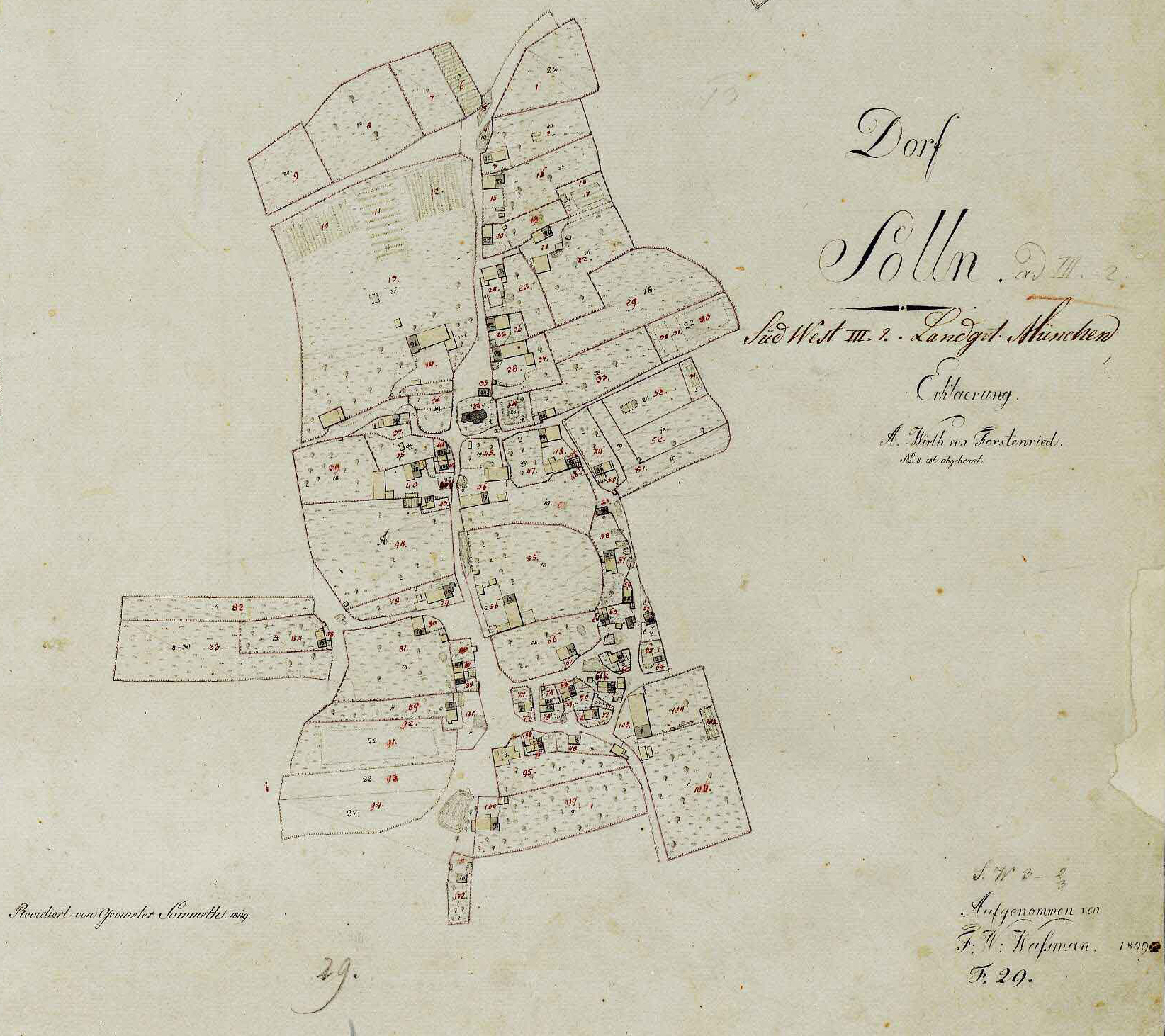
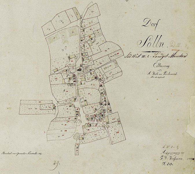
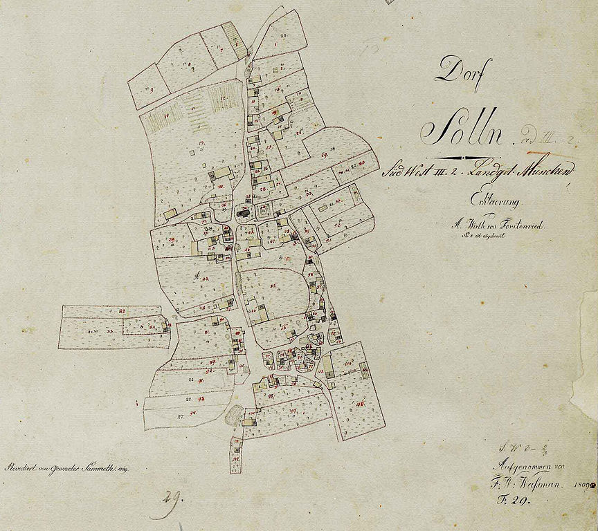
Deutsch: Historische Karten von Solln |
| Date | |
| Source | File:Ort For 1809 F29.jpg |
| Author | Unknown author |

Licensing
[edit]
| This image is in the public domain according to German copyright law because it is part of a statute, ordinance, official decree or judgment (official work) issued by a German authority or court (§ 5 Abs.1 UrhG).
|
 |
File history
Click on a date/time to view the file as it appeared at that time.
| Date/Time | Thumbnail | Dimensions | User | Comment | |
|---|---|---|---|---|---|
| current | 06:17, 16 June 2013 | | 1,644 × 1,462 (1.5 MB) | Bjs (talk | contribs) | {{Information |Description ={{de|1=Historische Karten von Solln}} |Source =File:Ort For 1809 F29.jpg |Author ={{unknown}} |Date =1809 |Permission= |other_versions= }} Category:Old maps of Munich [[Category:Maps of... |
You cannot overwrite this file.
File usage on Commons
The following 2 pages use this file:
File usage on other wikis
The following other wikis use this file: