File:Papcastle station, remains 1952 (geograph 5314107).jpg
Jump to navigation
Jump to search
Size of this preview: 800 × 436 pixels. Other resolutions: 320 × 174 pixels | 640 × 349 pixels | 1,024 × 558 pixels | 1,280 × 698 pixels | 2,102 × 1,146 pixels.
Original file (2,102 × 1,146 pixels, file size: 1,023 KB, MIME type: image/jpeg)
Captions
Captions
Add a one-line explanation of what this file represents
Summary
[edit].jpg&action=edit§ion=1)
| Description |
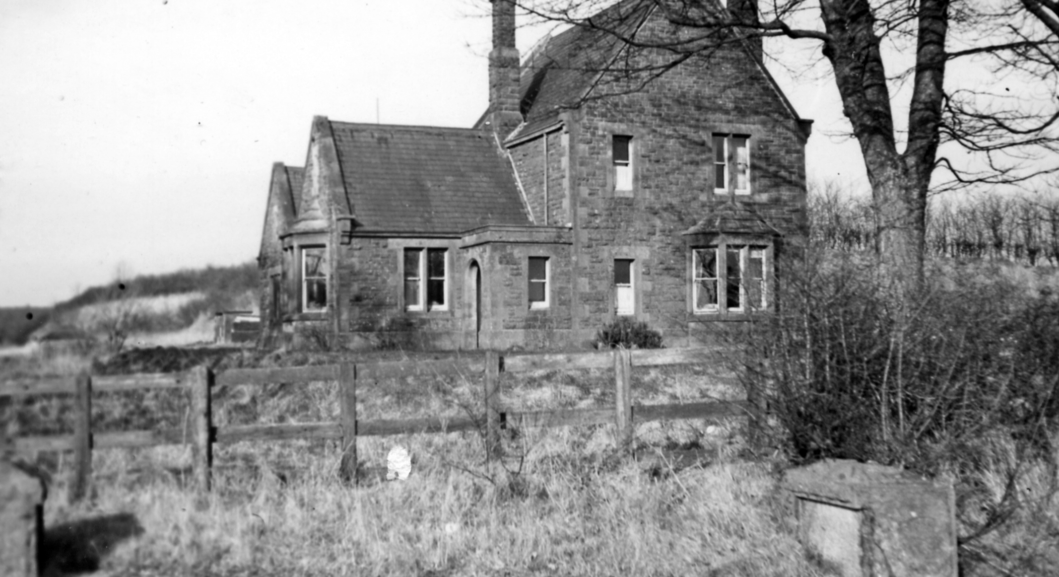
English: Papcastle station, remains 1952 View northward towards Bullgill on the Derwent Extension of the Maryport & Carlisle Railway. The station had been closed since 1/7/21, but the line remained for freight until 6/4/35. |
| Date | |
| Source | From geograph.org.uk |
| Author | Walter Dendy, deceased |
| Permission (Reusing this file) |
Creative Commons Attribution Share-alike license 2.0 |
| Attribution (required by the license) | Walter Dendy, deceased / Papcastle station, remains 1952 / |
| Camera location | | View this and other nearby images on: OpenStreetMap |
|---|
.jpg¶ms=054.670342_N_-003.411002_E_globe:Earth_type:camera_heading:22.00_source:geograph&language=en)
| Object location | | View this and other nearby images on: OpenStreetMap |
|---|
.jpg¶ms=054.670800_N_-003.410000_E_globe:Earth_class:object_type:object_source:geograph-osgb36(NY091315)_region:GB-GBN_heading:22.00&language=en)
Licensing
[edit].jpg&action=edit§ion=2)

|
This image was taken from the Geograph project collection. See this photograph's page on the Geograph website for the photographer's contact details. The copyright on this image is owned by Walter Dendy, deceased and is licensed for reuse under the Creative Commons Attribution-ShareAlike 2.0 license.
|
This file is licensed under the Creative Commons Attribution-Share Alike 2.0 Generic license.
Attribution: Walter Dendy, deceased
- You are free:
- to share – to copy, distribute and transmit the work
- to remix – to adapt the work
- Under the following conditions:
- attribution – You must give appropriate credit, provide a link to the license, and indicate if changes were made. You may do so in any reasonable manner, but not in any way that suggests the licensor endorses you or your use.
- share alike – If you remix, transform, or build upon the material, you must distribute your contributions under the same or compatible license as the original.
File history
Click on a date/time to view the file as it appeared at that time.
| Date/Time | Thumbnail | Dimensions | User | Comment | |
|---|---|---|---|---|---|
| current | 20:55, 20 March 2017 | | 2,102 × 1,146 (1,023 KB) | Andrewrabbott (talk | contribs) | Transferred from geograph.co.uk using [https://tools.wmflabs.org/geograph2commons/ geograph2commons] |
You cannot overwrite this file.
File usage on Commons
The following 2 pages use this file:
File usage on other wikis
The following other wikis use this file:
- Usage on en.wikipedia.org
- Usage on www.wikidata.org
.jpg&oldid=705290188)