File:Patcham Brighton and Hove ward map.svg
Jump to navigation
Jump to search

Size of this PNG preview of this SVG file: 800 × 517 pixels. Other resolutions: 320 × 207 pixels | 640 × 414 pixels | 1,024 × 662 pixels | 1,280 × 828 pixels | 2,560 × 1,655 pixels | 826 × 534 pixels.
Original file (SVG file, nominally 826 × 534 pixels, file size: 124 KB)
Captions
Captions
Add a one-line explanation of what this file represents
| Description |
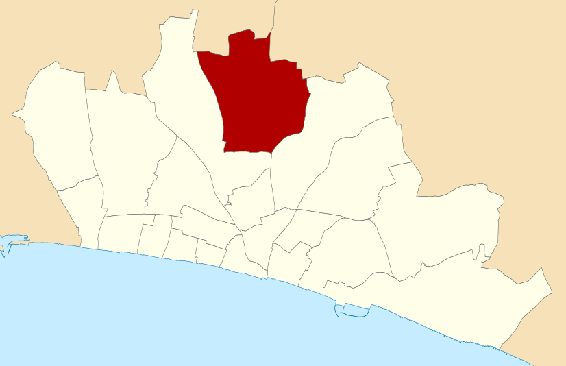
Map of Brighton and Hove, East Sussex, UK with Patcham ward highlighted. Equirectangular map projection on WGS 84 datum, with N/S stretched 155% Geographic limits:
|
||||||
| Date | |||||||
| Source | Ordnance Survey OpenData, Boundary-Line product | ||||||
| Author | Nilfanion, created from Ordnance Survey data | ||||||
| Permission (Reusing this file) |
|
_(St_Edwards_Crown).svg)
File history
Click on a date/time to view the file as it appeared at that time.
| Date/Time | Thumbnail | Dimensions | User | Comment | |
|---|---|---|---|---|---|
| current | 11:18, 22 June 2010 | | 826 × 534 (124 KB) | Nilfanion (talk | contribs) | {{Information |Description=Map of w:Brighton and Hove, East Sussex, UK with Patcham ward highlighted. Equirectangular map projection on WGS 84 datum, with N/S stretched 155% Geographic limits: *West: 0.25W *East: 0.01W *North: 50.895N *South: 50.795 |
You cannot overwrite this file.
File usage on Commons
There are no pages that use this file.
File usage on other wikis
The following other wikis use this file:
- Usage on en.wikipedia.org